The Four Fountains Circular Route

A lovely walk through varied countryside, with much of the route in the shade of the woodland. This route takes you past four fountains and their wash houses in the commune of Saint-Léger-de-la-Martinière: Mouchedune, au Blanc, du Bignon and de Mareuil.

Details

n°288950
Creation:
Last update:
Last review:
  • Walking
    Activity: Walking
  • ↔
    Distance: 6.92 mi
  • ◔
    Average duration: 3h 15 
  • ▲
    Difficulty: Moderate

  • ⚐
    Back to start: Yes
  • ↗
    Ascent: + 108 ft
  • ↘
    Descent: - 108 ft

  • ▲
    Highest point: 545 ft
  • ▼
    Lowest point: 446 ft

Photos

Description of the walk

Park at the hamlet of La Nouette.

(S/E) Turn left onto the road towards Bournaveau (northwards). At the T-junction with the road to Bournaveau (a hamlet situated on the left some distance away), continue straight ahead along the gently ascending path, passing close to a water tower.

(1) Immediately afterwards, at the junction with a road, carry on straight ahead along the path. About two hundred and fifty metres further on, you’ll come to a road. Carry on straight ahead again along the path opposite.

(2) At the next junction, take the road on the left to visit the Fontaine de Mouchedune. Retrace your steps and continue along the road until you reach the junction with the D14 (the road from Melle to Lezay). Cross the D14 and turn right for about one hundred metres to see the Fontaine au Blanc. Please note: the D14 is very busy and the verges are not ideal for walking, especially in a group.

(3) Return to the junction by walking alongside the D14 and continue for about a hundred metres towards Melle, then turn right onto the farm track that appears. At the next junction, turn right and, about a hundred metres further on, take the path on the right. Continue to the Fontaine du Bignon, situated slightly off the path, below it on the right.

(4) Follow the Chemin de la Fontaine du Bignon to the road and turn right onto it. Stay on this road, ignoring the roads and tracks on both the right and left.

(5) At the bend, turn right onto the farm track and, at the junction with the D14 road, carry on straight ahead along the track opposite. This track leads onto the road known as the Chemin de Mouchetune; turn right.

(6) At the next crossroads, turn left towards La Rousselière. Pass through the hamlet, staying on this road. At a T-junction, turn right and then immediately left. Shortly afterwards, the road passes a wayside cross. Continue along this road until you reach La Valtière.

(7) At the junction in La Valtière, turn right.

(8) At the first junction, take the path on the left towards La Corbillière. Just before joining the D305, turn right towards La Corbillière and continue for a few dozen metres along the D305.

(9) Turn onto the track to the left of the road: this track passes near La Sauvagère, then near La Terrassonnerie.

(10) At the junction of the six paths, take the second on the right from the one you arrived on. This path enters the forest and runs through it for over a kilometre. Just before reaching a junction with a road, ignore a path on the left.

(11) At the road, turn right for a few metres before turning left to take another path into the forest. Follow this path, passing a first path on the left, then, a little further on, a second path on the right. The path emerges from the forest and joins a forest track. Turn right onto this track. At the junction with a road, take the forest track almost directly opposite to continue towards L’Épine.

At the junction of two forest tracks, carry straight on towards this hamlet. The forest track leads onto a road in L’Épine; turn left and continue along this road, which slopes gently downwards.

(12) At the Fontaine de Mareuil, which you reach shortly after leaving L’Épine, continue along the road towards Les Épinards. After the hamlet, the road crosses a forest track. Turn right onto it. The forest track leads back towards the hamlet of La Nouette.

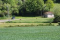
Where the track joins the road, you can just make out the starting point of the route on the right (S/E).

Waypoints

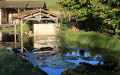
  1. S/E : mi 0 - alt. 449 ft - La Nouette private pond
  2. 1 : mi 0.34 - alt. 512 ft - Crossroads by the water tower
  3. 2 : mi 0.69 - alt. 469 ft - Mouchedune Fountain
  4. 3 : mi 0.97 - alt. 463 ft - Fontaine au Blanc
  5. 4 : mi 1.7 - alt. 489 ft - Bignon Fountain
  6. 5 : mi 2.11 - alt. 538 ft - Crossroads
  7. 6 : mi 2.6 - alt. 518 ft - Junction of the Chemin de Mouchetune and the Chemin de la Rousselière
  8. 7 : mi 3.17 - alt. 515 ft - La Valtière junction
  9. 8 : mi 3.7 - alt. 528 ft - Crossroads
  10. 9 : mi 4.15 - alt. 538 ft - La Corbillière
  11. 10 : mi 4.52 - alt. 535 ft - Crossroads of the Six Paths
  12. 11 : mi 5.31 - alt. 522 ft - Crossroads in the La Garde forest
  13. 12 : mi 6.5 - alt. 456 ft - Mareuil Fountain
  14. S/E : mi 6.92 - alt. 449 ft - La Nouette private pond

Notes

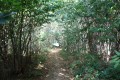
This route requires good walking shoes: the paths are mostly grassy and may sometimes have ruts caused by agricultural or forestry machinery. The Garde Forest consists of numerous large chestnut trees, which keep it pleasantly cool. It is quite shady, especially on overcast days.

(S/E) Coming from Saint-Léger-la-Martinière (or Melle), leave the D305 by turning left at a place called La Nouette and park on the grass near the entrance to the private pond at La Nouette, about a hundred metres from the crossroads.

Worth a visit

La Fontaine au Blanc washhouse:
This washhouse is situated on the D14 road from Lezay to Melle, 2 km before the D14/D950 junction. The rectangular washhouse is fed by a spring. The basin is formed from beautiful slabs of local white limestone. It is covered by a gabled lean-to. It is in fairly good condition, although the spring seems to run dry at times in summer. This spot is very pleasant but somewhat overlooked, particularly as it is several kilometres from the village and the road running alongside it is quite busy (Aurore Cheminade).

Saint-Léger-de-la-Martinière:
A silver-lead mine dating back to the Gallic period. Situated on the Way of St James.
The Duke of Orléans, grandson of Louis XIV, stayed here in 1700.
Historic houses.
16th-century inn.
Outbuildings of the former castle. Dovecote.
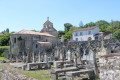
11th-century Romanesque church, restored in the 17th century: semi-circular apse, barrel-vaulted chancel, unvaulted nave; Flamboyant Gothic west door; fine tombstones.

Melle:
A small town full of character.
As well as the remains of its medieval fortifications, Melle boasts three interesting Romanesque churches. They were built mainly between the late 11th century and the mid-12th century, offering a concise overview of the architectural developments of that period in a single location. This group is known as the Romanesque triad of Melle.
Saint-Hilaire Church: listed as a Historic Monument since 30 March 1887. It has also been a UNESCO World Heritage Site since 1998, as a stop on the Way of St James in France.
Saint-Pierre Church: built of ochre limestone in the early 12th century on the site of an oratory dating from 950 and belonging to Saint-Maixent Abbey. This first church was surrounded by a Carolingian cemetery
Saint-Savinien Church: Probably the least remarkable of the three but the oldest, it is the only one to have been built within the feudal town. It was converted into a prison from 1801 to 1927 and now hosts a music festival and exhibitions.
The Hôtel de Ménoc or Bishop’s Palace: A charming 15th-century mansion named after the de Menoc family, who settled in Melle towards the end of the 12th century. It therefore housed the Courthouse until 31 December 2009.
Arboretum: An arboretum known as the ‘Chemin de la Découverte’ (Discovery Trail), a six-kilometre footpath that follows the route of the former SNCF railway line, the private railway line of the Melle factory and country lanes.
The route forms a circle around Melle. The trail was awarded the National Tree Prize in 2006. Alternating between wild and landscaped sections, the trail passes close to a Carolingian garden created on the site of the former silver mines of the Frankish kings. This garden features around sixty medicinal plants and forgotten vegetables: palm cabbage, runner beans, teasel, mandrake…
The Frankish kings’ silver mines: The Frankish kings’ silver mines are an archaeological site located on Rue du Pré-du-Gué. These mines were in operation from the 7th to the 10th century. There are around twenty of them, comprising some thirty kilometres of man-made tunnels on several levels, with heights varying from 1 to 8 metres depending on the abundance of the veins. More specifically, silver-bearing galena was extracted from these mines; this ore contains more lead than silver (on average, 1 g of silver per 1 kg of raw ore). The mines were known as far back as Roman times and were worked using the fire-setting technique due to the hardness of the rock: vertical pyres were lit in the tunnels to shatter the rock, which required ventilation shafts. Production was estimated at 90,000 tonnes of lead, used mainly for roofing (in particular at the Abbey of Saint-Denis, near Paris) but also for pipework and certain alloys. The ore, washed seven times to remove the gangue, was repeatedly smelted to extract the silver metal. This quantity of silver, once transformed into monetary ingots, would have amounted to 10,000 coins (deniers and obols) which are thought to have been minted between 768 – following Charles the Bald’s Edict of Pîtres – and 1189. The silver was also sent to Paris.

Reviews and comments

3.7 / 5
Based on 2 reviews

Reliability of the description
3.5 / 5
Ease of following the route
4 / 5
Route interest
3.5 / 5
sergion
sergion

Overall rating : 3.3 / 5

Date of your route : May 19, 2022
Reliability of the description : ★★★☆☆ Average
Ease of following the route : ★★★★☆ Good
Route interest : ★★★☆☆ Average
Very busy route : No

A signposted route, but very disappointing
The path was poorly maintained; in some places the grass was so high that we weren’t quite sure where to go, but thankfully we had a GPS
Beginners should give this a miss

Machine-translated

POUPI79
POUPI79

Overall rating : 4 / 5

Date of your route : Oct 08, 2016
Reliability of the description : ★★★★☆ Good
Ease of following the route : ★★★★☆ Good
Route interest : ★★★★☆ Good

A lovely walk.

Machine-translated

Other walks in the area

For more walks, use our search engine .

The GPS track and description are the property of this route's author. Please do not copy them without permission.