Four wash-and-water fountains in Saint-Léger-de-la-Martinière

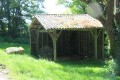
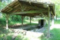
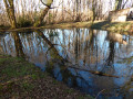
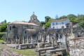
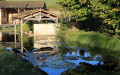
A pleasant little walk offering the chance to discover four beautiful wash-house fountains in the commune of Saint-Léger-de-la-Martinière: the Fontaine du Bignon, the Fontaine au Blanc, the Fontaine de Mouchedune and the Fontaine de Mareuil.

Details

1116907
Creation:
Last update:
Last review:
  • Walking
    Activity: Walking
  • ↔
    Distance: 3.55 mi
  • ◔
    Average duration: 1h 45 
  • ▲
    Difficulty: Easy

  • ⚐
    Back to start: Yes
  • ↗
    Ascent: + 115 ft
  • ↘
    Descent: - 105 ft

  • ▲
    Highest point: 541 ft
  • ▼
    Lowest point: 449 ft

Photos

Description of the walk

The car park is situated next to the pumping station opposite the Mareuil washhouse fountain, near Bournaveau and L’Épine.

(S/E) From the Mareuil fountain, head north-east towards L’Épine along the road. At the first right-hand bend, take the shaded path on the left and follow it until you reach a small road. Then turn left.

(1) When the road bends to the left, take a grassy path between two hedges. At the end, turn left. You’ll see a Protestant family cemetery on the right-hand side by the roadside; at the next junction, follow the road opposite, which is slightly offset to the right, known as the Rousselière. At the Stop sign, turn right onto the Chemin de Mouchetune.

(2) After about 150 metres, turn left onto a farm track. Cross the D14 (take care, as it is a very busy road) and continue along the track opposite. You’ll come out onto a road; follow it carefully to the left. Head downhill and ignore two successive turn-offs, first on the left then on the right.

(3) Just as the road begins to climb, turn left and, immediately afterwards, turn left again onto the path which quickly leads to the Fontaine du Bignon in a charming spot with a small wooden bridge and a picnic table. Cross the small wooden bridge and join a wider path: follow this south-westwards. Join another path and follow it to the left. Shortly afterwards (elevation 141), turn left. You’ll come out onto the D14 and follow it to the left (take care, as visibility is poor).

(4) At the junction, carry on straight ahead and, after about fifty metres, you’ll see the Fontaine au Blanc on your left. Retrace your steps.

(4) Cross the D14 (take care, very busy road) and follow a small road uphill. Turn left with the road, then slightly to the right.

(5) At the junction, carry on straight ahead and, after about 50 metres, you’ll come to the Fontaine de Mouchedune on your right (washhouse, pond). Retrace your steps.

(5) Take the path on the right (south-east). Cross a small road and continue along a grassy path to the water tower.

(6) At the junction at the foot of the water tower, follow the road to the left and downhill. At the bottom, cross another road and you’ll immediately reach the starting point (S/E).


Waypoints

  1. S/E : mi 0 - alt. 456 ft - Fontaine de Mareuil
  2. 1 : mi 0.37 - alt. 479 ft - Start of the path on the right
  3. 2 : mi 1.15 - alt. 528 ft - Start of the path on the left
  4. 3 : mi 1.9 - alt. 495 ft - Le Bignon Fountain
  5. 4 : mi 2.65 - alt. 453 ft - Fontaine au Blanc
  6. 5 : mi 2.94 - alt. 466 ft - Mouchedune Fountain
  7. 6 : mi 3.33 - alt. 512 ft - Water tower
  8. S/E : mi 3.56 - alt. 456 ft - Fontaine de Mareuil

Notes

This walk requires suitable footwear.

This unmarked route presents no real difficulties. It follows sections that are signposted. Consequently, it is advisable to follow the directions in this description and on the map, whilst also paying attention to the surrounding landscape. Distance markers from the starting point, or even the GPS coordinates of waypoints (including the start), may also help the walker find their way.

Hike completed by the author on 4 May 2018

Worth a visit

Saint-Léger-de-la-Martinière
Part of the commune forms a plateau, with an average altitude of 157 metres. Valleys cut through the other part, through which streams flow, joining to form the Légère.
This terrain forms an integral part of the Poitou Threshold, which links the Paris Basin and the Aquitaine Basin.
In 1973, Saint-Léger-lès-Melle and L’Enclave-de-la-Martinière merged to form Saint-Léger-de-la-Martinière.
In Saint-Léger-de-la-Martinière, certain Neolithic remains bear witness to very ancient settlement, as demonstrated by the defensive structure discovered in the Bois de la Garde.
As far back as the Gallic period, prospectors searching for silver-bearing lead dug tunnels to supply the mint at Melle.
Moreover, the road network makes Saint-Léger a transport hub and an essential route for travel. Indeed, at a place known as ‘la Colonne’, the roads from Nantes to Limoges and from Poitiers to Saintes (Paris–Bordeaux) cross.
In the Middle Ages, the latter route saw the passage of the singing – and sometimes pitiful – processions of pilgrims heading for Santiago de Compostela (a route first mentioned in 1333). Some stayed in the inns, a few of which can still be seen today.
It would therefore appear that Saint-Léger has long been the scene of intense human activity.

Saint-Léger is a priory of Saint-Jean-d’Angély, as indicated by a deed of donation dated around 1088–89.
Archival documents indicate that the church was restored in the 17th century: on 22 July 1682, an entry in Berthommé’s records records a contract between the architect François le Duc, known as Toscane, and René de la Varenne de Poix, Baron of Saint-Romans-les-Melle, for the restoration of the church. The work involved repairing “the walls, the vault and the arcade of the said church”.

The church: Restoration work continued into the early 20th century in an effort to save the building. It culminated in the restoration of the gable on the façade under the direction of the architect Buzy (the date 1901 is engraved on the north belfry).
The church was listed as a historic monument in 1988.

There is a factory (440 employees) belonging to the Sanofi-Avantis group (formerly Rhône-Poulenc).
Shops, crafts
Agriculture (cereals, livestock, goat’s milk)

La Fontaine au Blanc washhouse
This washhouse is situated on the D14 road from Lezay to Melle, 2 kilometres before the D14/D950 junction. The rectangular washhouse is fed by a spring.
The basin is formed from beautiful slabs of local white limestone. It is covered by a gabled lean-to roof.
It is in fairly good condition, although the spring seems to run dry at times during the summer.
This is a very pleasant spot but somewhat overlooked, particularly as it is several kilometres from the village and the road running alongside it is quite busy.

In Melle, it is possible to visit three Romanesque churches dating from the 11th and 12th centuries:
- Saint-Hilaire (the most significant of the three churches, both for its architecture and its sculpture. It is listed as a UNESCO World Heritage Site as a stop on the Way of St James.)
- Saint-Pierre (Romanesque chancel)
- Saint-Savinien (the only one to have been built within the walls of the fortified town. Its apse is surrounded by the old town walls. It served as a prison in the 19th and 20th centuries).
In Melle, there is also the Hôtel du Ménoc (former courthouse)

Reviews and comments

4.8 / 5
Based on 3 reviews

Reliability of the description
5 / 5
Ease of following the route
4.7 / 5
Route interest
4.7 / 5
quentrilu
quentrilu

Overall rating : 5 / 5

Date of your route : Aug 24, 2026
Reliability of the description : ★★★★★ Very good
Ease of following the route : ★★★★★ Very good
Route interest : ★★★★★ Very good
Very busy route : No

A lovely walk through the countryside around Melle. We went on this walk in August 2026, after the heatwaves we’d been through. Unfortunately, the lack of rain and the drought had left almost all the washhouses and fountains dry.

Machine-translated

pgetrochon
pgetrochon

Hello
The fact that the signposting isn’t great highlights the value of the route description and map provided by Visorando. This often helps ensure the walk goes smoothly.
Kind regards

Machine-translated

Buffevent
Buffevent

Overall rating : 4.7 / 5

Date of your route : Oct 26, 2018
Reliability of the description : ★★★★★ Very good
Ease of following the route : ★★★★★ Very good
Route interest : ★★★★☆ Good

We love the map and the picnic table next to the pumping station.
The signposting wasn’t great.

Machine-translated

AliettePLP
AliettePLP

Overall rating : 4.7 / 5

Date of your route : Aug 20, 2018
Reliability of the description : ★★★★★ Very good
Ease of following the route : ★★★★☆ Good
Route interest : ★★★★★ Very good

A very pleasant route, even when it’s hot. The fountains and wash houses are clearly signposted. Thanks to the

hiker who planned this route

Machine-translated

Other walks in the area

For more walks, use our search engine .

The GPS track and description are the property of this route's author. Please do not copy them without permission.