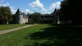
Circular walk between Chail and Fontivillié

A pleasant walk through the plains and woods of Chail. This route forms part of the ‘Grand 8’ trail; the other section is located in the former commune of Sompt.

Details

28915614
Creation:
Last update:
Last review:
  • Walking
    Activity: Walking
  • ↔
    Distance: 7.64 mi
  • ◔
    Average duration: 3h 35 
  • ▲
    Difficulty: Moderate

  • ⚐
    Back to start: Yes
  • ↗
    Ascent: + 125 ft
  • ↘
    Descent: - 125 ft

  • ▲
    Highest point: 571 ft
  • ▼
    Lowest point: 417 ft
  • ⚐ Country: France
  • ⚐ City: Chail (79500)
  • ⚑
    Start/End: N 46.209806° / W 0.091998°
  • ❏
    IGN map(s): Ref. 1629SB
  • Hour-by-hour weather

Photos

Description of the walk

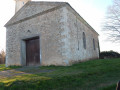
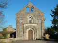
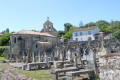
Park in the car park by Chail Church.

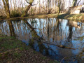
(S/E) Walk alongside the cemetery and head down into the village along Rue du Forgeron. At the bottom of the village, keep to the left and walk up Rue du Pré Chapelier, which bends to the left. Leave the Cerizat stream on your right and continue along the road, which becomes Route des Forges. You’ll reach a crossroads.

(1) Turn right at the haulage company. Cross the RD948 with the utmost care to take the path opposite. At the junction, turn left to reach Miseré.

(2) Turn right, walk past the houses, follow the edge of the woodland and then turn right. At the end of the path, turn left to reach the junction of the Grand 8 trails on the Voie Romaine.

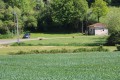
(3) Turn left and continue through fields and meadows. Once you reach the tarmac road, follow it to the left, passing the entrance to Le Paradis on your right, until you reach Maisonnay cemetery.

(4) Turn left, rejoin the RD948 and cross it again with the same caution to follow the small road opposite.

(5) Turn right onto the grassy track, then, at the second junction, turn left and go past the Petit Châtenet crossroads.

(6) Turn right onto the path leading to Les Jauffretières. At the junction, turn left.

(7) When you reach the temple, turn right, then right again onto the path. Carry straight on through the woods until you reach the junction near the Giraudières stables.

(8) Turn left and join the Route de Saint-Vincent. Follow it to the left with care, then cross it and turn right towards La Tallée. Go straight on at the crossroads.

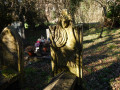
(9) In the hamlet of La Tallée, visit the Protestant cemetery and turn left between the houses. At the road, turn right then left to reach the Grand Lac.

(10) Turn left after the hunters’ hut in the woods. At the four-way junction, go straight on, then turn left, then right and then left again before coming out onto a stony track.

(11) Turn right and join a tarmac road. Turn left, cross the junction and follow the road straight ahead, which leads back to Chail Church (S/E).

Waypoints

  1. S/E : mi 0 - alt. 446 ft - Église Saint-Pierre (Chail)
  2. 1 : mi 0.64 - alt. 466 ft - Crossroads
  3. 2 : mi 1.27 - alt. 423 ft - Miseré fountain
  4. 3 : mi 2.24 - alt. 476 ft - The Poitiers–Saintes Roman road
  5. 4 : mi 3.29 - alt. 541 ft - Maisonnay Cemetery
  6. 5 : mi 3.88 - alt. 502 ft - Junction
  7. 6 : mi 4.59 - alt. 509 ft - Crossroads
  8. 7 : mi 4.94 - alt. 538 ft - Temple
  9. 8 : mi 5.49 - alt. 561 ft - Carrefour des Giraudières
  10. 9 : mi 6.06 - alt. 518 ft - La Tallée Protestant cemetery
  11. 10 : mi 6.36 - alt. 512 ft - Grand Lac Woodland
  12. 11 : mi 7.06 - alt. 446 ft - Stony path
  13. S/E : mi 7.64 - alt. 446 ft - Église Saint-Pierre (Chail)

Notes

Information boards along the route with QR codes providing further details.
Picnic table at the starting point.
Water point at Chail Cemetery.
Hunting shelter and picnic tables at Grand Lac.

Worth a visit

Pyrographed wooden signs indicating nearby places of interest.

Reviews and comments

4.5 / 5
Based on 2 reviews

Reliability of the description
5 / 5
Ease of following the route
5 / 5
Route interest
3.5 / 5
Jean Pierre N1.
Jean Pierre N1.

Overall rating : 4.7 / 5

Date of your route : Jul 24, 2025
Reliability of the description : ★★★★★ Very good
Ease of following the route : ★★★★★ Very good
Route interest : ★★★★☆ Good
Very busy route : No

Born in Chail in the middle of the last century and having returned to live in Melle after a long period away in Touraine, this walk was a must for me.
I really enjoyed the sections through the woodland.
Crossing the departmental road twice isn’t a problem as there’s plenty of visibility.

Machine-translated

philouis
philouis

Overall rating : 4.3 / 5

Date of your route : Jan 06, 2023
Reliability of the description : ★★★★★ Very good
Ease of following the route : ★★★★★ Very good
Route interest : ★★★☆☆ Average
Very busy route : No

First of all, this walk is signposted in yellow from start to finish, which makes it easy to follow.
The walk really starts to get interesting from point 5 onwards. The start is simply a walk across the plain with views of the Maisonnais mast and the (indispensable) wind turbines in the distance.
The main drawback of this walk is the constant noise from vehicles travelling along the road between Niort and Limoges. You have to reach point 8 to escape the noise.
A lovely walk nonetheless to kick off 2023.

Machine-translated

Other walks in the area

For more walks, use our search engine .

The GPS track and description are the property of this route's author. Please do not copy them without permission.