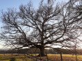
Saint-Cernin-de-Reillac circular walk

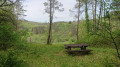
A walk starting from the small village of Saint-Cernin-de-Reillac. A good walk that allows you to enjoy nature and the peace and quiet. A lovely viewpoint towards the end of the route rewards you for your efforts.

Details

35844849
Creation:
Last update:
Last review:
  • Walking
    Activity: Walking
  • ↔
    Distance: 5.41 mi
  • ◔
    Average duration: 3h 10 
  • ▲
    Difficulty: Easy

  • ⚐
    Back to start: Yes
  • ↗
    Ascent: + 778 ft
  • ↘
    Descent: - 778 ft

  • ▲
    Highest point: 925 ft
  • ▼
    Lowest point: 420 ft

Description of the walk

From the village of Rouffignac, drive towards Les Eyzies and Le Bugue, then turn left towards Saint-Cernin just before the T-junction. After 3 km, you’ll reach the village of Saint-Cernin and its church.

(S/E) From the church car park, head down the “Route des Moulins” to reach the junction marking the end of the circular route.

(1) Continue along the descending path until you reach a second junction.

(2) Take the path through the woods which climbs to the left. You will then reach a junction with another path.

(3) Follow the path on the left to climb up onto the plateau. Keep going straight ahead at the junctions until you reach the plateau.

(4) Turn right and continue along the path through meadows and the edge of the woods towards La Laudinie, until you reach a ruined house.

(5) Turn right just after the barn. Begin a long descent into the valley, with a few fairly steep sections. The path continues through the woods. You’ll reach the junction with the Mauzens and Miremont walking routes, just after crossing the small bridge at the junction.

(6) Carry on, following the path to the left. After 10 minutes, in this lovely woodland, you’ll reach another junction; here too, turn left and cross the stream again. Climb gently back up towards the plateau until you reach a Fork in the road.

(7) Continue along the path on the right; then, after a short stretch of level ground, begin a fairly steep climb up to the hamlet known as “Montribot”. Continue on to the Route de Montribot.

(8) Turn left until you reach the Fork in the road.

(9) Take the path branching off to the left until you reach Route de la Borélie. Turn left and you’ll come to a Fork in the road with Route des Chaties.

(10) Carry on to the right, heading for the junction you passed on the way out, just a stone’s throw from the first path.

(1) Finish walking up the road to reach the car park (S/E).

Waypoints

  1. S/E : mi 0 - alt. 686 ft - Church car park - Manaurie (ruisseau) - Affluent de la Vézère
  2. 1 : mi 0.14 - alt. 636 ft - Crossroads at the end of the circular loop
  3. 2 : mi 0.24 - alt. 607 ft - Path
  4. 3 : mi 0.62 - alt. 571 ft - Junction of paths
  5. 4 : mi 1.34 - alt. 761 ft - Plateau
  6. 5 : mi 1.82 - alt. 761 ft - La Laudinie
  7. 6 : mi 3.02 - alt. 427 ft - Crossroads
  8. 7 : mi 3.88 - alt. 597 ft - Fork in the path on the climb
  9. 8 : mi 4.49 - alt. 876 ft - Route de Monribot
  10. 9 : mi 4.6 - alt. 892 ft - Y-junction
  11. 10 : mi 4.77 - alt. 919 ft - Route de Chaties
  12. S/E : mi 5.41 - alt. 686 ft - Church car park

Worth a visit

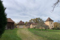
(5) On your right, behind the trees, you can see a superb 16th-century Carthusian monastery (private property).
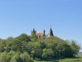
(9) A lovely view awaits you after all that effort.

Reviews and comments

4 / 5
Based on 3 reviews

Reliability of the description
3.3 / 5
Ease of following the route
4.7 / 5
Route interest
4 / 5
Pascal31
Pascal31
• Edited:

Overall rating : 4.7 / 5

Date of your route : Aug 18, 2025
Reliability of the description : ★★★★★ Very good
Ease of following the route : ★★★★★ Very good
Route interest : ★★★★☆ Good
Very busy route : No

...

Machine-translated

Joël Arnaud 😎
Joël Arnaud 😎

Overall rating : 4.3 / 5

Date of your route : Jun 01, 2025
Reliability of the description : ★★★★☆ Good
Ease of following the route : ★★★★★ Very good
Route interest : ★★★★☆ Good
Very busy route : No

An easy walk,
well signposted from start to finish.
A lovely walk through the woods on very pleasant paths, with two long climbs
A short stretch of road towards the end (over 1 km)
Must-see: the church
the stream
Beautiful Périgord mansions
Panoramic views towards the end

Machine-translated

OT LDVV
OT LDVV

Thank you for clarifying that. This isn’t about causing a row – it’s simply about helping one another so that walkers can enjoy the best possible experience, and we really appreciate your feedback
Have a lovely rest of the day.

Machine-translated

jean.favre
jean.favre

Hello, Madam
It is not my intention to argue,
Let’s begin.
Setting off from Rouffignac (Town Hall), it seems to me that you need to turn right to get to Saint Cernin de Reilhac (opposite the supermarket)
Let’s park in the square by the church in Saint Cernin, taking care not to block access to the cemetery.
The ‘Route des Moulins’ ends well before the junction with the path through the woods and continues not along a footpath but along a tarmac road.
Have a lovely day, Madam

Machine-translated

OT LDVV
OT LDVV

Hello,
I’d be delighted to take another look at the description of this circular route. Could you please let me know what’s missing from the description and what you found ‘rubbish’? Thank you in advance for your feedback.

Machine-translated

jean.favre
jean.favre

Overall rating : 3 / 5

Date of your route : Jul 07, 2023
Reliability of the description : ★☆☆☆☆ Very disappointing
Ease of following the route : ★★★★☆ Good
Route interest : ★★★★☆ Good
Very busy route : No

Hello
A very pleasant walk, but the route description is really poor, if not downright useless.
I live 10 km from Saint-Cernin de Reillac (Reilhac) and have been doing this walk regularly for several years.
On the ground, the signposting is good, apart from the start, which is a bit confusing.
Jean

Machine-translated

Other walks in the area

For more walks, use our search engine .

The GPS track and description are the property of this route's author. Please do not copy them without permission.