Country:

 City:
City:


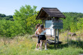
The meeting point is in the car park at Saint-Félix de Reilhac Town Hall, which has space for a few vehicles.
(S/E) Walk up the hill behind the town hall building and then immediately turn left to follow the D47 to the lay-by.
(1) Follow the Chemin des Jarriges to the right, then turn left at the next junction to reach the Route de Brugère.
(2) Continue straight ahead, then turn left in front of the livestock farm.
(3) At the next bend, turn left into the forest and follow the path as it curves to the right to reach the Route des Brugettes.
(4) Turn right and carry on to the Route du Puridier
(5) Turn left to reach the hamlet of the same name.
(6) As you leave the houses behind, turn right onto the Traverse de la Fontaine du Puridier until you reach the Route de la Gare de la Gélie.
(7) Continue carefully to the right until you reach the junction with the Route du Cazelat
(8) Turn right, before the concrete shelter, onto Route du Meyrat until you reach the next Fork in the road
(9) Take the Chemin du Font Brésil on the left, which crosses the forest and then crosses the Ruisseau de la Manaurie.
(10) Shortly afterwards, turn right to rejoin the road and follow it to the Route des Moulins at a T-junction.
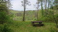
(11) Turn left and, after 120 m up the hill, take the forest track signposted on the right (Saint-Cernin circular route). Picnic area 150 m further on with panoramic views. As you walk along this hillside, take the path on the left at the Fork in the road. You’ll reach the junction with a cross-country path at an altitude of 230 m.
(12) Continue to the right, pass the 232-metre mark and carry on to La Laudinie
(13) Turn right at the wooden cottage, walk past La Forge Neuve and continue to the next crossroads at Étang Roux (spring).
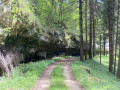
(14) Follow the path furthest to the right (GR® Mauzens Miramont); after 40 m, turn right again and walk along the cliff face to the Moulin de la Durantie. Cross the hamlet, cross the stream and reach the road at a wayside cross.
(15) Turn right onto Route du Ruisseau des Forges, then follow the Routes des Moulins until you reach the junction with Route des Lioussane.
(16) Turn left onto this road. At the Fork in the road, turn left until you reach the junction with the Impasse du Pigeonnier.
(17) Go down the hill and turn right at the next junction to return to the starting point, the Town Hall car park (S/E).


 A truly lovely walk in the Périgord Noir!


 .
. Tourist office

 Visorando Member
 Easy
Easy