On the trails of Château Sainte-Anne

This circular route passes by Château Sainte-Anne in Marcilly-le-Châtel, then through the vineyards of the Forez to Le Vieux Bourg, before continuing through the forest to La Goutte des Brosses.

Details

53570989
Creation:
Last update:
Last review:
  • Walking
    Activity: Walking
  • ↔
    Distance: 5.77 mi
  • ◔
    Average duration: 3h 35 
  • ▲
    Difficulty: Easy

  • ⚐
    Back to start: Yes
  • ↗
    Ascent: + 1,030 ft
  • ↘
    Descent: - 1,027 ft

  • ▲
    Highest point: 2,021 ft
  • ▼
    Lowest point: 1,483 ft

Photos

Description of the walk

The start is in Marcilly-le-Châtel, at the Volerie du Forez car park.

(S/E) Head towards the château.

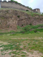
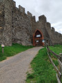
(1) Head right towards the Volerie du Forez. Then take the path on the left. Go round Château Sainte-Anne – home to the Volerie du Forez – on the left. At the junction, turn right onto the Route de Sainte-Anne.

(2) Cross the road and take the Chemin des Boëles opposite. Turn right onto the Chemin des Éparons.

(3) Then turn left just before the road, then right onto the Chemin des Plagnes. Take the Rue de la Cote on the right. Pass the cross and turn right onto the path opposite the château.

(4) At Route de Sainte-Anne, turn right then left onto Rue du Vieux Bourg. Walk past the church and, immediately afterwards, take the path on the right.

(5) At the barriers, head down the path on the left. Cross the river. Turn right and you’ll come to a road at a place called Le Bizay.

(6) Take the path opposite. Follow the Y1 signposts. Turn right.

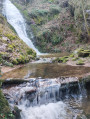
(7) Cross the river La Gouttes des Brosses and follow the path running alongside it.

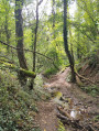
(8) At the hamlet of La Gouttes des Brosses, turn right to rejoin the path, then right again. Ignore the side paths, keeping generally eastwards. Return to the junction of the circular path.

(6) Turn left to follow the route back in the opposite direction to the outward journey, cross the river again and return to the junction with the barriers.

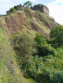
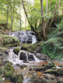
(5) Turn left; further on, follow the bend to the right. Pass the columnar basalt formations and return to the junction you passed at the start of the walk.

(1) Opposite, follow the route back in the opposite direction to return to the car park (S/E).

Waypoints

  1. S/E : mi 0 - alt. 1,690 ft - Marcilly-le-Châtel, Volerie du Forez car park
  2. 1 : mi 0.11 - alt. 1,726 ft - Junction common to both the outward and return journeys
  3. 2 : mi 0.5 - alt. 1,745 ft - Chemin des Boëles
  4. 3 : mi 1.2 - alt. 1,650 ft - Junction before the road
  5. 4 : mi 1.66 - alt. 1,565 ft - Route de Sainte-Anne
  6. 5 : mi 1.99 - alt. 1,558 ft - Crossroads with barriers
  7. 6 : mi 2.2 - alt. 1,591 ft - Le Bizay, junction of the circular loop
  8. 7 : mi 3.07 - alt. 1,608 ft - Crossing the river
  9. 8 : mi 3.66 - alt. 1,890 ft - La Goutte des Brosses
  10. S/E : mi 5.77 - alt. 1,693 ft - Marcilly-le-Châtel, Volerie du Forez car park

Worth a visit

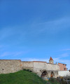
Château Sainte-Anne is home to the Volerie du Forez, which puts on bird and horse shows.
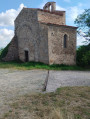
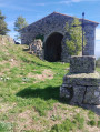
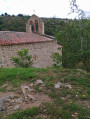
The church in the Old Town

Reviews and comments

4.5 / 5
Based on 2 reviews

Reliability of the description
4.5 / 5
Ease of following the route
4 / 5
Route interest
5 / 5
DDx
DDx

Overall rating : 4.7 / 5

Date of your route : Apr 20, 2025
Reliability of the description : ★★★★★ Very good
Ease of following the route : ★★★★☆ Good
Route interest : ★★★★★ Very good
Very busy route : No

Always an interesting route with Visorando.
Very well signposted. Well maintained.
Well worth a go.

Machine-translated

Minus
Minus

Overall rating : 4.3 / 5

Date of your route : Jan 06, 2025
Reliability of the description : ★★★★☆ Good
Ease of following the route : ★★★★☆ Good
Route interest : ★★★★★ Very good
Very busy route : Yes

A lovely discovery in the area around Marcilly-le-Châtel

Machine-translated

Other walks in the area

For more walks, use our search engine .

The GPS track and description are the property of this route's author. Please do not copy them without permission.