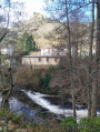
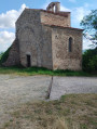
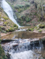
Goutelas Castle and Bélizar’s Tomb

Goutelas Castle and Bélizar’s Tomb: a walk through woodland and vineyards, with views over the plain...

Details

46906468
Creation:
Last update:
Last review:
  • Walking
    Activity: Walking
  • ↔
    Distance: 2.13 mi
  • ◔
    Average duration: 1h 20 
  • ▲
    Difficulty: Easy

  • ⚐
    Back to start: Yes
  • ↗
    Ascent: + 410 ft
  • ↘
    Descent: - 404 ft

  • ▲
    Highest point: 1,949 ft
  • ▼
    Lowest point: 1,499 ft

Description of the walk

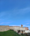
Château de Goutelas car park.

(S/E) Opposite the castle’s entrance gate, turn left and walk round the castle. Follow the path uphill until you reach the D20 road. Cross the road carefully and continue along the path opposite, which climbs into the forest.

(1) At the edge of the woodland, turn left onto a short but steep climb.
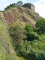
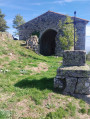
Turn left again onto the first path leading uphill into the woods, heading towards Bélizar’s tomb (Volcan de Montaubourg) . Along the way, you’ll catch sight of the villages of Trelins and Boën. At the tomb, you’ll see the villages of Marcoux, Montverdun, Le Mont d’Uzore and the Forez bird sanctuary.

(2) Head down through the meadows and vineyards, cross the D20 with care, and carry on until you reach a fork in the road.

(3) Turn left and carry on until you reach the woodland.

(4) Continue your descent, pass a riding centre and join the Allée du Château.

(5) Follow this quiet little road back to the Château de Goutelas car park (S/E).

Waypoints

  1. S/E : mi 0 - alt. 1,545 ft - Château de Goutelas car park
  2. 1 : mi 0.54 - alt. 1,811 ft - Junction at the edge of the woodland
  3. 2 : mi 0.81 - alt. 1,949 ft - Bélizar’s Tomb
  4. 3 : mi 1.2 - alt. 1,772 ft - Junction
  5. 4 : mi 1.6 - alt. 1,716 ft - Descent through the woodland
  6. 5 : mi 1.9 - alt. 1,503 ft - Allée du Château
  7. S/E : mi 2.13 - alt. 1,545 ft - Château de Goutelas car park

Worth a visit

Reviews and comments

4.8 / 5
Based on 2 reviews

Reliability of the description
5 / 5
Ease of following the route
5 / 5
Route interest
4.5 / 5
luc delaguillaumie
luc delaguillaumie

Overall rating : 5 / 5

Date of your route : Aug 26, 2024
Reliability of the description : ★★★★★ Very good
Ease of following the route : ★★★★★ Very good
Route interest : ★★★★★ Very good
Very busy route : No

Easy to walk. Ideal for those who don’t walk far. The information boards are also interesting, but unfortunately they’re starting to become illegible.

Machine-translated

jcmontbrison
jcmontbrison

Overall rating : 4.7 / 5

Date of your route : Apr 07, 2024
Reliability of the description : ★★★★★ Very good
Ease of following the route : ★★★★★ Very good
Route interest : ★★★★☆ Good
Very busy route : No

An easy route, almost entirely on wide paths. Can be done on a mountain bike.

Machine-translated

Other walks in the area

For more walks, use our search engine .

The GPS track and description are the property of this route's author. Please do not copy them without permission.