Vizézy Valley Circular Tour

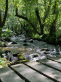
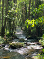
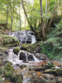
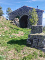
This circular route passes through the medieval site and Saint-Étienne Chapel, with the Source du Pic, which was once considered miraculous. The route then follows the river, before returning via the Bois d’Hérieux. A walk offering stunning views over the Vizézy valley.

Details

62808132
Creation:
Last update:
Last review:
  • Walking
    Activity: Walking
  • ↔
    Distance: 4.81 mi
  • ◔
    Average duration: 3h 10 
  • ▲
    Difficulty: Moderate

  • ⚐
    Back to start: Yes
  • ↗
    Ascent: + 1,142 ft
  • ↘
    Descent: - 1,129 ft

  • ▲
    Highest point: 2,556 ft
  • ▼
    Lowest point: 1,549 ft

Photos

Description of the walk

The start is in Essertines-en-Châtelneuf: park opposite the town hall.
This route follows the red markers indicating the Vizézy Valley.

(S/E) Opposite the town hall, turn left onto the Montée de l’Église. At the crossroads, walk past the wooden sculpture of a fisherman and continue along the path.

(1) Cross the Route d’Essertines and take the path opposite.

(2) At the junction, turn left. Follow the sign pointing towards the chapel. A little further on, turn right to reach the site.

(3) Then retrace your steps to return to the junction.

(2) Continue to the left.

(4) Cross the bridge over the Vitézy at Essertines basses, and follow the river to the right along the path. At the Y-junction, do not take the bridge but continue to the left.

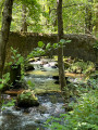
(5) Cross the three bridges that allow you to follow the river.

(6) At the end of the path, take the track on the left, then the one on the right.

(7) Climb the steps. At the Route d’Essertines, take a path that’s almost directly opposite, a few metres to the left. At the Fork in the road, turn right into the forest and, at the junction, go straight on up the path.

(8) At Mont Dion, walk past the hut and turn right to cross the Bois d’Hérieux.

(9) Go round a house to reach the hamlet of Hérieux. Before the cross, turn left, then right at the Y-junction.

(10) At the next junction, turn right.

(11) Cross the bridge over the Trézaillette.

(12) Cross the road to take the path opposite and continue to the right. Turn left onto the road, follow it for a few metres, then take the Chemin des Mésanges on the left. At the Fork in the road, turn right. When you reach the Montée de l’Église, cross the Place des Anciens Combattants, continue opposite the church, then turn right to return to the car park (S/E).

Waypoints

  1. S/E : mi 0 - alt. 2,326 ft - Essertines-en-Châtelneuf Town Hall
  2. 1 : mi 0.39 - alt. 1,965 ft - Cross the road
  3. 2 : mi 0.53 - alt. 1,916 ft - Les Sagnes Basses
  4. 3 : mi 0.74 - alt. 1,939 ft - Medieval site and - Chapelle Saint Etienne (Essertines-en-Châtelneuf)
  5. 4 : mi 1.07 - alt. 1,759 ft - Bridge at Essertines Basses - Vizézy (rivière)
  6. 5 : mi 1.53 - alt. 1,663 ft - First of the three bridges
  7. 6 : mi 2.17 - alt. 1,572 ft - junction
  8. 7 : mi 2.36 - alt. 1,640 ft - Route d’Essertines
  9. 8 : mi 2.83 - alt. 2,024 ft - Mont Dion (617m)
  10. 9 : mi 3.53 - alt. 2,270 ft - Hérieux
  11. 10 : mi 3.99 - alt. 2,556 ft - Junction
  12. 11 : mi 4.25 - alt. 2,402 ft - Waterfall Trail - Trézaillette (cours d'eau) - Affluent du Vizezy
  13. 12 : mi 4.44 - alt. 2,441 ft - Ascent to the Church
  14. S/E : mi 4.81 - alt. 2,326 ft - Essertines-en-Châtelneuf Town Hall

Notes

(3) Picnic area at the lower chapel.

(12) Picnic tables on the Chemin des Mésanges.

(3) At the chapel, you can go down the stairs to rejoin the path, then turn right to reach point (4).

Worth a visit

(3) Chapel and medieval site – free access.

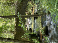
(11) On the right is a path leading down to the waterfalls.

Reviews and comments

4.8 / 5
Based on 2 reviews

Reliability of the description
5 / 5
Ease of following the route
5 / 5
Route interest
4.5 / 5
ASSG
ASSG

Overall rating : 4.7 / 5

Date of your route : Nov 17, 2025
Reliability of the description : ★★★★★ Very good
Ease of following the route : ★★★★★ Very good
Route interest : ★★★★☆ Good
Very busy route : No

A very beautiful walk in the woods with lovely autumn colours and a beautiful river.

Machine-translated

Belette42
Belette42

Overall rating : 5 / 5

Date of your route : May 15, 2025
Reliability of the description : ★★★★★ Very good
Ease of following the route : ★★★★★ Very good
Route interest : ★★★★★ Very good
Very busy route : No

A magnificent route! Very well signposted…
Following the route, we stopped off at St Etienne Chapel – a lovely spot… with a small picnic area… we walked alongside the Vizezy in simply stunning surroundings, which made us forget the initial descent and the climb that lay ahead 😁 but it was well worth it!

Machine-translated

Other walks in the area

For more walks, use our search engine .

The GPS track and description are the property of this route's author. Please do not copy them without permission.