The waterfall route in Essertines-en-Châtelneuf

Starting from the village of Essertines-en-Châtelneuf, this route, winding through woodland and countryside, passes through small hamlets and by the Trézaillette Waterfall.

Details

62567421
Creation:
Last update:
Last review:
  • Walking
    Activity: Walking
  • ↔
    Distance: 5.27 mi
  • ◔
    Average duration: 3h 15 
  • ▲
    Difficulty: Moderate

  • ⚐
    Back to start: Yes
  • ↗
    Ascent: + 965 ft
  • ↘
    Descent: - 971 ft

  • ▲
    Highest point: 2,572 ft
  • ▼
    Lowest point: 1,972 ft

Photos

Description of the walk

The start is in Essertines-en-Châtelneuf. Park opposite the town hall.

(S/E) Turn right towards the church. Cross the Place des Anciens Combattants and turn left onto the Montée de l’Église. Turn right onto the Chemin des Mésanges, then, at the junction, turn left towards Le Chevallard and rejoin the Montée de l’Église. Follow it, keeping to the right, for a few metres before taking a path on the right.

(1) Turn left at the Fork in the road to cross the road (Montée de l’Église) and join a path opposite. Cross the bridge over the Trézaillette (on the right is a path leading down to the waterfalls). At the next junction, turn left.

(2) At the next junction, turn right.

(3) At the junction by several meadows, turn left, then right at the next junction. On the road, turn left towards Contéol, then continue straight on along the path, following theGR®3signposts.

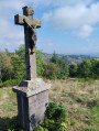
(4) When you reach a Black Cross, turn right towards Cantéol Bas. Then, at a Y-junction, take the “Les Clos” path on the left.

(5) Follow the small road on the left past the Moulin Palais. Walk past a cross and turn onto a path on the left.

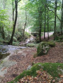
(6) Leave theGR®3. Turn left onto the Chemin du Champ du Plat, which descends into the forest.

(7) Turn left at the next junction, then, at the Fork in the road shortly afterwards, turn right.

(8) At Mont Dion, turn left to cross the Bois d’Hérieux.

(9) At Hérieux, go round the house, then, on the Chemin d’Hérieux, turn right to pass in front of a cross. Head towards the Trézaillette stream.

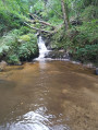
(10) The waterfall is on the left. Cross the stream and continue along the path to the next road junction; turn off almost directly opposite and head uphill towards the church to reach the car park opposite the town hall (S/E).


Waypoints

  1. S/E : mi 0 - alt. 2,336 ft - Essertines-en-Châtelneuf Town Hall
  2. 1 : mi 0.33 - alt. 2,444 ft - Junction
  3. 2 : mi 1.16 - alt. 2,316 ft - Hérieux, woodland side
  4. 3 : mi 1.71 - alt. 2,569 ft - Crossroads in the meadows
  5. 4 : mi 2.1 - alt. 2,411 ft - Cantéol Bas
  6. 5 : mi 2.47 - alt. 2,178 ft - Moulin Palais
  7. 6 : mi 2.69 - alt. 2,073 ft - Junction
  8. 7 : mi 3.19 - alt. 1,998 ft - The flat field
  9. 8 : mi 3.63 - alt. 2,024 ft - Mont Dion (617m)
  10. 9 : mi 4.34 - alt. 2,274 ft - Hérieux hamlet
  11. 10 : mi 4.86 - alt. 2,244 ft - The waterfall at the - Trézaillette (cours d'eau) - Affluent du Vizezy
  12. S/E : mi 5.27 - alt. 2,336 ft - Essertines-en-Châtelneuf Town Hall

Notes

(S/E) Picnic tables on the Chemin des Mésanges.

Worth a visit

200 m after (1), near the first bridge, there is a path on the right that leads down to the waterfalls and joins point (10). Look out for an orange pole as a marker.

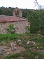
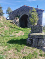
(10) On your return from the Chemin d’Hérieux, at the crossroads turn immediately right onto the path leading to Sagnes Basses to explore the medieval site and the chapel.

Always be cautious and plan ahead when you're outdoors. Visorando and the author of this route cannot be held responsible for any accidents occurring on this route.

The GR® and PR® markings are the intellectual property of the Fédération Française de Randonnée Pédestre.

Reviews and comments

4.3 / 5
Based on 3 reviews

Reliability of the description
4.3 / 5
Ease of following the route
4.7 / 5
Route interest
4 / 5
ASSG
ASSG

Overall rating : 4.7 / 5

Date of your route : Nov 17, 2025
Reliability of the description : ★★★★★ Very good
Ease of following the route : ★★★★★ Very good
Route interest : ★★★★☆ Good
Very busy route : No

A very beautiful walk in the woods with lovely autumn colours.

Machine-translated

Mel Melou
Mel Melou

Overall rating : 4.3 / 5

Date of your route : Mar 30, 2025
Reliability of the description : ★★★★☆ Good
Ease of following the route : ★★★★☆ Good
Route interest : ★★★★★ Very good
Very busy route : Yes

A very enjoyable route with a few challenging bits. At times it wasn’t easy to follow, but we quickly realised where we’d gone wrong. We did it with our five-and-a-half-year-old daughter, who managed to keep up from start to almost finish, so the description of it being of medium difficulty is accurate.
The waterfall at the end is a lovely reward.

Machine-translated

bader
bader

Overall rating : 4 / 5

Date of your route : Nov 18, 2024
Reliability of the description : ★★★★☆ Good
Ease of following the route : ★★★★★ Very good
Route interest : ★★★☆☆ Average
Very busy route : No

Carried out on Saturday 16 November 2024.

Machine-translated

Other walks in the area

For more walks, use our search engine .

The GPS track and description are the property of this route's author. Please do not copy them without permission.