Refine your search for walks in Mont Dion (617m)
Mont Dion (617m) walks


 Vizézy Valley Circular Tour
 Visorando Member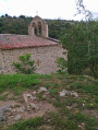
 4.81 mi
 +1,142 ft
 -1,129 ft
 3h 10
3h 10
 Moderate
 Departure from Essertines-en-Châtelneuf (Loire)
This circular route passes through the medieval site and Saint-Étienne Chapel, with the Source du Pic, which was once considered miraculous. The route then follows the river, before returning via the Bois d’Hérieux. A walk offering stunning views over the Vizézy valley.
The waterfall route in Essertines-en-Châtelneuf
 5.27 mi
+965 ft
-971 ft
3h 15
Moderate
Departure from Essertines-en-Châtelneuf (Loire)
5.27 mi
+965 ft
-971 ft
3h 15
Moderate
Departure from Essertines-en-Châtelneuf (Loire)
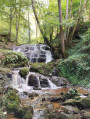
Starting from the village of Essertines-en-Châtelneuf, this route, winding through woodland and countryside, passes through small hamlets and by the Trézaillette Waterfall.
Walks near Mont Dion (617m)
 Col des Supeyres to Col du Béal
 8.78 mi
+1,178 ft
-1,099 ft
3 hrs
8.78 mi
+1,178 ft
-1,099 ft
3 hrs
 Easy
Departure from Valcivières (Puy-de-Dôme)
Easy
Departure from Valcivières (Puy-de-Dôme)
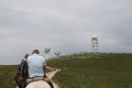
Spend two days discovering one of the most beautiful destinations in “France à cheval”.
Col des Pradeaux – Col des Supeyres
6.88 mi
+1,020 ft
-440 ft
4h 05
Moderate
Departure from Grandrif (Puy-de-Dôme)
This is stage 1 of a mini-trek that can be completed in two days, linking two iconic passes in the Forez region. From the Col des Pradeaux, you’ll make your way to the Col des Supeyres. During this walk, you’ll be able to admire the Pradeaux Dam, the Hautes Chaumes and the iconic shepherd's huts.
Col du Béal – Col des Supeyres
 10.70 mi
+1,503 ft
-1,591 ft
6h 15
Moderate
Departure from Saint-Pierre-la-Bourlhonne (Puy-de-Dôme)
10.70 mi
+1,503 ft
-1,591 ft
6h 15
Moderate
Departure from Saint-Pierre-la-Bourlhonne (Puy-de-Dôme)
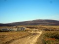
Stage 2: the most beautiful stage of the route. Spectacular, with heathland stretching as far as the eye can see, a boundless 360° view where stunted pines bend under the “burle”. Photos, scents – set aside the whole day.
GR®3route, partly well signposted.