Neumatt Circular Route

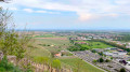
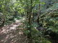
This route winds its way up through the Vosges forests, overlooking Lake Kruth-Wildenstein. It offers some lovely views of the lake.

If you’re quiet enough, you might also spot does, stags and roe deer.

You can carry on further from the (2) towards the Le Grieb inn for a lunch break!

Details

n°2176730
Creation:
Last update:
Last review:
  • Mountain biking
    Activity: Mountain biking
  • ↔
    Distance: 5.56 mi
  • ◔
    Duration according to the author: 1.5 hrs 
  • ▲
    Difficulty: Moderate

  • ⚐
    Back to start: Yes
  • ↗
    Ascent: + 1,132 ft
  • ↘
    Descent: - 1,122 ft

  • ▲
    Highest point: 2,802 ft
  • ▼
    Lowest point: 1,673 ft

Description of the route

Starting point: Kruth-Wildenstein Lake Visitor Centre (car park).

(S/E) Take the D27 road towards Markstein. After about 140 metres, take the ‘Claire Vie’ forest track. At the junction, continue straight on along the main track, leaving the Claire Vie track on your right.

(1) Stay on this main track, leaving the path leading to the Neumatt chalet (private) on your left.

Pass close to a stream without crossing it and continue along the main track, which climbs and curves slightly to the left, then descends after a few kilometres.

(2) When you reach the junction with the D27 road, turn right.

At the first bend, turn onto the track that branches off to the left and leaves the departmental road. This track is steep and stony; it is suitable for experienced mountain bikers.

(3) Once you reach Kruth, turn right onto the D13bis, then left onto the D144 to reach the lake’s dam.

(4) Follow the D144 along the right-hand side of the lake to return to the visitor centre (S/E).

Waypoints

  1. S/E : mi 0 - alt. 1,808 ft - Car park at the Lake Visitor Centre - Lac de Kruth-Wildenstein
  2. 1 : mi 0.95 - alt. 2,365 ft - Chalet de la Neumatt
  3. 2 : mi 3.8 - alt. 2,172 ft - D27. Right onto the road/left onto the path
  4. 3 : mi 4.35 - alt. 1,673 ft - D13bis. Right turn/left turn
  5. 4 : mi 4.82 - alt. 1,801 ft - Kruth-Wildenstein Dam - La Thur
  6. S/E : mi 5.56 - alt. 1,804 ft - Car park at the Lake Visitor Centre. Near the - Château de Wildenstein

Worth a visit

Lake Kruth-Wildenstein is an ideal spot for family days out in summer: you can go fishing and swimming there (at your own risk), as well as enjoy the activities at the Tree Adventure Park (tree-top adventure course, archery, mountain biking, pedalos, etc.).

The Kruth-Wildenstein Lake dam was built in 1960 to regulate the irregular flow of the River Thur. The river is renowned for its impetuous nature, with frequent and sudden floods when the heavily snow-covered hills thaw in winter.

You can also take the opportunity to go on a short (1½ hours) and enjoyable walk: head up to the ruins of Wildenstein Castle on the Schlossberg. You’ll have a breathtaking view of the valley from the summit!

Reviews and comments

4.7 / 5
Based on 1 review

Reliability of the description
5 / 5
Ease of following the route
5 / 5
Route interest
4 / 5
User 31035710

Overall rating : 4.7 / 5

Date of your route : Sep 08, 2026
Reliability of the description : ★★★★★ Very good
Ease of following the route : ★★★★★ Very good
Route interest : ★★★★☆ Good
Very busy route : No

A lovely walk. The signposts were clear. The view when we reached the farm was magnificent.

Machine-translated

Other walks in the area

For more walks, use our search engine .

The GPS track and description are the property of this route's author. Please do not copy them without permission.