The Trou de l’Enfer in Rehaupal

A short, very pleasant route for stretching your legs in the woodland.

Details

36839061
Creation:
Last update:
Last review:
  • Mountain biking
    Activity: Mountain biking
  • ↔
    Distance: 4.94 mi
  • ◔
    Duration according to the author: 1 hr 
  • ▲
    Difficulty: Moderate

  • ⚐
    Back to start: Yes
  • ↗
    Ascent: + 587 ft
  • ↘
    Descent: - 587 ft

  • ▲
    Highest point: 2,251 ft
  • ▼
    Lowest point: 1,654 ft
  • ⚐ Country: France
  • ⚐
  • ⚐ City: Rehaupal (88640)
  • ⚑
    Start/End: N 48.119753° / E 6.731149°
  • ❏
    IGN map(s): Ref. 3618OT, 3618OTR

  • ◶
    Type of surface: Not specified
  • ⇧
    Bike carrying: Not specified
  • ▲
    Difficulty: Moderate
  • Hour-by-hour weather

Photos

Description of the route

Start from the small car park near the church.

Red Ring markings

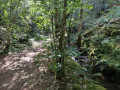
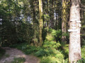
(S/E) Head south towards the inn, then take the road on the right just after No. 40. Continue along the Chemin du Trou de l’Enfer, which is very smooth and slightly uphill. Enter the forest.

(1) Carry on straight for about 2 km until you reach a road.

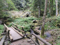
(2) Ignore this and turn left, following the signs for the Trou de l’Enfer. Descend a few metres and carefully navigate the technical section of the walk, which is about ten metres long . Less experienced riders should not hesitate to dismount.
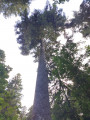
Carry on along a narrow path on the hillside and you’ll soon reach the access path to the Sapin Président. (Don’t hesitate to walk the 100 m there and back to see the base of this majestic tree.) Carry on and you’ll then reach the Trou de l’Enfer.

(3) Cross the stream and head back up onto the main path. Turn left and follow the path alongside the Ruisseau du Barba.

(4) Pass a scree slope (on your right) and carry on straight ahead until you reach a three-way junction.

(5) Follow the path to the left and rejoin the track you took earlier.

(1) Continue to the right and retrace your steps to the church at Rehaupal (S/E).

Waypoints

  1. S/E : mi 0 - alt. 1,663 ft - Car park - Église Saint-Pierre (Rehaupal)
  2. 1 : mi 0.8 - alt. 1,739 ft - Crossroads at the end of the circular loop - Barba (rivière)
  3. 2 : mi 2.33 - alt. 2,238 ft - Turn left at the fork
  4. 3 : mi 2.51 - alt. 2,073 ft - Trou de l'Enfer (Le Tholy)
  5. 4 : mi 2.69 - alt. 2,034 ft - Scree slope on the right
  6. 5 : mi 3.14 - alt. 1,959 ft - Path to the left
  7. S/E : mi 4.94 - alt. 1,663 ft - Car park - Église Saint-Pierre (Rehaupal)

Notes

The car park in front of the Auberge du Haut Jardin is private.

The whole route is very easy and smooth; there is just one technical section on the descent to the Trou de l’Enfer, which is why I’ve rated this hike as moderate rather than easy.

Reviews and comments

4 / 5
Based on 4 reviews

Reliability of the description
3.8 / 5
Ease of following the route
4.3 / 5
Route interest
4 / 5
Olivier G8.
Olivier G8.

Overall rating : 5 / 5

Date of your route : Feb 23, 2026
Reliability of the description : ★★★★★ Very good
Ease of following the route : ★★★★★ Very good
Route interest : ★★★★★ Very good
Very busy route : No

A very pleasant walk through the woods along the Barba river.

Machine-translated

Tessier sylviane
Tessier sylviane

Overall rating : 4.7 / 5

Date of your route : Sep 17, 2024
Reliability of the description : ★★★★☆ Good
Ease of following the route : ★★★★★ Very good
Route interest : ★★★★★ Very good
Very busy route : No

A lovely, easy walk

Machine-translated

jeom5670
jeom5670

Overall rating : 4 / 5

Date of your route : Sep 10, 2024
Reliability of the description : ★★★★☆ Good
Ease of following the route : ★★★★☆ Good
Route interest : ★★★★☆ Good
Very busy route : Yes

Set off from Le Tholy towards the ‘Trou de l’Enfer’, then a return trip to Rehaupal, followed by the ‘4 Chemins’ route back to Le Tholy. Enjoy the walk!

Machine-translated

primtemps
primtemps

Overall rating : 2.3 / 5

Date of your route : Aug 27, 2024
Reliability of the description : ★★☆☆☆ Disappointing
Ease of following the route : ★★★☆☆ Average
Route interest : ★★☆☆☆ Disappointing
Very busy route : No

Hello,
There was a mistake right from the start: it says ‘No. 36’ when it should be ‘No. 40’.
As a result, we headed off in the wrong direction and wasted a lot of time.
So please correct this, thank you.
Have a good day.

Machine-translated

Other walks in the area

For more walks, use our search engine .

The GPS track and description are the property of this route's author. Please do not copy them without permission.