Route of L’Épine, La Bernardière, La Braudière and La Sauvagère

A lovely walk starting from the Fontaine de Mareuil, offering the chance to explore the Mellois plateau in the Épine area, near La Bernardière, La Braudière, the Bois de la Garde and La Sauvagère.

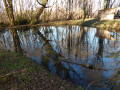
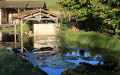
The Fontaine – the wash house at Fontaine de Mareuil – is one of the many well-restored wash houses on the Mellois plateau. The stream that feeds it flows into the River Légère.

Details

n°491922
Creation:
Last update:
Last review:
  • Walking
    Activity: Walking
  • ↔
    Distance: 4.79 mi
  • ◔
    Average duration: 2h 20 
  • ▲
    Difficulty: Easy

  • ⚐
    Back to start: Yes
  • ↗
    Ascent: + 105 ft
  • ↘
    Descent: - 105 ft

  • ▲
    Highest point: 558 ft
  • ▼
    Lowest point: 456 ft

Photos

Description of the walk

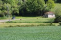
The car park is situated near the Mareuil Fountain (on the other side of the small road in a grassy area near the pumping station).
Make the most of the proximity to the Mareuil fountain and washhouse to admire this well-restored washhouse, typical of the many washhouses on the Mellois plateau.

(S/E) Leave the car park by taking the small road eastwards towards L’Épine. Pass the road on your left which leads, amongst other places, to Saint-Léger-de-la-Martinière.
Just as the road bends to the right and begins to climb, turn left onto the farm track opposite. Initially, it runs alongside a farm track on the right-hand side through private land. Follow the track until it joins a small road at a T-junction. Turn left.
At the next left-hand bend, turn right onto the farm track that appears on the right behind a hedge. Follow this farm track, which climbs very gently, until it joins a small road at the hamlet of Terre Noire.

(1) Turn right onto the small road and follow it to the hamlet of La Valtière. At the next junction, carry on straight ahead. Shortly afterwards, pass a small dead-end road on your left which serves a few houses, then immediately, still on the left, a short farm track leading to a house.
Further on, at a right-hand bend, pass a track on the left and continue along the small road. Take the next track on the left before the houses at La Bernardière.
The track joins the small road at a T-junction: turn left and take the road, which quickly becomes a farm track.
Follow the farm track until you reach the first farm track on the right.

(2) Turn right. Follow this farm track until it joins a small road linking La Bernardière to La Braudière. Turn left towards La Braudière.

(3) Cross the D305 straight ahead to reach the hamlet of La Braudière. Almost immediately, turn right onto the street that serves most of the houses in the hamlet. As you pass, you can admire a communal well and a bread oven on the left. Ignore the streets on the right and left leading to the various houses.
After a left-hand bend, the street leads to a T-junction. Turn right. A little further on, pass the path on the left leading to a house (Maison Neuve).
A little further on, pass a farm track on the right and, immediately afterwards, another on the left.
Just as the small road bends sharply to the right, continue along the path opposite, which runs along the edge of the Bois Charbonnier.

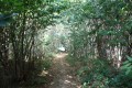
(4) At the first Y-junction of forest tracks, turn right, leaving the track running along the edge of the woodland. After crossing a good part of the Bois de la Garde, take the track on the right at a Y-junction of forest tracks.
The path soon joins the Route du Bois de la Garde: turn right.
After a short stretch between two woods, the road runs alongside the Bois Charbonnier on the right and a field on the left.

(5) Take the first forest track on the left. This track will soon reach the edge of the Bois de la Garde. At the next junction where six tracks meet, carry on straight ahead, leaving two tracks on the left (including the one that crosses the Bois de la Garde) and two tracks on the right (including the one leading to the hamlet of La Terrassonerie).
Near the hamlet of La Sauvagère, leave the road on your right that serves the houses and continue straight on along the farm track opposite.
The farm track runs alongside some gardens before moving away from the hamlet. Before it joins the D305 road at La Cordillière, take the small track on the right and join the D305.

(6) Cross the road and take the farm track between the road and the houses. Further on, turn left onto the farm track.
Shortly afterwards, the farm track takes a right-angled left-hand bend. Follow the farm track as it climbs very gently before levelling out. The farm track leads to a crossroads. Take the road opposite, which leads to L’Épine.
At the next right-angle bend to the right, take the farm track on the left, almost directly opposite.

(7) At the next junction of farm tracks, turn right and head back towards the houses in L’Épine. A little further on, turn left (do not go straight on down a dead-end track).
The track descends gently towards L’Épine. The track joins the road that runs through the hamlet. Turn left onto the road that goes downhill.
At a wide bend to the left, leave the farm track on your right (the one you took at the start), then the road leading to Bournaveau and Saint-Léger-la-Martinière.
On the left, the route ends at the car park (S/E).

Waypoints

  1. S/E : mi 0 - alt. 456 ft - Mareuil Fountain
  2. 1 : mi 0.65 - alt. 528 ft - Junction of a farm track and a minor road
  3. 2 : mi 1.44 - alt. 554 ft - T-junction of farm tracks
  4. 3 : mi 1.96 - alt. 541 ft - Road junction with the D305 near La Braudière
  5. 4 : mi 2.54 - alt. 509 ft - T-junction
  6. 5 : mi 3.14 - alt. 528 ft - Junction between a road and a farm track
  7. 6 : mi 3.66 - alt. 535 ft - Crossroads near La Corbillière
  8. 7 : mi 4.38 - alt. 512 ft - Crossroads of farm tracks
  9. S/E : mi 4.79 - alt. 456 ft - Mareuil Fountain

Notes

The variety of soils encountered during this walk means you’ll need suitable footwear.

In Saint-Léger-de-la-Martinière, the landscape of the commune consists of:

  • bocage
  • open field plains
  • valleys

The different types of soil in the commune of Saint-Léger-de-la-Martinière are mainly red soil plateaus (shallow red soils 60 per cent, medium-depth red soils 10 per cent and
deep red soils 19%), the Seuil du Poitou plateaus (shallow flint-rich clay 4%), alluvial valleys and terraces (clay valleys of the Pays Mellois 3%), other areas (built-up areas 5%) and limestone plains (wooded middle Groie of the Saintonge less than 1%).

Worth a visit

Mareuil Spring
It is fed by the 1.6 km-long Mareuil Spring stream, which runs entirely through the commune of Saint-Léger-de-la Martinière

Saint-Léger-de-la Martinière
Its church
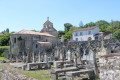
Built in the 12th century, the church of Saint-Léger-lès-Melle was under the jurisdiction of the Abbey of Saint-Jean d’Angély.
It was restored in 1682 by the architect Le Duc, known as ‘Toscane’, at the expense of René de Poix, lord of the fief of Saint-Romans, who had his coat of arms depicted on either side of the chancel.
An illiterate sculptor engraved “elle dègle” to refer to the eagle’s wings depicted on the coat of arms.
The nave is paved with tombstones, including that of Charles Lecoq, Lord of Saint-Léger, who died in 1718.
The portal dates from the 16th century. In the 19th century, various restoration works were carried out and windows were opened up in the chancel.
In 1901, the gable of the façade was rebuilt, and two new bells were installed there.

Melle
Saint-Hilaire Church: a Catholic church situated in Melle, France. It has also been listed as a UNESCO World Heritage Site since 1998, as a stop on the Routes of Santiago de Compostela in France. Of particular note is the chevet, characterised by the stepped arrangement of the roofs of the apses, followed by the ambulatory, and finally the chancel, which is surmounted by the bell tower. It is a model of balance. The south façade: above the portal runs a cornice with historiated modillions (symbols of the Evangelists), between which the signs of the zodiac are carved. The north side wall: stands out for its sculptures. The horseman in high relief, set in a niche, is said to symbolise Constantine I’s victory over the pagans; he surmounts the depiction of the battle between the vices and the virtues on the outer roll of the arch. The current sculpture dates mainly from a restoration in 1872; only the central section is authentic.

There are two other Romanesque churches in the town: Saint-Savinien and Saint-Pierre. The Hôtel du Ménoc is also worth a visit (the former courthouse).

In addition to the Romanesque churches, Melle boasts a variety of remarkable monuments and sites:
- The Hôtel de Ménoc, a composite building with stair towers in the Flamboyant Gothic style
- The Art Deco bandstand
- The market halls, with their metal framework
- The Hôpital, a former Capuchin convent
- The Protestant church and cemeteries, evidence of the strong influence of the Reformation
- The Discovery Trail
- The Green Belt
- The Forest Arboretum
- The Loubeau quarries

Reviews and comments

4.7 / 5
Based on 1 review

Reliability of the description
5 / 5
Ease of following the route
5 / 5
Route interest
4 / 5
pgetrochon
pgetrochon

Hello,

Thank you for your message.
I’m surprised by your comment regarding the GPS coordinates for the starting point. I checked them this morning on both Visorando (IGN map) and Google Maps, and they are correct. Moreover, with the map and the landmarks provided by the roads and the nearby Mareuil washhouse, you should have found it easily.
Enjoy your walks.

Machine-translated

Sneg
Sneg
• Edited:

Overall rating : 4.7 / 5

Date of your route : Mar 28, 2021
Reliability of the description : ★★★★★ Very good
Ease of following the route : ★★★★★ Very good
Route interest : ★★★★☆ Good
Very busy route : No

.

Machine-translated

Other walks in the area

For more walks, use our search engine .

The GPS track and description are the property of this route's author. Please do not copy them without permission.