The Gaulardière circular walk in Sennely

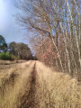
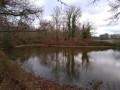
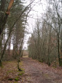
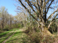
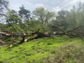
A lovely circular walk along varied paths and through the Sologne forests with their diverse range of tree species. If you remain alert and keep a low profile, you can spot numerous animal species, including birds, deer and wild boar. Please be aware of hunting seasons!

Details

1599178
Creation:
Last update:
Last review:
  • Walking
    Activity: Walking
  • ↔
    Distance: 9.24 mi
  • ◔
    Average duration: 4h 20 
  • ▲
    Difficulty: Moderate

  • ⚐
    Back to start: Yes
  • ↗
    Ascent: + 69 ft
  • ↘
    Descent: - 69 ft

  • ▲
    Highest point: 486 ft
  • ▼
    Lowest point: 397 ft
  • ⚐ Country: France
  • ⚐
    Area: Sologne
  • ⚐ City: Sennely (45240)
  • ⚑
    Start/End: N 47.678274° / E 2.14441°
  • ❏
    IGN map(s): Ref. 2221SB, 2321SB
  • Hour-by-hour weather

Photos

Description of the walk

To reach the starting point of this circular walk:
From Sennely town centre, take the D17 (Grand Rue then Rue de Villechaume) towards La Ferté-Saint-Aubin.
Park in the car park at the junction of Route de la Ferté-Saint-Aubin and Route de Vouzon.

(S/E) Start on the D12 towards Vouzon, then take the first track on the left (signposted CR – Chemin des Bâtes). You’ll reach an X-junction near the Étang des Bâtes.

(1) Follow the track on the left (signposted CR). Carry on, ignoring all side tracks. Pass the hamlet of Maison Neuve and join the D126.

(2) Turn left, follow the D126 for about 35 metres, then turn right onto the path signposted CR – take care when crossing the road. Follow this path, ignoring any side paths. You will arrive at the foot of La Valinière.

(3) Turn left, continue along the descending track until you reach a T-junction, then turn right and follow a grassy track. Pass a hairpin bend then continue straight on; the track runs between the Petit Étang and the Étang des Gâts. Join the SologneGRP®.

(4) Continue to the right along theGRP®, marked in yellow and red, for about 1,300 metres. You’ll reach a junction with a wide path.

(5) Leave theGRP® by turning right and follow the CR signposts on a red background. Ignore the minor tracks and reach the D126. Cross with care.

(6) Follow the track opposite, signposted ‘CR’ on a red background. Ignore all side paths as well as a ‘CR’ track branching off to the left. You’ll reach a junction of four tracks.

(7) Ignore the path on the left signposted ‘CR’ on a red background and continue straight on, following the ‘CR’ signs on a brown background. You’ll cross a wide, open track. Then go round the hamlet of Maisonnette on the right. You’ll reach a T-junction.

(8) Turn right and continue to follow the CR signs on a brown background. Ignore all minor tracks. At the next junction, at elevation 142, first turn right then left and continue along a grassy path. This path runs alongside a ditch on the edge of the Lamotte-Beuvron State Forest.

(9) Caution! At this point, ignore the brown CR signposting to the right. Continue straight ahead, crossing the ditch to do so. Pass the Carrefour de la Gaulardière and join the D125; there is a picnic area on the left-hand side of the road.

(10) Cross the D125 – take care. At the fork in the road, take the right-hand path, Allée du Gué de la Cansle. This is a grassy path heading north, situated at the corner of Lot No. 16.

Continue straight on along this path for about 1,700 metres. Ignore all the side paths (Allée des Chevreuils, Allée des Terres Noires and other unnamed paths) until you come to a ditch.

(11) Turn right, follow the ditch, ignoring all side paths.

(12) Ignore the path branching off to the right, cross the ditch to join a path signposted ‘CR’, which you should follow to the left.

Pass the hamlet of La Folie on your right and join the D17. Cross it carefully, then cross the D64 carefully. Follow the path opposite, signposted CR.

(13) At the Y-junction, take the left-hand path to go round the hamlet of Champ Guilbert on the left. Continue until you join the SologneGRP ®.

(14) Turn right and follow the yellow-and-red markings with additional yellow markings. Pass through the hamlets of Le Petit Gâtinais, La Venottière, Cellettes and Bel-Air in turn, until you reach the D17.

(15) Follow the D17 to the left, towards the town centre, and return to the starting car park (A/D).

Waypoints

  1. S/E : mi 0 - alt. 417 ft - Car park at the junction of Route Ferté-Saint-Aubin and Route Vouzon
  2. 1 : mi 0.38 - alt. 433 ft - Left-hand track signposted ‘CR’
  3. 2 : mi 0.87 - alt. 453 ft - Turn left/right onto the D126 then the CR
  4. 3 : mi 1.19 - alt. 456 ft - On the left, a path leading downhill
  5. 4 : mi 1.64 - alt. 440 ft - Turn right onto the GR de Pays de Sologne trail (Yellow-Red)
  6. 5 : mi 2.43 - alt. 472 ft - Turn right onto the CR on the red background
  7. 6 : mi 2.87 - alt. 486 ft - Straight ahead, CR on a red background
  8. 7 : mi 3.39 - alt. 479 ft - Straight ahead, CR on a brown background
  9. 8 : mi 4.14 - alt. 469 ft - On the right: CR on a brown background
  10. 9 : mi 5.1 - alt. 449 ft - Fossé
  11. 10 : mi 5.48 - alt. 446 ft - Cross the D15, then take the grassy track on the right
  12. 11 : mi 6.53 - alt. 427 ft - On the right as you walk along the ditch
  13. 12 : mi 7.11 - alt. 427 ft - On the left as you cross the ditch
  14. 13 : mi 7.96 - alt. 413 ft - Champ Guilbert
  15. 14 : mi 8.19 - alt. 407 ft - Turn right at the junction, Red-Yellow GRP trail
  16. 15 : mi 9.07 - alt. 427 ft - Turn left onto the D17
  17. S/E : mi 9.24 - alt. 417 ft - Car park at the junction of Route Ferté-Saint-Aubin and Route Vouzon

Worth a visit

Sennely

- Its history:
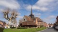
Derived from the Latin ‘Seneliacum’, its known origins are very ancient. In 855, Charles the Bald donated his estates to Saint-Euverte Abbey in Orléans. In 1160, Louis VII subjected its inhabitants to the laws and customs of Lorris and, in 1180, Sennely was a fief of Thibault, Count of Blois and Grand Seneschal of France. Subsequently, the Lordship of Sennely was attached to the barony of Sully, which made it a castellany.

- Geographical location:
A small village in Sologne, Sennely is situated at the southern tip of the Loiret department, near the Loir-et-Cher. Covering an area of 4,932 hectares, it forms part of the canton of La Ferté-Saint-Aubin, the administrative centre of the community of communes, from which it is 18 km away. Its altitude of 135 metres makes it one of the highest communes in Sologne. Its red-brick houses reflect the character of this region, which experienced a period of great prosperity during the Second Empire.

Source: Sennely Town Hall website.

Reviews and comments

4.8 / 5
Based on 2 reviews

Reliability of the description
4.5 / 5
Ease of following the route
5 / 5
Route interest
5 / 5
landrette
landrette

Overall rating : 5 / 5

Date of your route : Jan 24, 2022
Reliability of the description : ★★★★★ Very good
Ease of following the route : ★★★★★ Very good
Route interest : ★★★★★ Very good
Very busy route : No

A brilliant circular route, typical of the Sologne region, following paths almost all the way with very little tarmac and very easy to follow! Well done and thank you to whoever was kind enough to share it. Winter is probably not the best time of year (some of the paths can get very muddy at times), but we’ll be happy to do it again in the other three seasons!!!

Machine-translated

AnneBihan
AnneBihan

Overall rating : 4.7 / 5

Date of your route : Apr 21, 2019
Reliability of the description : ★★★★☆ Good
Ease of following the route : ★★★★★ Very good
Route interest : ★★★★★ Very good

A lovely walk through varied, wild and peaceful countryside.

Machine-translated

marmo89
marmo89

unused

Machine-translated

Other walks in the area

For more walks, use our search engine .

The GPS track and description are the property of this route's author. Please do not copy them without permission.