Towards the treasures of La Grillère

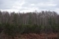
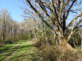
A circular route through the wild landscapes of the Sologne, amongst moors, ponds, woods and forests, will introduce you to a land rich in game, where the variety of the scenery is sure to surprise you.

Details

n°1122960
Creation:
Last update:
Last review:
  • Walking
    Activity: Walking
  • ↔
    Distance: 10.77 mi
  • ◔
    Average duration: 5h 00 
  • ▲
    Difficulty: Moderate

  • ⚐
    Back to start: Yes
  • ↗
    Ascent: + 59 ft
  • ↘
    Descent: - 59 ft

  • ▲
    Highest point: 479 ft
  • ▼
    Lowest point: 394 ft
  • ⚐ Country: France
  • ⚐
    Area: Sologne
  • ⚐ City: Sennely (45240)
  • ⚑
    Start/End: N 47.677388° / E 2.146723°
  • ❏
    IGN map(s): Ref. 2220E, 2221SB, 2321SB
  • Hour-by-hour weather

Photos

Description of the walk

The route starts at the Place de l’Église in Sennely.

(S/E) From the square, turn left onto the Grand Rue, then take the left-hand lane at the Fork in the road – this is the Rue de la Forêt – heading towards Vouzon and Lamotte-Beuvron. Immediately afterwards, ignore the Rue de Villechaume on the right, which you will take on the return journey.

(1) Take the first track on the left, the Chemin des Bastes, then ignore the various turn-offs until you reach La Brossinière.

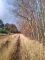
(2) At the four-way crossroads, ignore the lane leading to the Brossinière farm, turning left near the spring, then immediately right to walk alongside a heath covered in broom. This lovely lane soon becomes a forest track.

(3) Turn right at the four-way junction and ignore the adjacent paths leading to the hamlet of Maisonnette on the left.

(4) At the T-junction, turn right onto the grassy path.

(5) At the three-way junction, go round the gate before taking the wide grassy lane on the left. Pass two crossroads.

(6) At the next junction, leave the path straight ahead and take a grassy track on the right, the Allée de Souvigny. This straight path leads to the beautiful Étang du Petit Cansle, which you’ll walk alongside on the right, then go round, ignoring the turn-off to the right. Continue along the Vieux Chemin de Vouzon.

(7) After passing through the gate, at the star-shaped junction, leave the grassy path straight ahead – which also has a gate – and turn off to the right towards the Carrefour de la Grillère.

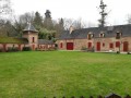
(8) Continue along the lovely lane, which has no barrier, keeping slightly to the right (ignore the two paths furthest to the right). At the junction with the D125 (take care), carry on straight ahead towards the Grillaire farm. Pass the farm and its pond mill, as well as the château; cross the path by the pond (barely visible behind a hedge) and note the old mill on the left.

(9) At the fork in the road, head straight on towards Ménestreau, leaving the right-hand track towards Sennely. The lovely avenue turns into a forest track.

(10) At the crossroads 400 metres further on, turn right and then cross the Chaussée de l’Étang.

(11) At the star-shaped junction, continue along the path without a barrier, keeping slightly to the left, and stay heading in the same direction. Turn right when you reach the D17.

(12) After 350m, take the grassy path on the left, opposite the fences and the lane leading to La Guérinière. Ignore the various offshoots, cross the D64 (take care) and head straight ahead onto the grassy path.

(13) When you reach a hard-surfaced lane, turn right, then, after passing the shed, turn left onto the grassy path, crossing a small wooden bridge. Take the left-hand track as you approach the pond. This grassy path, which is rarely used, is poorly marked.

(14) At the cross-path, turn right onto a track that is initially sandy to cross the stream, then head along the path opposite at the star-shaped junction. This forest track crosses a hard-surfaced lane and then becomes hard-surfaced itself, taking the name Chemin de Champ Guilbert as you approach the various localities and then the first houses of Sennely.

(15) Keep left when you reach the D17, Rue de Villechaume, walk past the cemetery, turn left onto the D12 and then right at the Fork in the road to rejoin the Grand Rue and then the Place de l’Église, our starting point (S/E).

Waypoints

  1. S/E : mi 0 - alt. 420 ft - Sennely Church Square
  2. 1 : mi 0.18 - alt. 417 ft - Chemin des Bastes on the left
  3. 2 : mi 1.1 - alt. 472 ft - Turn left near the fountain, then right
  4. 3 : mi 1.37 - alt. 479 ft - Turn right at the crossroads
  5. 4 : mi 2.11 - alt. 469 ft - Turn right onto the grassy path
  6. 5 : mi 2.41 - alt. 463 ft - Wide grassy path to the left
  7. 6 : mi 2.73 - alt. 476 ft - Grassy path on the right
  8. 7 : mi 3.8 - alt. 459 ft - Turn right onto a path with no barrier
  9. 8 : mi 4.2 - alt. 449 ft - Turn right onto a lovely lane with no barrier
  10. 9 : mi 5.02 - alt. 417 ft - Towards Menestreau
  11. 10 : mi 5.3 - alt. 410 ft - Turn right onto the path by the pond
  12. 11 : mi 5.78 - alt. 423 ft - Turn left onto a path with no barrier
  13. 12 : mi 6.76 - alt. 420 ft - CR grassy path to the left
  14. 13 : mi 8.08 - alt. 404 ft - Turn right, then, once past the hangar, turn left
  15. 14 : mi 8.36 - alt. 400 ft - Turn right onto a path that is initially sandy
  16. 15 : mi 10.47 - alt. 423 ft - Turn left onto the D17
  17. S/E : mi 10.77 - alt. 420 ft - Sennely Church Square

Notes

After heavy rain, the path around the pond near La Grillère may be flooded.

The lack of signposting means you need to be vigilant. However, there are relatively few changes of direction, which allows you to focus on the few challenging sections.

Worth a visit

Places to see during the walk:
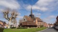
- the Saint-Jean-Baptiste church in Sennely, with its distinctive bell tower, as well as the Place du Marché,
- the Grillère farm and its pond mill. However, the château is difficult to admire as it is hidden behind an imposing gate,
- the Lamotte-Beuvron State Forest during the first half of the route.

Reviews and comments

4.7 / 5
Based on 1 review

Reliability of the description
5 / 5
Ease of following the route
5 / 5
Route interest
4 / 5
Jean-Louis Pinault
Jean-Louis Pinault

Thank you for your comments; the Sologne forest is the perfect setting during this spell of hot weather!
Jean-Louis

Machine-translated

User 19032612
• Edited:

Overall rating : 4.7 / 5

Date of your route : Jul 06, 2026
Reliability of the description : ★★★★★ Very good
Ease of following the route : ★★★★★ Very good
Route interest : ★★★★☆ Good
Very busy route : No

A lovely walk featuring various views of the Sologne Forest (coniferous and deciduous woodland, state-owned forest with its wide, symmetrical paths, a castle, farms, the Sologne plain, the Chemin des Sables and the little village of Sennely, with a small grocery shop where you can quench your thirst and grab a bite to eat on arrival or departure (Church Square))

Machine-translated

Other walks in the area

For more walks, use our search engine .

The GPS track and description are the property of this route's author. Please do not copy them without permission.