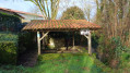
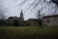
Hermitain Forest
Boundaries and/or area
614 ha
Site of interest
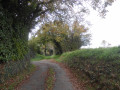
- A forest of oak and chestnut trees on ‘red chestnut soils’.
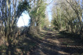
- A 2 km nature trail (forestry, botany, ecology, etc.).
- Close to the legendary site of Chambrille (La Mothe-St-Héray).
- Highlighting of notable trees.
Land, administrative and regulatory aspects:
State-owned forest
Potential hazards to the public
- The forest is criss-crossed by roads with fairly heavy traffic.
- Caution: check for hunting days.
Régné Castle
Régné Castle has belonged to the Vasselot de Régné family since 1403.
The Vasselots originated from Poitou. Their fiefdoms were mainly concentrated around Saint-Maixent-l’Ecole and Niort, in a territory roughly corresponding to the present-day Deux-Sèvres department, where the family was firmly established.
The proven lineage of this noble family of ancient descent dates back to before 1340.
Motto: ‘In hoc signo vinces’, taken from Constantine’s motto, which translates as ‘By this sign, you shall conquer’.
Surname and title
The surname “Vasselot” is probably derived from the term “vassal”, either in its feudal sense of “vassal (feudal subject) of a suzerain”, or in its sense of “valiant”. Another etymological hypothesis suggests that “Vasselot” is derived from “vexillarius” (standard-bearer).
The head of the family usually bears the title of marquis. On 14 January 1786, Jacques Marie Alexis Vasselot (1758–1828) proved his nobility before Chérin, and was admitted to the Court’s honours on 27 March 1789. He was presented to the king under the name and title of ‘Count of Vasselot d’Annemarie’. Having no male heirs, Jacques and subsequently his brother Marin (1760–1836) bequeathed to their cousin Gabriel Vasselot de Régné (1782–1842) a number of titles, including that of Marquis of Saint-Mesmin. It therefore appears that the practice of using the courtesy title “Marquis de Vasselot” dates from this period, resulting from the contraction of the family name (Vasselot) and the title (Marquis de Saint-Mesmin) and serving to distinguish him from other members of the family.
The use of the particle ‘de’ before the surname ‘Vasselot’ became widespread in the 19th century.
Since 1882, the only surname still in use has been “de Vasselot de Régné”, to the exclusion of all others.
Since the marriage of Sélima Vasselot de La Chesnaye (1807–1879) and Marin de Vasselot d’Annemarie (1760–1836) in 1828, the owner of La Guillotière has borne the courtesy title of “Vicomte de La Guillotière” in memory of Marin de Vasselot d’Annemarie, who bequeathed this estate to them.
NotableFigures
Regnault Vasselot, commander of the castle and town of Saint-Maixent between 1322 and 1324
Yvon Vasselot, a knight in Rennes before 1340, after whom Rue Vasselot in Rennes is named
Joseph Amand Vasselot d’Annemarie (1762–1796), a naval officer during the American War of Independence, a Vendée general during the War in the Vendée, and one of the last Vendée leaders to be executed by the ‘Bleus’
Médéric de Vasselot de Régné (1837–1919), Inspector of Water and Forests, Superintendent of Forestry Services at the Cape of Good Hope
Odile de Vasselot de Régné (1922–), member of the Resistance, founder and headmistress of the Lycée Sainte-Marie in Abidjan
Saint Maixent
History
The town developed around the monastery founded in 459 by the Oratorian monk Agapit, who was joined in 480 by Adjutor, who then took the name Maixent. The town was initially known as Saint-Saturnin and prospered in the 5th and 6th centuries.
In September 1346, the Earl of Derby failed in his assault to capture the town (Hundred Years’ War).
In February 1469, by letters patent, King Louis XI authorised the establishment of fairs and markets in Saint-Maixent, following a request from the Count of Maine.
It was the district capital from 1790 to 1795.
From 1880 to 1940, the Military Infantry School (EMI, later EMICC, which included tank training) trained thousands of officers drawn from the ranks of non-commissioned officers.
In June 1940, these officer cadets from Saint-Maixent joined the cadets of the Saumur Cavalry School in their sacrifice to defend the crossing over the Loire.
After the war, the Military School of Infantry and Battle Tanks merged with the Joint Services Military Academy at the Saint-Cyr Coëtquidan camp.
In 1948, the National School for Active Non-Commissioned Officers was established
Heritage
Porte Chalon
This building houses the Haut Val de Sèvre Tourist Office. Dating from the 18th century, it was constructed as part of town-planning works commissioned by the Count of Blossac, Intendant of Poitou. It replaced one of the old gates of the fortified town and formed part of a fief belonging to the Chalon family, a powerful family from Saint-Maixent in the 14th century.
This new gate housed the town hall until 1921. The Chalon Gate has been listed as a historic monument since 1999.
Chauray House
The Hôtel Chauray was built for Pierre Paen in 1531. The building formed part of the Chauray estate, which stretched from Rue Chalon to Rue de l’Audience.
The Paen family is a very old family in Saint-Maixent. Philippon Paen, a merchant in Saint-Maixent, was the town’s first mayor in 1441. He served as mayor on three occasions.
His brother Pierre purchased the seigneury of Chauray around 1450. He served as mayor of Niort and then of Saint-Maixent. So did his son Guillaume. And it was Pierre, Guillaume’s son, who had this townhouse built. He also served as mayor of Saint-Maixent.
Originally, the Hôtel Chauray was flanked by two half-tower-shaped wings. Today, only one remains.
After the Revolution, the building belonged to several families. In 1921, the last owners sold the entire estate to the town. It was occupied by the Post Office until the 1950s.
Saint-Léger Church next to the Abbey Church
Only a Gothic chapel of the Church of Saint-Léger remains, housing the 7th-century crypt rediscovered in the 19th century and listed as a historic monument.
The abbey church, built in 940, housed the relics of Saints Maixent and Léger and was destroyed by an earthquake. Rebuilt in the 11th and 12th centuries (as a Romanesque church), it was destroyed once more by the Calvinists in September 1568, and rebuilt (as an abbey church) on its Romanesque foundations in a very beautiful Gothic style.
Canclaux Gate
This 17th-century gate of the Abbey is in the classical style. Below the cornice, in the centre of the frieze, note the three cartouches bearing inscriptions; the one in the centre bears the date ‘1660’ – the date of the Abbey’s reconstruction. Above the archway are three coats of arms: on the left, the coat of arms of the Benedictines featuring a fleur-de-lis; in the centre, the coat of arms of France featuring three fleurs-de-lis; and on the right, the coat of arms of the abbey featuring a fleur-de-lis. The abbey was therefore a ‘royal’ abbey.
When the military moved into the abbey, the barracks were named the ‘Benedictine Barracks’ and then, in 1886, the ‘Canclaux Barracks’; this explains the name of this entrance gate to the abbey.
The Quai des Tanneries
This stretch of the canal was used for cleaning hides as early as the 11th century. The processing of wool, hemp and hides, as well as dyeing, spinning and weaving, were important activities in the Middle Ages and in modern times.
The location of the tanneries was dictated by the need for a strong current of water, supplied by the diversion canal from the abbey’s mills. At the same time, a location outside the town centre was essential given the unpleasant odours and health risks associated with the trade. The last tannery ceased operations in 1889.
The Apothecary’s House
On Rue Anatole-France stands a 15th-century house which has retained the inscription ‘HIC VALETUDO’ (here is health, 1442) on its half-timbered façade. This was once an apothecary’s house.
Hôtel Balisy
The Hôtel Balisy was built in 1530 for Aimery de Léau, Lord of Balisy, captain of the Château de Saint-Maixent from 1522 to 1549. It hosted many prominent figures of the time, such as Catherine de’ Medici and the Duke of Sully.
Its 16th-century classical façade is extended by a Renaissance-style gallery and is adorned with sculpted medallions bearing the effigies of Roman emperors, surmounted by dormer windows with pediments decorated with shells. In 1625, this mansion became the seat of the magistrates’ court, a role it held until the mid-20th century.
Hôtel Pied Foulard
The 17th-century Hôtel Pied Foulard served as the vicarage until the 1905 Act. It became the town hall in 1921.
The Non-Commissioned Officers’ Museum
On Avenue de l’École-Militaire stands the St Maixent l’École Military Museum. This site was also the location of the former castle.
The tree-lined avenues
The green avenues were laid out in the 18th century at the instigation of the Count of Blossac. Consisting of four rows of trees, they surround Place Denfert-Rochereau, which covers an area of 2 hectares. In the centre stands the statue of Colonel Denfert-Rochereau, defender of Belfort in 1870, who was born in Saint-Maixent on 2 January 1823.



 Country:
 City:
City:




 Visorando Member
 Moderate