A walk from Prailles to Aigonnay

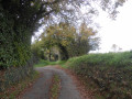
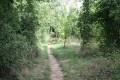
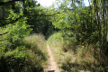
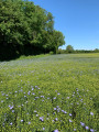
A pleasant walk in a quiet and peaceful part of southern Deux-Sèvres, along good paths – sometimes overgrown with grass – and crossings onto small, quiet roads. This route, set in the heart of Protestant territory and shaped by the Reformation, winds through wooded countryside and offers the chance to discover several wash houses, springs and traditional Poitou buildings.

Details

986962
Creation:
Last update:
Last review:
  • Walking
    Activity: Walking
  • ↔
    Distance: 5.91 mi
  • ◔
    Average duration: 2h 55 
  • ▲
    Difficulty: Easy

  • ⚐
    Back to start: Yes
  • ↗
    Ascent: + 226 ft
  • ↘
    Descent: - 253 ft

  • ▲
    Highest point: 515 ft
  • ▼
    Lowest point: 308 ft
  • ⚐ Country: France
  • ⚐ City: Prailles (79370)
  • ⚑
    Start/End: N 46.322758° / W 0.219263°
  • ❏
    IGN map(s): Ref. 1628SB
  • Hour-by-hour weather

Photos

Description of the walk

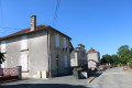
Car park next to the school at the start of Route de Mailloche

(S/E) Join the Route de Mailloche. Turn right into the Rue des Écoles almost immediately. Follow this road with care as far as the hamlet known as Le Breuil. The road then climbs until it reaches a right-angled bend.

(1) Turn right onto a track and then immediately left (T-junction). After a sharp bend to the right, the track continues on almost level ground.

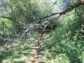
(2) Three to four hundred metres after this bend, turn left onto a downhill track. Follow it until you reach a junction with a road. Please note that a short section of the track is poorly maintained (nettles for about 150 metres along the edge of the field on the left).

Cross the road carefully and continue along the small road opposite. It descends, passes through the hamlet of La Minée, then runs alongside a pond on the left-hand side. A little further on, leave the main road at a bend to the left, continuing straight ahead along a road leading to a housing estate. This road immediately leads to a junction.

(3) Turn right onto the track and continue to a T-junction. Turn right onto the downhill track leading away from the houses. At the bottom of the descent, the track reaches another T-junction.

(4) Turn left and carry on straight ahead along the track that crosses Les Quarante Bosselées until you reach the D124. Cross this road with care and continue straight ahead onto the small road leading towards Aigonnay.

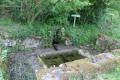
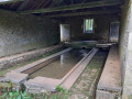
(5) As you approach the houses at the bottom of the descent, turn right onto the small road leading to the hamlet of La Rivière. Continue along this road after passing through the hamlet until you reach the hamlet of La Balderie. On the way up the hill, on the right-hand side, you’ll see the Augas wash house. Pass through La Balderie.

(6) On leaving La Balderie, at a right-angled bend to the left, turn right onto a path. Carry on straight ahead along this path until you reach the D124 road.
Cross the road carefully and carry on straight ahead along a path that climbs very gently. It leads towards a telecoms mast.
The track joins a small road near a T-junction with the D5. Turn left and join the D5, keeping to the right at the junction.

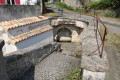
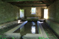
(7) Cross the D7 road with care and take the grassy path leading straight ahead to the right of the buildings. The path soon descends to a small road at the hamlet of Vaillé. Turn right onto the Route de Vaillé and follow it until you reach the D5 road. As you pass through the hamlet of Vaillé, you will see the Vaillé fountain and wash house on your right.

(8) Cross the D5 with care and continue straight ahead along the path that descends slightly to the left. Carry on until you reach a small road. Cross it carefully and continue along the path opposite.
At the next T-junction, turn right and carry on until you reach a small road at a T-junction. Turn right and continue to the next junction.

(9) Turn left and follow the road, which is initially flat before heading downhill after a bend to the right. Continue until you reach a junction with a small road. Cross it carefully and continue along the road opposite, which bends to the left and heads downhill to join the Route de Mailloche. At the junction, admire the Prailles washhouse fountain – known as the Royou washhouse fountain – on the right-hand side.
Cross the Route de Mailloche carefully and continue straight ahead up the road between two properties. The road leads to the Prailles cemetery. Go round the cemetery by turning left and head up towards the upper car park (S/E).


Waypoints

  1. S/E : mi 0 - alt. 476 ft - Écoles car park
  2. 1 : mi 0.43 - alt. 495 ft - Road–path junction
  3. 2 : mi 0.79 - alt. 499 ft - Crossroads
  4. 3 : mi 1.67 - alt. 420 ft - Road–path junction
  5. 4 : mi 1.92 - alt. 371 ft - T-junction with farm tracks
  6. 5 : mi 2.62 - alt. 312 ft - Turn right towards the hamlet of La Rivière
  7. 6 : mi 3.25 - alt. 459 ft - Turn right at the exit from La Balderie
  8. 7 : mi 4.01 - alt. 515 ft - Junction of the D 5 road and the grassy track
  9. 8 : mi 4.73 - alt. 479 ft - Junction of the D5 road and the track
  10. 9 : mi 5.56 - alt. 495 ft - Junction of the Route des Minées and Chemin Borgne
  11. S/E : mi 5.91 - alt. 476 ft - Écoles car park

Notes

The car park is located next to the school at the start of the Route de Mailloche.

This walk across varied terrain requires sturdy footwear.

This unmarked route presents no real difficulties. At times, it follows sections marked in yellow. Consequently, it is advisable to follow the instructions in this description and on the map, whilst also taking note of the landscapes you pass through. Distance markers from the starting point, or even the GPS coordinates of waypoints (including the start), can also help hikers navigate.

Hike completed by the author on 15 May 2018

Worth a visit

Prailles

The Monastery of the Annunciation in Prailles has, since 1999, been home to a community of Benedictine nuns at a place called Pié Foulard; these nuns originally came from the monastery in Poitiers, founded in 1617. It is one of three French monasteries belonging to the Congregation of the Benedictines of Our Lady of Calvary.
When, on 25 October 1617, Antoinette d’Orléans left the priory of Lencloître with 24 of her sisters, she aspired to a simple monastic life, far from honours, just as Saint Benedict had sought solitude in the cave at Subiaco. She then founded our community in Poitiers, the first monastery of a new congregation, the Benedictines of Our Lady of Calvary. Simplicity in relationships and the modest size of the communities, united by a common spirit, characterise this small branch of the great Benedictine tree.
From Poitiers, the community moved in 1962 to Saint-Julien l’Ars, then in 1999 to the south of the Deux-Sèvres, to a region marked by the Wars of Religion, to live out a simple monastic presence open to all. The ‘concern for Christian unity’, which the congregation has upheld since its inception, along with that for peace in the Holy Land, forms an integral part of their way of life. In 2002, sisters from the community of Kerbénéat (Finistère) joined the monastery at Pied Foulard following the closure of their own monastery.

Le Royou Washhouse

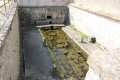
This washhouse is situated at the junction of local road No. 7 and the Chemin Rural de la Bascule; a stone staircase leads down to the uncovered basin, fed by a masonry spring covered by a semi-circular arch. Along the edges of the two long sides, the cement slabs—sloped to form washing boards—have been restored. The four upright stone supports, designed to hold two poles for hanging out the laundry to be beaten, are still in place. Note the water drainage channel, which is said to have been built in 1822.

Aigonnay

History
Aigonnay was a parish with a Protestant population. Following the revocation of the Edict of Nantes, the Protestants gathered at the Château du Grand-Ry fell victim to a ‘dragonnade’ on the orders of Intendant Foucault. Five were hanged, and forty were sent to the galleys. The château was demolished.
Places and monuments
Logis du Breuil-Malicorne (listed).
History
The name Malicorne first appears around 1430 when Andrée de Varèze married Guy de Chourses, Lord of Malicorne, and took the title of Lady of Magné, Mons, Châteauneuf, du Breuil d’Aignonnay and Chantecaille. It is likely that, originally, Le Breuil-Malicorne formed part of the fief of Le Breuil d’Aigonnay. Many features of the manor house, notably the stone-capped fireplaces and the arched doors, may date from the second half of the 16th century. It is possible that, either through a gift or by inheritance, Le Breuil-Malicorne was transferred at that time to the youngest son of the owners of Le Breuil d’Aigonnay, Jacques Chalmot and Florence de Villiers. In any case, by 1698 the two estates were clearly separate, as Breuil-Malicorne is mentioned as a fief, worth 250 livres, belonging to Messrs Simon de la Mourlonnière and des Anges, whilst the fief of Breuil d’Aigonnay, worth 400 livres, belonged to Mr Chalmot. Between 1804 and 1840, the manor belonged to the Chevaleau de Boiragon family. On the cadastral map of 1819, it is marked as ‘a dairy farm’.
Description
The various building blocks are situated around a polygonal courtyard, with the main dwelling occupying the western side. This consists of a central section, with three bays, a square upper storey and an attic, flanked on either side by lower residential wings. The solid bays on the façades of the central section are dressed in ashlar. The courtyard façade retains the base of a watchtower. An oven and a barn are attached to the main dwelling; the former is situated to the north and in a straight line with the main building, whilst the latter is to the south and set back at a right angle. Three doors leading to the outbuildings in the north-west are covered by semicircular arches. Two embrasures are still in place: one at the northern entrance, in a wall of the laundry room, and the other at the south-eastern passageway, in a wall of the barn.

Notable figures associated with the commune
- Louis-Alexandre Jard-Panvillier (1757–1822), French politician and revolutionary, who served as a Member of Parliament for Deux-Sèvres on seven occasions.
- Victor Fleuret (1861–1935), Member of Parliament for Deux-Sèvres from 1914 to 1919, mayor of Aigonnay, born and died in Aigonnay.
- André Clert (1921–2010), Member of Parliament for Deux-Sèvres from 1986 to 1993, born in Aigonnay.

Reviews and comments

4.1 / 5
Based on 3 reviews

Reliability of the description
4 / 5
Ease of following the route
4.3 / 5
Route interest
4 / 5
dandom79
dandom79

Overall rating : 4 / 5

Date of your route : Jul 24, 2023
Reliability of the description : ★★★★☆ Good
Ease of following the route : ★★★★☆ Good
Route interest : ★★★★☆ Good
Very busy route : No

an interesting walk

Machine-translated

jlfaure
jlfaure

Overall rating : 4.5 / 5

Date of your route : Jun 09, 2023
Reliability of the description : Not used / Not applicable
Ease of following the route : ★★★★★ Very good
Route interest : ★★★★☆ Good
Very busy route : No

As always, I followed this route using the Visorando app, so I haven’t made much use of the description. I should point out a small error in the route in the village of Vaillé. You must stay on the road at all times and not turn right as indicated by the route, which goes round a house (private property) and rejoins the road further up. Note the small Protestant cemetery on your right-hand side at the bend in the road where it climbs steeply.
It’s also surprising that the Vaillé wash house and its spring aren’t shown on the maps (?)
Otherwise, it is a very pleasant route at this time of year, following often shaded paths through cultivated fields offering varied scenery. There aren’t many roads and very little traffic.
Some sections are overgrown with tall grass that hasn’t yet been mown – will it ever be? This is quite common on unmarked routes as they aren’t maintained.
I’ve done this walk twice this week with two different groups of people, who both enjoyed it. Thank you for this route, which helps us discover the region.

Machine-translated

philouis
philouis

Overall rating : 4 / 5

Date of your route : Nov 29, 2020
Reliability of the description : ★★★★☆ Good
Ease of following the route : ★★★★☆ Good
Route interest : ★★★★☆ Good
Very busy route : No

A LOVELY 1KM WALK TO MARK THE END OF LOCKDOWN – IT DID US A WORLD OF GOOD AND ALLOWED US TO GO ON A PROPER WALK WHILE STAYING WITHIN THE 20KM RADIUS.
THE WEATHER WAS EXCELLENT, WITH LOVELY SUNSHINE FOR THE END OF NOVEMBER.
A GOOD BALANCE BETWEEN TRAILS AND TARMACK (NOT TOO MUCH OF THE LATTER).
A lovely Sunday – here’s hoping for plenty more like it.

Machine-translated

Other walks in the area

For more walks, use our search engine .

The GPS track and description are the property of this route's author. Please do not copy them without permission.