Country:

 City:


Park in Saint-Pierre de Chignac, on Place Charles de Gaulle, between the town hall and the market hall, near the church (look for the sign listing the town’s walking routes at the corner of the square).
(S/E) Head towards the church and continue along the street that bends to the left. At the stop sign, turn right, cross the railway line and then cross the Ruisseau du Manoire. Join the D6089 (formerly the N89 from Périgueux to Brive) and cross it with care.
(1) Take the Impasse du Truttou, which is almost directly opposite. Shortly afterwards, do not turn left uphill but take the small street opposite (yellow marker). At the junction by the gendarmerie, continue straight ahead onto the Route de Beausoleil, which climbs steeply between the houses, then enters a woodland and becomes a track suitable for vehicles after Beausoleil.
(2) Continue through the woodland, cross a road and carry on along the track opposite (yellow marker). Shortly afterwards, you’ll reach another road; follow it straight ahead, leaving the turn-off to Marsaneix on your right.
(3) After a 30 km/h speed limit sign, leave the road and take a track branching off to the right. At a junction of tracks, carry on straight ahead. Shortly afterwards, ignore a track on the right and follow the main track to the left, descending towards a small valley. You’ll come to a track suitable for vehicles.
(4) Follow this track to the left until you reach a road.
(5) Turn right. When you reach a house, pass the first road on the left, then, immediately afterwards, pass the Route de Caleix on the right and take the Impasse de la Chapelle straight ahead. Then pass the sign for “Les Minières” on the right.
(6) After the first few houses, take the path that branches off to the left at a bend (there’s a small pond on the corner) and you’ll come to a T-junction.
(7) Turn left, heading due north, then veer north-west and subsequently north-east until you reach another path.
(8) Follow it to the right. At the next junction with a small road, turn left and you’ll soon come to a stop sign. Cross the D6 carefully and take the Route des Cluzeaux opposite.
(9) At the three-way junction, turn left. The path is immediately on the left, just below house no. 97 (sign for ‘Circular Route of the Chapelle’). After crossing a meadow, take the path on the right (with a pond in the corner). At the crossroads, carry straight on. Then pass a smaller path ahead and turn right onto the main path (yellow marker), which joins a road.
(10) Turn left towards “Circular Route of the Chapelle”. Pass the junction with Saint-Geyrac on your right. Continue along the road which descends into a small valley and then climbs back up on the opposite side to a crossroads.
(11)Here, you can shorten the route by continuing along the same road to reach the point directly (14). Take the path branching off to the right, opposite the Route Impériale. Join a road ahead and follow it. Pass the Route des Drouillets on your right, then, immediately afterwards, turn left onto the Chemin des Sablières towards “La Sigonie”.
(12) Shortly afterwards, take a path on the left (signposted “Circular Tour of the Chapelle”). The path winds through the woods before reaching a crossroads.
(13) Carry on straight ahead towards “Les Vignaux”. When you come within sight of a house with blue shutters, turn onto the path on the right which runs alongside the woods and leads out onto a road.
(14) Turn right towards “La Grafeuille”. In the hamlet, you can see the Chartreuse de Fayard in the distance. Head back up the road you left earlier, opposite a wooden house.
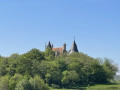
(15) Turn right and then leave the sign for “Puyferrier” on your right to continue straight on towards Jean-Petit and La Peyzie. Carry on along this road. On the other side of the valley, you can see Lardimalie Castle (a 19th-century castle, built on the site of an ancient fortress). You’ll reach the D6089
(16) Follow it to the left, along the pavement, to reach the village.
(1) Turn right and, following the route in reverse to the one taken on the way there, head back to the car park (S/E).

 Visorando Member

 Tourist office
 Easy