Circular route from L’Isle to Antonne and Trigonnant

A pleasant circular loop that runs alongside the Isle for about 1 km. At certain times of year, part of the loop may be flooded.

Details

n°427027
Creation:
Last update:
Last review:
  • Walking
    Activity: Walking
  • ↔
    Distance: 2.42 mi
  • ◔
    Average duration: 1h 10 
  • ▲
    Difficulty: Easy

  • ⚐
    Back to start: No
  • ↗
    Ascent: + 13 ft
  • ↘
    Descent: - 49 ft

  • ▲
    Highest point: 358 ft
  • ▼
    Lowest point: 305 ft

Description of the walk

Car park at the junction of the RN21 and Rue Beethoven.

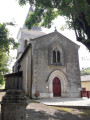
(S/E) Set off from this street heading south-east, then turn left onto Rue Jacques Brel for a few metres and turn right towards the church car park.

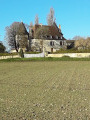
(1) Then turn right in front of the church and follow the road towards La Closerie (a former small farmstead enclosed by a long wall).

(2) At the junction, turn left (sign: Boucle de la Rivière – yellow markings) onto the dirt track which runs alongside the river for nearly a kilometre.

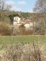
(3) Turn right to leave the banks of the Isle and pass by a ruin. Follow this path for over a kilometre.

(4) At the fork, take the road on the right which passes in front of the C.A.T. and continue straight on at the next two junctions to rejoin the path you took on the way out.

(2) Turn left, pass the Closerie again and follow the path back in the opposite direction to reach the car park (S/E).

Waypoints

  1. S : mi 0 - alt. 354 ft - Car park, Rue Beethoven
  2. 1 : mi 0.26 - alt. 341 ft - Church
  3. 2 : mi 0.62 - alt. 318 ft - Towards the - Isle (rivière)
  4. 3 : mi 1.19 - alt. 312 ft - Leave the banks of the Isle
  5. 4 : mi 2.04 - alt. 312 ft - To the right, towards the C.A.T
  6. E : mi 2.42 - alt. 318 ft - Car park, Rue Beethoven

Worth a visit

Reviews and comments

3.5 / 5
Based on 3 reviews

Reliability of the description
4.5 / 5
Ease of following the route
3.3 / 5
Route interest
2.7 / 5
FerrezMarlene
FerrezMarlene

Overall rating : 1 / 5

Date of your route : Aug 11, 2023
Reliability of the description : Not used / Not applicable
Ease of following the route : ★☆☆☆☆ Very disappointing
Route interest : ★☆☆☆☆ Very disappointing
Very busy route : No

Please note
There is someone living in a caravan just past the hedge
This person has dogs running loose, and we were attacked by one of these dogs whilst we were with our children
Do not go on this walk!!!!

Machine-translated

NathetFapetitspieds
NathetFapetitspieds

Overall rating : 3.7 / 5

Date of your route : Sep 08, 2021
Reliability of the description : ★★★★☆ Good
Ease of following the route : ★★★★☆ Good
Route interest : ★★★☆☆ Average
Very busy route : No

The good thing is that you can now do a circular route. After leaving the riverside, you head through fields (maize and sunflowers)
About half the route runs alongside the road.

Machine-translated

florenceperando
florenceperando

In the end, I didn’t go on that walk

Machine-translated

647
647

Overall rating : 4.7 / 5

Date of your route : Jan 29, 2018
Reliability of the description : ★★★★★ Very good
Ease of following the route : ★★★★★ Very good
Route interest : ★★★★☆ Good

On the other hand, when they say ‘partly flood-prone’, it actually means it’s very, very, very prone to flooding – so it’s a massive, massive hassle on the walk when there’s water (you’re forced to cut across the field and end up knee-deep in mud with every step, for 700 metres. An absolutely dreadful ordeal!)

So it’s very, very strongly not recommended if there’s water; I’d even go so far as to say it’s dangerous when there’s water.

Machine-translated

Other walks in the area

For more walks, use our search engine .

The GPS track and description are the property of this route's author. Please do not copy them without permission.