Country:

 City:
City:


Park in the Quais de l’Isle car park (free), below Boulevard Georges Saumande; there are several car parks available around this boulevard.
(S/E) From the car park, with your back to the river, head up the ramp on your right to reach Boulevard Georges Saumande. Follow it to the right, staying on the pavement. Turn right onto the Pont du Barris to cross it. At the end of the bridge, turn left into the street that slopes down to the riverbank.
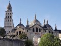
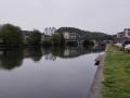
On your left, you’ll find some steps leading to a footbridge over the water. Turn left onto this footbridge, pass under the bridge and follow the path running alongside the Isle. On your right, admire the view of Périgueux and, in particular, Saint-Front Cathedral, which can be seen in its entirety.
(1) When you reach the foot of the Saint-Georges Bridge, follow the footbridge over the water, which continues from the path. Keep walking along the riverbank and pass under the footbridge spanning the Isle.
Carry on along the riverbank until you reach an information board about the Sainte-Claire and Cachepur mills. Ignore the footbridge on the right, which leads to a small island, and go round the kayaking area on the left. Walk round these facilities until you reach the South Bridge.
(2) Turn round, go round the kayaking facilities again, and, before reaching the footbridge, turn right onto the road that leads back up to its entrance. Turn left and cross it.
(3) At the end of the footbridge, go down the few steps and turn right onto Rue Nouvelle des Quais, keeping to the riverside.
Just before the Pont Saint-Georges, turn left into Rue du Bal, then right into Rue Fayard Hervé.
Turn right onto Cours Fénélon, then cross to the left at the pedestrian crossing. Walk a few steps, then turn right at another pedestrian crossing to cross Boulevard Georges Saumande. Head left along the pavement, then go down the stairs on the right which lead to the car park (S/E).

 Visorando Member


 Moderate
 Association / Club / Walk leader