Circular walk in the Robertsau Nature Reserve via Pourtalès Park

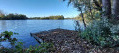
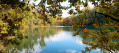
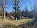
This discovery trail, situated north-east of Strasbourg, just a few minutes from the city centre, offers an immersion in the natural and heritage landscapes of the Robertsau and its surroundings. The route, following the suggested direction, passes through Pourtalès Park – notable for its castle and landscaped setting – before reaching the Robertsau Rhine Forest, a natural area characteristic of the Rhine’s alluvial environments. The route allows you to discover a mosaic of landscapes comprising undergrowth, clearings, small streams, ponds and wetlands, all testaments to the ecological richness of this area. The section through the SRPO wildlife park adds an extra dimension to this walk, offering the chance to observe various animal species. This route is suitable for walkers accustomed to medium-distance walks, as it presents no difficulties in terms of terrain. However, it does require a certain amount of stamina due to its length.

Details

n°111729644
Creation:
Last update:
Last review:
–
  • Walking
    Activity: Walking
  • ↔
    Distance: 10.03 mi
  • ◔
    Average duration: 4h 35 
  • ▲
    Difficulty: Moderate

  • ⚐
    Back to start: Yes
  • ↗
    Ascent: + 13 ft
  • ↘
    Descent: - 13 ft

  • ▲
    Highest point: 453 ft
  • ▼
    Lowest point: 433 ft
  • ⚐ Country: France
  • ⚐ City: Strasbourg (67000|67200|67100)
  • ⚑
    Start/End: N 48.611938° / E 7.800421°
  • ❏
    IGN map(s): Ref. 3815E, 3816OT
  • Hour-by-hour weather

Description of the walk

Park in the car parkon Rue Kempf, opposite the Ferme Bussière.

(S/E) Return to the car park entrance and take the country lane that heads right into the forest. A large sign for the “Robertsau Nature Reserve” is on the left-hand side of the path, which starts behind the barrier restricting vehicle access. You will come to a junction.

(1)Take the Chemin du Beulengrund on the left for about 300 metres, until you reach the junction with the Sentier du Hellwasser.

(2)Turn left, then immediately turn left again to follow the path alongside the Hellwasser stream. This takes you round a wide circular loop to the right.

(3) Follow the path to the left below the bridge: if the ground is too wet, head up the Allée des Trois Sapins and cross via the bridge – this is also the route back.

(4) Turn left onto the Sentier des Catherinettes, which is clearly signposted with attractive signs. Continue, keeping the Hellwasser stream on your left at varying distances, until you reach the junction with a path running at right angles.

(5) Turn left,cross the bridge a few metres ahead and join the Petite Route du Steingiessen immediately on the right-hand side on the other side. This leads out onto the Allée de la Digue.

(6) Head left to quickly reach the Neuf-Empert fort: the path forms part of the Piste des Forts, a cycle route linking nineteen forts around Strasbourg and the surrounding area. When you reach the junction with a few houses opposite, turn onto the path on the right.

(7) At the junction, take the road on the right and follow the fence on your left for about a hundred metres before turning right onto the path called Salmenkopfgrund.

(8) Pass the pond at the Regional Bird Protection Station : there’s a lovely covered wooden shelter on the right with a large table and benches for a good ten people. Follow this path, keeping the aviaries on your left, until you reach the junction by the nature reserve.

(9)Follow the path to the left, keeping the Steingiessen on your right.

(10)Cross the iron footbridge over the secondary canal to reach the embankment: a lovely view of the Rhine. Turn right to walk alongside the canal, passing the sewage treatment works on higher ground.

(11) Turn right to cross the side canal below, then the Route du Glaserswoerth (with care) and enter the forest at the Leutesheim Pond. You’ll come out onto the Chemin des Treize Peupliers; follow it by turning left. You’ll come to the Allée de la Digue: a wooden shelter with a table and benches for around six people.

(12) Continue straight ahead along the service track until you reach the junction with the Chemin de la Patrouille. Turn left, reach the junction with the Allée des Trois Sapins and follow this path to the left.

(13) Crossthe bridge and continue along the Allée des Trois Sapins beside the Kaelbesgraben. Pass a path on your left leading to a footbridge and carry on for about 200 m.

(14) Turn right at a 90° angle to follow the Chemin de Beulengrund, then quickly take the small path on the left which leads into the forest and joins the Allée de la Digue: information point, table and benches.

(15) Turn right, reach Rue Mélanie and carry on straight ahead.

(16) At the junction, turn right, then take the path on the left at the corner of a building to reach Pourtalès Castle. Walk past the castle, continue straight on at the junction, then turn right at a small pond. About a hundred metres further on, take a path on the left to reach the monument and plaque dedicated to the victims of the storm of 6 July 2001.

(17) Continue along the path, turn left onto Rue Kempf to return to the car park (S/E).

Waypoints

  1. S/E : mi 0 - alt. 446 ft - Car park on Rue Kempf
  2. 1 : mi 0.32 - alt. 443 ft - Beulengrund Trail
  3. 2 : mi 0.48 - alt. 440 ft - Hellwasser Trail
  4. 3 : mi 1.56 - alt. 440 ft - Path on the left
  5. 4 : mi 1.64 - alt. 443 ft - The Catherinettes Trail
  6. 5 : mi 2.86 - alt. 440 ft - Bridge
  7. 6 : mi 3.48 - alt. 443 ft - Allée de la Digue
  8. 7 : mi 4.4 - alt. 443 ft - Junction, turn right
  9. 8 : mi 4.54 - alt. 436 ft - Shelter at the Regional Bird Protection Station
  10. 9 : mi 4.8 - alt. 436 ft - Junction, turn left
  11. 10 : mi 5.27 - alt. 436 ft - Footbridge over the secondary canal - Rhin (fleuve)
  12. 11 : mi 6.48 - alt. 440 ft - Turn right at the fork - Étang de Leutesheim
  13. 12 : mi 7.09 - alt. 443 ft - Allée de la Digue – Shelter
  14. 13 : mi 8 - alt. 443 ft - Bridge
  15. 14 : mi 8.31 - alt. 443 ft - Beulengrund Trail
  16. 15 : mi 8.62 - alt. 449 ft - Allée de la Digue – Information point – Table and benches
  17. 16 : mi 9.47 - alt. 446 ft - Junction, on the right
  18. 17 : mi 9.88 - alt. 443 ft - Monument to the victims of the storm of 6 July 2001
  19. S/E : mi 10.03 - alt. 446 ft - Car park on Rue Kempf

Notes

It’s peaceful here! You won’t hear any road or lorry noise, just the chirping of birds, the creaking of wood and perhaps the occasional bark of a happy dog. You’re bound to come across joggers and perhaps other dog-walkers, but no bikes or pushchairs! Dogs can drink and swim in the Hellwasser and the Kaelbelsgraben. Be careful, though – sometimes the water is stagnant and muddy, so swimming isn’t always a good idea.

It is officially forbidden to let dogs run free in the forest. In practice, some forest rangers are tolerant… others, unfortunately, much less so! The Robertsau Forest is designated a National Nature Reserve. This means that breaking this rule would expose us to the risk of a4th-class fine, amounting to €135.

This approved and much-loved route was walked on 18 November 2026 by the Branquignol.e.s. This is the famous group of Alsatian friends – hikers and bon vivants – whose motto is: ‘Have a great time on foot’.

Worth a visit

In the heart of the Wantzenau Forest, a wildlife park has been set up by volunteers from the S.R.P.O. association. The enclosure is fenced off, so you can observe the animals in complete safety. In their spacious enclosures, with access to the River Ill, numerous species of birds – including pheasants and canaries – as well as chickens, ducks, rabbits, peacocks, goats, billy goats and even fallow deer roam peacefully! You can make use of the benches and table provided nearby. You can then continue your walk through the forest along a signposted 2.3 km trail (Hibou). Source: Petit Futé.

The Bussière Farm

This old farm, built at the end of the 19th century, was once an outbuilding of Pourtalès Castle, situated in the adjoining park. But do you know what it’s home to today? Since 2003, it has been home to the SINE association – Strasbourg Initiation NatureEnvironnement – whose aim is to raise awareness of nature and the environment amongst residents of the Strasbourg Eurometropolis. It brings together organisations whose work focuses on educating and raising awareness about nature and the environment: Alsace Nature, the League for the Protection of Birds, the Alsace Mammal Research and Protection Group, and others. To find out more and view their calendar of events, visit their website: here

Other walks in the area

For more walks, use our search engine .

The GPS track and description are the property of this route's author. Please do not copy them without permission.