Country:
 City:






Park in the Fortin car park on Route de la Wantzenau near the Fuchs am Buckel neighbourhood.
(S/E) Go under the archway at the start of the fitness trail and follow the route. Ignore the Chemin Unterjaegerhof on the right and continue along the fitness trail until you reach exercise station no. 9.
(1) Take the path behind the obstacle and turn left shortly afterwards onto Chemin Unterjaegerhof. Follow the Steingiessen to the footbridge and cross it.
(2) Turn right straight away and follow the path alongside the Steingiessen to the Chemin de l’Étoile. Turn right and head towards the bridge.
(3) Take the path on the left just before the bridge and follow the water’s edge. Continue straight on along the riverbank past another bridge.
(4) Turn right onto the path just before the bridge and the Allée des Trois Sapins. Cross the bridge and, a few dozen metres further on, take the path on the right, then immediately turn onto the path on the right. Follow the water’s edge to the Chemin du Beulengrund, ignoring all paths or tracks on the left. You’ll reach a T-junction at the edge of the forest.
(5) Turn left: you can see Scottish cows in the meadow on the right. Take the next path on the right to go round the meadow, then turn left onto the cycle path (Allée de la Digue).
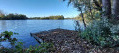
(6) Take the Chemin de la Digue du Karpfenloch on the right. Take the first path on the right and enter a high-risk area: there’s a lovely view of a lake on the left. Follow the winding path which, further on, runs alongside a meadow for about 50 metres.
(7) Turn onto the path on the left, then turn right to cross a footbridge and climb some steps.
(8) Turn left after a bunker. Cross a footbridge, then another, and rejoin the Chemin de la Digue du Karpfenloch.
(9) Turn left to cross the bridge and continue straight on.
(6) Cross the Allée de la Digue and take the path heading due north into the forest opposite. Follow this path as it zigzags slightly through the pipeline trench. Cut across two paths, then cross the bridge you crossed on the way there.
(4) Turn right to join the tarmac road straight away. Head left, ignore the first path on the right and take the next one, called Allée des Catherinettes. Further on, turn left with the path, cross the Allée des Trois Sapins and turn right onto the path that runs as close as possible alongside it.
(10) Turn onto the path on the left, which is also used by horse riders. Cross four successive paths and continue until you reach the cycle path on the embankment. Turn left, follow the cycle path and cross the Chemin de la Patrouille to emerge onto the Allée de la Digue.
(11) Take a short first turn left then right just before the bridge to follow the path that runs alongside the Steingiessen to the footbridge.
(2) Cross the footbridge and continue straight ahead, following the path that runs diagonally through the pipeline trench. Continue to the first white marker.
(12) Take the path on the right. Turn right at the fork, then follow the fitness trail to the car park (S/E).
 Visorando Member


 Easy