Circular route in the Montagne de Saint-Benoît

The Montagne de Saint-Benoît is a fold in the Bugey range overlooking the Rhône valley: despite its low altitude, it offers a variety of routes that can be tackled in almost any season. This wide, figure-of-eight-shaped circular route combines two steep ascents of this mountain and traverses it via its geographical summit (La Graye – 786 m) and several unobstructed viewpoints.

Details

3236434
Creation:
Last update:
Last review:
  • Walking
    Activity: Walking
  • ↔
    Distance: 7.73 mi
  • ◔
    Average duration: 5h 45 
  • ▲
    Difficulty: Difficult

  • ⚐
    Back to start: Yes
  • ↗
    Ascent: + 2,513 ft
  • ↘
    Descent: - 2,497 ft

  • ▲
    Highest point: 2,566 ft
  • ▼
    Lowest point: 709 ft

Photos

Description of the walk

The route starts from Saint-Benoît, which can be reached from Ambérieu via the D19, from Morestel via the D33 and the Pont d’Envieux, or from Belley via the D10 and D19. As there is no parking in the hamlet itself, please park near the boules court or the cemetery so as not to cause any inconvenience.

(S/E) Walk up the road to the hamlet of Les Bonards and turn left onto Rue du Bonnard. Pass the Creux de Faroud forest track on your right (return route) and, 100 metres further on, turn right onto a path winding its way between the houses.

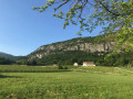
It heads towards the cliffs and begins to climb increasingly steep slopes, skilfully using ledges and crevices in the rock to haul itself up to the edge of the Granges plateau.

After a flat stretch, it continues uphill, crossing a few fields before joining a good path coming from the left.

(1) Take this on the right, pass by a spring and, when it makes a sharp left-hand bend as it climbs, continue straight on along a well-marked path. It climbs above the Roche du Midi until it joins a path coming from Les Granges on the left.

(2) Do not stay on this path but turn immediately right onto the one that begins a steady descent to the Route Forestière du Creux de Faroux. Follow it downstream, due south, for about 400 metres.

(3) Just before a significant change of direction, take a path on the left that heads south and climbs towards the Picotin cliff. The slope steepens and becomes more precipitous. After a few rockier sections, it follows a well-defined, ascending ledge from right to left – which is therefore relatively exposed – overlooking the main cliff.

(4) Follow this route right to the end before turning right to cross the final steep sections of the Picotin; the slope then gradually levels out and the path becomes an old forest track as it enters the wooded side of the Graye plateau.

(5) At the first junction, turn left to continue on level ground. The path, which is more or less well marked depending on the vegetation, gradually veers to the left and begins an ascent that might be pleasant with its moderate gradient, were it not so overgrown with brambles.

This climb leads onto a wider forest track coming from the nearby Route Forestière de Saint-Julien.

(6) From this point, it is possible to make a round trip (25 mins there and back) to a viewing point set up on the edge of the eastern cliff. Head down onto the forest road, then follow it back up to the left until you reach a pass. Turn onto a path branching off to the right and descend a hilly stretch that has been damaged by recent logging. Gradually veer to the right to rejoin a path marked with old red dots leading to the viewpoint.

(7) From the viewpoint, retrace your steps to the junction you left earlier.

(6) Take the forest track again, which climbs slightly and winds through the forest to reach the foot of the highest point of the Graye massif.

(8) The small rocky ridge at the summit is climbed off-track to the right, over moss-covered rocks.

There are several routes back down to the Creux de Faroud, but they are relatively steep. The easiest way down is to follow the forest track eastwards and then south-eastwards, which leads back to the road to Saint-Julien.

(9) Turn left onto this road to descend to the Saint-Julien viewpoint, which offers unobstructed views of the Alps. On the circular route following the viewpoint, the Route du Creux de Faroud branches off to the left.

(10) Take this road southwards. It climbs slightly to cross a ridge, after which it descends into the Creux de Faroud, first via two hairpin bends, then straight on. You rejoin the section you took earlier during the descent.

(3) Just after the junction with the start of the Pas du Picotin footpath, the road changes direction abruptly, heading north-north-west towards Saint-Benoît. This long stretch alternates between flat sections and descents before reaching the first houses in Les Bonards.

At the junction with Rue du Bonnard, turn left, then 100 metres further on, turn right to head down to the cemetery (S/E).

Waypoints

  1. S/E : mi 0 - alt. 709 ft - Saint Benoît – cemetery
  2. 1 : mi 0.78 - alt. 1,532 ft - Les Granges
  3. 2 : mi 1.26 - alt. 1,949 ft - High point above the Roche du Midi
  4. 3 : mi 2.04 - alt. 1,427 ft - Route du Creux de Faroud: starting point at the Picotin path
  5. 4 : mi 2.31 - alt. 1,873 ft - Turn right at the fork
  6. 5 : mi 2.59 - alt. 2,028 ft - Grange de la Graye area
  7. 6 : mi 3.09 - alt. 2,411 ft - Crossroads near the Route de St Julien
  8. 7 : mi 3.33 - alt. 2,375 ft - Viewpoint over the eastern cliffs
  9. 8 : mi 3.98 - alt. 2,539 ft - La Graye (786m)
  10. 9 : mi 4.23 - alt. 2,428 ft - Junction with the Route de St Julien
  11. 10 : mi 5.05 - alt. 2,119 ft - St Julien: junction with the Route du Creux de Faroud
  12. S/E : mi 7.73 - alt. 709 ft - Saint Benoît – cemetery

Notes

Although there is a small spring near Les Granges, you should not rely on water sources in this type of limestone massif.

The only sections warranting a ‘Difficult’ rating are the ascent to Les Granges (between (S) and (1)) and the Pas du Picotin (between (3) and (5)). The rest of the route consists of moderately steep paths and even forest tracks.

No special equipment is required: the most useful item will be a pair of secateurs, as brambles grow rampantly at this altitude, especially since the box trees have been ravaged by the box tree moth.

If you wish to avoid the descent between (2) and (3), you can simplify the route into a circular loop: in that case, it is preferable to ascend directly via the Picotin and descend via Les Granges, as whilst these steep sections are of equivalent length and difficulty, the Picotin is more exposed and therefore the descent via Les Granges is safer.

Worth a visit

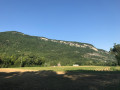
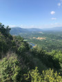
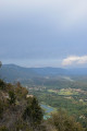
The steep ascents offer unobstructed views over the Rhône Valley.

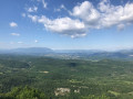
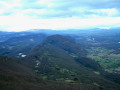
The viewpoint in the forest and the Saint-Julien viewpoint offer sweeping views of the Bugey, the Chat, the Bauges, the Tournette and Mont Blanc on a clear day.

Reviews and comments

3 / 5
Based on 9 reviews

Reliability of the description
3.4 / 5
Ease of following the route
2.7 / 5
Route interest
2.9 / 5
pmahieu
pmahieu

Overall rating : 2.7 / 5

Date of your route : Nov 27, 2024
Reliability of the description : ★★★☆☆ Average
Ease of following the route : ★★☆☆☆ Disappointing
Route interest : ★★★☆☆ Average
Very busy route : No

Hello,
I’m quite surprised to find this route on Visorando… I should point out that I’m one of those who ‘explored’ these trails about fifteen years ago (with G. Barré from ‘Sentier-Nature’) and I published a guide on the Bivouak website (which has been reproduced here almost in its entirety). The problem is that these trails (which are magnificent) aren’t maintained regularly. It’s the hunters who clear the undergrowth from time to time (as confirmed by a ‘local’ from Les Bonnards). The Les Bonnards trail and the one crossing the Picotin ridge can be very well cleared or completely overgrown, depending on the time of year. During my last visit to the Picotin trail in spring 2024, it was even very dangerous and exposed because of trees lying across the path towards the rocks…As for the route to the Tête de la Graye, it has always been problematic due to logging and the vegetation reclaiming its territory. Even with a GPS and a good track, you can still lose the paths and find yourself struggling through brambles and undergrowth...It’s beautiful and wild, but hikers really do need to be warned – something that isn’t really made clear in the route description. This little mountain range is wild and full of surprises, but you can never be sure you’ll end up where you planned if you stray from the main marked tracks.

Machine-translated

BRUNO48
BRUNO48

Overall rating : 2.7 / 5

Date of your route : Nov 17, 2024
Reliability of the description : ★★★☆☆ Average
Ease of following the route : ★★☆☆☆ Disappointing
Route interest : ★★★☆☆ Average
Very busy route : No

I have nothing to add to the comments already provided:
for wild boar between point 3 and point 6
geolocation is useful, if not essential

Nothing has changed for over a year

Machine-translated

Alain7392
Alain7392
• Edited:

Overall rating : 2.3 / 5

Date of your route : Apr 14, 2023
Reliability of the description : ★★★★☆ Good
Ease of following the route : ★☆☆☆☆ Very disappointing
Route interest : ★★☆☆☆ Disappointing
Very busy route : No

This route should be temporarily removed from Visorando
- the climb between points 3 and 4 is completely overgrown with brambles, which is particularly unpleasant on such a steep path
- the section between 4 and 5: it’s a jumble of fallen trees and branches on the ground, very difficult to get through. What’s more, to find the narrow path leading from 5 to 6, it was just as well we had a GPS app on our phone – otherwise it would have been impossible to find
- We’d decided to head straight up via the Chemin des Bonards to avoid the uninteresting descent between 2 and 3, then on the way back to head down via the path beneath the Plateau des Granges. Unfortunately, we couldn’t find the path leading down to the rocky ledges – yet another tangle of brambles.
Overall, we were very disappointed by this mountain range, which is overrun with brambles and offers few views, apart from the St Julien viewpoint.

Machine-translated

Anouche38
Anouche38

Overall rating : 2.3 / 5

Date of your route : Mar 16, 2023
Reliability of the description : ★★★☆☆ Average
Ease of following the route : ★☆☆☆☆ Very disappointing
Route interest : ★★★☆☆ Average
Very busy route : No

Hike completed on 16 March 2023 – I can confirm that the path is very poorly maintained; the first section is difficult. It runs through a scree slope, making it difficult to find your way. The path is sometimes barely visible, and the felled timber has not been cleared and is blocking the way.

Machine-translated

GUNZBURGER
GUNZBURGER

Overall rating : 3 / 5

Date of your route : Nov 22, 2022
Reliability of the description : ★★★★☆ Good
Ease of following the route : ★★★☆☆ Average
Route interest : ★★☆☆☆ Disappointing
Very busy route : No

We went on this hike with a group of three people on 20 November 2022. It was just as well we had the route mapped out on our smartphones, otherwise we would have got lost. The path is sometimes barely visible and hidden in the brambles for a very long stretch of the route. The path is in very poor condition in places and the steep sections are difficult. We did a recce to see if it was suitable for a group, but it isn’t. Furthermore, there are areas where trees have been felled, blocking the path, and the trail disappears. With the time lost cutting through brambles, we didn’t make it to the first viewpoint (point 7). At the second (point 10), the view is interesting, but that’s all. Part of the walk, particularly on the way back, follows a wide track through the undergrowth with no unobstructed views and not much to see.
It’s a shame – the idea behind such a circular loop is an interesting one, but the reality on the ground is quite different.
Best regards.

Machine-translated

phdev
phdev

Hello,

I think the difficulty level of this walk should be raised.

Kind regards.

Machine-translated

phdev
phdev

Overall rating : 4.3 / 5

Date of your route : Jun 11, 2022
Reliability of the description : ★★★★★ Very good
Ease of following the route : ★★★★☆ Good
Route interest : ★★★★☆ Good
Very busy route : No

Hello,

I’d rate this hike as very difficult, if not worse! The route is very well marked, but most of the ascent involves following paths used by wild boars and roe deer (which you do come across, incidentally). There are plenty of brambles (impossible to get through without suitable clothing) and the path has collapsed in several places. Some sections are very narrow, yet run right along the cliff face...
In short, it’s very enjoyable but not to be attempted in wet weather or during the hunting season (there are numerous hunting hides), and you’ll need a solid knowledge of the terrain and sure-footedness.
Above all, don’t attempt it in the opposite direction, as the descent via the paths must be a real challenge.

Machine-translated

Luc M
Luc M

Overall rating : 4.3 / 5

Date of your route : Mar 06, 2022
Reliability of the description : ★★★★☆ Good
Ease of following the route : ★★★★★ Very good
Route interest : ★★★★☆ Good
Very busy route : No

Some lovely views, but most of the walk takes place in the forest. We really enjoyed it, though. Don’t underestimate the time needed for this walk, particularly for the two main climbs.
A GPS is almost essential for this walk. Also, the route suggested to us seemed logical, and I wouldn’t recommend doing it the other way round.
The route is clearly marked (thank goodness!), and we had to check the GPS several times to be sure we were on the right track, or even to find the path or get back on course.
The path sometimes seems to come to an end, but if you make your way through the vegetation for a few metres, you’ll always find a trail again.
A pair of secateurs or a machete would have been useful. Consequently, long sleeves and trousers are almost essential to avoid ending up with cuts.
Some sections require you to be comfortable with heights and to have a sure footing. But you never actually need to use your hands.

Machine-translated

chelouche helene
chelouche helene

Overall rating : 2.3 / 5

Date of your route : Jun 18, 2020
Reliability of the description : ★★★☆☆ Average
Ease of following the route : ★★☆☆☆ Disappointing
Route interest : ★★☆☆☆ Disappointing
Very busy route : No

Hello
We tried the circular route today, starting in the opposite direction. We managed to find the start of the Picotin trail, but as the route marking wasn’t very reliable, we didn’t get very far from the rock and, unable to find the way through, we headed back down. We did, however, make good use of the secateurs
No trouble finding the path from 3 to 2 – a lovely, pleasant track – but then the descent towards Les Granges got tricky; the tracks weren’t very clear. Thanks to those who’d been there before us – we followed the flattened grass. The descent wasn’t exactly a walk in the park either
It’s not a route I’d recommend
helenedolo

Machine-translated

JCParavy
JCParavy

I can confirm that this route guide was written after the route was walked following the end of lockdown: the description does indeed mention the presence of brambles and recommends bringing secateurs.
A hike at this low altitude rated as ‘difficult’ does indeed mean that some sections are steep and that you’re almost in ‘wild boar’ mode, but there is a clear path all the way along.
I hope that the return of a certain level of footfall will make future walks easier.
Jean-Claude.

Machine-translated

matju38
matju38

Overall rating : 3 / 5

Date of your route : Jun 07, 2020
Reliability of the description : ★★☆☆☆ Disappointing
Ease of following the route : ★★★★☆ Good
Route interest : ★★★☆☆ Average
Very busy route : No

I hadn’t read the reviews, but perhaps I should have… Right from the start, we were climbing up wild boar trails that weren’t particularly clear – presumably due to the lockdown. At times it was a bit of a guesswork, but fortunately the waypoints on the map were relatively accurate. Right up to waypoint 1. At waypoint 2, we improvised by taking a different path. We took a shortcut to reach waypoint 10. Then we found point 9 but never point 8. We found point 6, but there was absolutely no visible path. The vegetation had taken over. So we decided to head down the forest track to the barn, using GPS to find point 5. We went back down the correct route, but you really shouldn’t go that way to reach points 4 and 3. There are some lovely views. But it really isn’t clear enough. So I’d give it a rating of 3/5 if the route were done in the right order. For the lovely views at times. It is indeed difficult; don’t take children on this route. At times, you mustn’t be afraid of heights.

Machine-translated

Tibor.O
Tibor.O
• Edited:

We tried to complete the hike described above but were unsuccessful, despite being fully equipped for this sort of hike. The vegetation has completely overgrown the paths, which are no longer passable. Moreover, as these are forest tracks rather than designated hiking trails, they are not maintained.
We therefore strongly advise against this walk (despite a few very beautiful viewpoints), as the route is sometimes no longer even visible. We had to use our GPS to find our way, as the paths were not visible.

Machine-translated

Other walks in the area

For more walks, use our search engine .

The GPS track and description are the property of this route's author. Please do not copy them without permission.