Circular walk starting from Chissey-en-Morvan

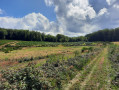
A lovely walk through meadows and woods that will take you to the hamlet of Valouze.

Details

31887752
Creation:
Last update:
Last review:
  • Walking
    Activity: Walking
  • ↔
    Distance: 3.82 mi
  • ◔
    Average duration: 2h 10 
  • ▲
    Difficulty: Easy

  • ⚐
    Back to start: Yes
  • ↗
    Ascent: + 463 ft
  • ↘
    Descent: - 463 ft

  • ▲
    Highest point: 1,667 ft
  • ▼
    Lowest point: 1,194 ft

Description of the walk

To reach the start point from Chissey-en-Morvan, take Rue Chagnot and park in the car park at the Ternin rest area.

(S/E) Cross the small bridge over the Ternin and follow Route de Vaussery. At the crossroads in the hamlet of La Prée, turn right onto Rue des Soitures and continue until you reach two houses.

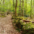
(1) Take the path on the left just after thesecond house. Continue through the woods until you reach the Valouze wash house.

(2) Leave the woods and carry on to enter the village of Valouze.

(3) Turn right onto Rue des Boulandiaires, follow this road – which becomes a dirt track – and carry on straight ahead. The track climbs up the hillside and joins a crossroads of footpaths at the edge of the woods.

(4) Turn right at almost a 90° angle. Then enter the woods and, after a hairpin bend, reach the Bas de l’Eau Moiron valley.

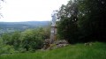
(5) Head downhill to the right and you’ll soon reach a clearing. Follow the edge of the woodland and, overlooking the Ternin valley, you’ll arrive near the designated area at La Place.

(6) Continue along the edge of the woodland, passing the Moulin de la Mouche and then the hamlet of Les Soitures, to return to the Prée crossroads which you passed on the way out.

(1) Follow the route you took on the way there in the opposite direction to return to the car park at the rest area on the banks of the Ternin (S/E).

Waypoints

  1. S/E : mi 0 - alt. 1,204 ft - Developed area on the banks of the - Ternin (rivière) - Affluent de l'Arroux
  2. 1 : mi 0.29 - alt. 1,214 ft - Crossroads at the end of the circular loop
  3. 2 : mi 0.97 - alt. 1,486 ft - Valouze wash house
  4. 3 : mi 1.29 - alt. 1,572 ft - Valouze
  5. 4 : mi 1.77 - alt. 1,667 ft - Crossroads at the edge of the woods
  6. 5 : mi 2.23 - alt. 1,378 ft - Bas de l’Eau Moiron Valley
  7. 6 : mi 2.73 - alt. 1,230 ft - La Place
  8. S/E : mi 3.82 - alt. 1,204 ft - Developed area on the banks of the - Ternin (rivière) - Affluent de l'Arroux

Reviews and comments

3.9 / 5
Based on 5 reviews

Reliability of the description
3.8 / 5
Ease of following the route
3.8 / 5
Route interest
4.2 / 5
User 3887464

Overall rating : 4.7 / 5

Date of your route : Jul 27, 2026
Reliability of the description : ★★★★★ Very good
Ease of following the route : ★★★★★ Very good
Route interest : ★★★★☆ Good
Very busy route : No

A slightly undulating route

Machine-translated

Lysis3058
Lysis3058

Overall rating : 4 / 5

Date of your route : Dec 01, 2024
Reliability of the description : ★★★★☆ Good
Ease of following the route : ★★★★☆ Good
Route interest : ★★★★☆ Good
Very busy route : No

Please note: the walking time given is for experienced walkers; you should allow around 2 hours 30 minutes (without stops)

There’s a small detail missing from the description:

On the climb towards Valouze, there is a fork in the road at one point: you must take the path on the right, not the one on the left, which leads to a dead end overgrown with broom.

Machine-translated

Anne NLG
Anne NLG

Overall rating : 5 / 5

Date of your route : Oct 14, 2024
Reliability of the description : Not used / Not applicable
Ease of following the route : Not used / Not applicable
Route interest : ★★★★★ Very good
Very busy route : No

Very good

Machine-translated

MENA
MENA

Overall rating : 4.3 / 5

Date of your route : Feb 26, 2024
Reliability of the description : ★★★★★ Very good
Ease of following the route : ★★★★☆ Good
Route interest : ★★★★☆ Good
Very busy route : Yes

Machine-translated

grandin
grandin ★

alaind4771
Just so you know, the distances are shown at each waypoint on the route description

Machine-translated

alaind4771
alaind4771

Overall rating : 2.3 / 5

Date of your route : Jun 05, 2023
Reliability of the description : ★☆☆☆☆ Very disappointing
Ease of following the route : ★★☆☆☆ Disappointing
Route interest : ★★★★☆ Good
Very busy route : No

A rough description of the route, with errors and a notable lack of precision, and no indication of distance whatsoever! The walk, which was supposed to take 2 hours 10 minutes, ended up taking 4 hours 30 minutes because we lost the path and became completely disoriented in a semi-wooded scrubland area on a very steep hillside, which we descended at great risk. My Open Runner GPS enabled us to re-route our walk and find our way out of there. Best avoided!

Machine-translated

Other walks in the area

For more walks, use our search engine .

The GPS track and description are the property of this route's author. Please do not copy them without permission.