The Roman road above Chissey and return via the Ternin valley

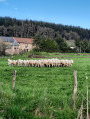
The Roman Road, which passes above Chissey, linked Lyon to Boulogne-sur-Mer and offers beautiful views of the Morvan hills. The return journey takes you through the valley, following the River Ternin.

Details

32730959
Creation:
Last update:
Last review:
  • Walking
    Activity: Walking
  • ↔
    Distance: 3.95 mi
  • ◔
    Average duration: 2h 10 
  • ▲
    Difficulty: Easy

  • ⚐
    Back to start: Yes
  • ↗
    Ascent: + 371 ft
  • ↘
    Descent: - 374 ft

  • ▲
    Highest point: 1,575 ft
  • ▼
    Lowest point: 1,194 ft

Description of the walk

The walk starts at the bottom of Rue Chagnot; there is parking available at the picnic area.

(S/E) Walk up Rue Chagnot to Route Michel de Chaugy (D980) and cross this county road.

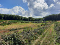
(1) Take the steep path opposite which climbs up to the Roman road. Turn left onto it. The tarmac soon gives way to a dirt track. Follow this path as it climbs through the meadows. Continue straight on along the ridge until you reach
a four-way junction where there is a cross at the foot of a tree.

(2) Take the hairpin bend onto the path leading down to the left and follow it until you rejoin the Route Michel de Chaugy. Admire the Château de Buis on your right.

(3) Walk alongside the departmental road for a few metres on the left, then turn right towards “La Place – la Mouche” onto Rue de la Mouche. Follow it alongside the River Ternin; when it veers off to the left, it becomes Rue des Soitures, which you should follow until you reach Route de Vaussery.

(4) Turn left, continue straight on, cross the small bridge over the River Ternin and return to the car park (S/E).

Waypoints

  1. S/E : mi 0 - alt. 1,204 ft - Picnic area - Ternin (rivière) - Affluent de l'Arroux
  2. 1 : mi 0.23 - alt. 1,260 ft - Route Michel de Chaugy
  3. 2 : mi 2.11 - alt. 1,565 ft - Crossroads at the cross
  4. 3 : mi 2.64 - alt. 1,250 ft - Route Michel de Chaugy
  5. 4 : mi 3.8 - alt. 1,211 ft - Route de Vaussery
  6. S/E : mi 3.95 - alt. 1,201 ft - Picnic area

Reviews and comments

4.7 / 5
Based on 2 reviews

Reliability of the description
5 / 5
Ease of following the route
5 / 5
Route interest
4 / 5
Kath86
Kath86

Overall rating : 5 / 5

Date of your route : May 05, 2025
Reliability of the description : ★★★★★ Very good
Ease of following the route : ★★★★★ Very good
Route interest : ★★★★★ Very good
Very busy route : No

Clear explanations
A very enjoyable route

Machine-translated

Nova’s team
Nova’s team

Overall rating : 4 / 5

Date of your route : Sep 13, 2023
Reliability of the description : Not used / Not applicable
Ease of following the route : ★★★★★ Very good
Route interest : ★★★☆☆ Average
Very busy route : No

As for the accuracy of the description, I can’t really comment as we only use the IGN route map. The walk starts near the river. There are no particular difficulties; it goes up and down gently. In my opinion, it’s a bit more challenging in very hot weather as a large part of the route (particularly the climb at the start) is in full sun. The scenery alternates between woodland and a few patches of bocage.
Not unpleasant, but not our favourite walk in the area
I’d like to take this opportunity to thank the administrators for offering us such a varied selection of walks in every corner of France

Machine-translated

Other walks in the area

For more walks, use our search engine .

The GPS track and description are the property of this route's author. Please do not copy them without permission.