Country:

 City:
City:


Car park in the centre of the village of Alligny-en-Morvan, opposite the Museum of Wet Nurses.
(S/E) Leave the car park heading north, walk past the church then turn left towards the cemetery. Walk past it and, at the next junction, turn right onto the old tram track.
(1) Cross the D121 with care, then continue along the old tramway track until you reach a footbridge made of large stone slabs at a ford on the River Ternin.
(2) Cross the ford, climb up to the hamlet of Champcommeau, turn left, then take the second right (Route de Beaumont). After 50 m, take the second tarmac road on the left (Chemin des Boulais). After 200 m, turn right onto a farm track and follow it north-north-east for about 2 km until you reach a crossroads.
Marked yellow-blue and “Chemins des Pélerins”.
(3) Continue straight ahead along the track/path to the foot of the embankment of a pond. Turn left twice to walk alongside another pond. Walk alongside a third pond on the right and arrive at a crossroads.
Marked GRP®
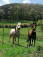
(4) Take the path on the right which runs alongside a pasture with a high fence. Follow the GRP® which turns right, crosses two streams, then turns left. You’ll come within sight of the Chamboux dam.
(5) Continue to the right to stay on the GRP® as it climbs to the top of the dam.
Follow the GRP® path which runs along the eastern shore of the lake (depending on the water level, long sections can be pleasantly walked on the sand right at the water’s edge: see GPS track).
(6) When you reach a causeway, do not take it; cross the D106 carefully and continue along the GRP®. Reach a small road and follow it to the left. After 200 m, leave the road and the GRP® to take the PR® on the left.
Signposted PR®
(7) Walk round the lake to the north. Cross a road (at the other end of the causeway) and continue along the PR® which runs alongside the road for 200 m, then veers left to follow the lakeshore. You’ll reach the D26; follow it to the left along the causeway and, 150 m past the causeway, leave the road to take a path on the right.
Unmarked
(8) After 500 m, turn left at the track junction, then continue for about 1.5 km to the D234 and follow it to the left for about 100 m before the junction with the D121.
GRP® signposted
(9) Take the path leading uphill to the right (avoid the path running parallel to the road, as it is private).
You’ll come to a road in the hamlet of Fétigny. Turn left onto the D234. At the junction, go to the right of the large White Cross to stay on the D234.
(10) At the next junction, go to the left of the Black Cross onto the Chemin des Bettoux.
Cross a stream, then at the crossroads, turn left and join a good track; follow this to the left for about 500 m.
(11) Don’t miss this junction; turn right (signposted) and follow this track for about 1.5 km to reach a valley floor via a fairly steep descent.
(12) Climb up the other side, turn right at the junction of forest tracks on the ridge (elevation 506) and come out onto a road
(13) Follow it to the left for about 100 m and take a path on the left. You’ll reach the hamlet of La Crémaine. Continue down the main street, which curves to the right and then takes another sharp bend to the left.
Unmarked
(14) 150 m further on, leave the GRP® and the road to take a path on the right (at a concrete electricity pole and a letterbox marked number 26). You will reach a road; follow it, turn left and reach the car park (S/E). On the way, you will pass Alligny Castle on the left.
 Visorando Member
 Moderate

 Easy
Easy