Valouze and Les Crots Barbizots from Chissey

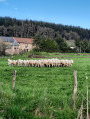
A lovely walk that will take you to magnificent viewpoints at Les Crots Barbizots, and through a beautiful forest on the way back down.

Details

32006579
Creation:
Last update:
Last review:
  • Walking
    Activity: Walking
  • ↔
    Distance: 4.32 mi
  • ◔
    Average duration: 2h 35 
  • ▲
    Difficulty: Easy

  • ⚐
    Back to start: Yes
  • ↗
    Ascent: + 656 ft
  • ↘
    Descent: - 656 ft

  • ▲
    Highest point: 1,847 ft
  • ▼
    Lowest point: 1,191 ft

Description of the walk

Start and finish at the bottom of Rue Chagnot, at a picnic area next to the small bridge crossing the Ternin. Parking available.

(S/E) Follow Route de Vaussery north-west and cross the bridge. Turn right at the three-way junction to follow Rue des Soitures.

(1) After the two houses, take the path leading off to the left. Continue to the top and you’ll come out onto Rue du Lavoir.

(2) Carry on straight ahead and pass through the hamlet of Valouze.

(3) At the end of the hamlet, take the path leading uphill opposite, pass the last house on your right, cross the road and carry on straight ahead along a narrow track. Follow this track through the forest, taking a first turn left then right, to reach the junction just after the first house in Les Crots Barbizots, near a wayside cross.

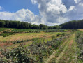
(4) Turn right, heading due north, onto the grassy path which leads out onto a meadow; follow the edge of the meadow on the right until you reach a cross-path.

(5) Turn left onto it, then continue downhill, taking thefirst path on the right. Enjoy the lovely view on your right. Walk all the way down through a beautiful forest. Once you reach the valley, carry on straight ahead to the square and join a tarmac road.

(6) Walk past an isolated house and continue straight ahead, heading south-east along Rue de la Mouche, which then becomes Rue des Soitures. Return to the original junction.

(1) Carry on straight ahead in the opposite direction to your outward journey to reach the picnic area (S/E).

Waypoints

  1. S/E : mi 0 - alt. 1,191 ft - Picnic area, car park - Ternin (rivière) - Affluent de l'Arroux
  2. 1 : mi 0.29 - alt. 1,217 ft - Junction of the circular loop
  3. 2 : mi 0.97 - alt. 1,486 ft - Valouze, Rue du Lavoir
  4. 3 : mi 1.34 - alt. 1,588 ft - Fond de Valouze, straight ahead
  5. 4 : mi 1.66 - alt. 1,808 ft - Les Crots Barbizots, wayside cross
  6. 5 : mi 2.18 - alt. 1,673 ft - Junction, turn left
  7. 6 : mi 3.23 - alt. 1,230 ft - The Square
  8. S/E : mi 4.32 - alt. 1,191 ft - Picnic area, car park

Reviews and comments

4.4 / 5
Based on 3 reviews

Reliability of the description
4.5 / 5
Ease of following the route
4 / 5
Route interest
4.7 / 5
User 25943171

Overall rating : 3.7 / 5

Date of your route : Mar 16, 2026
Reliability of the description : ★★★★☆ Good
Ease of following the route : ★★★☆☆ Average
Route interest : ★★★★☆ Good
Very busy route : No

The start of the walk is poorly signposted
Lovely view

Machine-translated

Anne NLG
Anne NLG

Overall rating : 5 / 5

Date of your route : Oct 14, 2024
Reliability of the description : Not used / Not applicable
Ease of following the route : Not used / Not applicable
Route interest : ★★★★★ Very good
Very busy route : No

Very well.

Machine-translated

Pymouss75
Pymouss75

Overall rating : 5 / 5

Date of your route : Dec 27, 2023
Reliability of the description : ★★★★★ Very good
Ease of following the route : ★★★★★ Very good
Route interest : ★★★★★ Very good
Very busy route : No

A lovely walk through the Morvan forests and pastures.
Do watch out, however, for hunters, who are out and about at this time of year and whom we came across on some of the paths.
There are no major difficulties on this walk.

Machine-translated

Other walks in the area

For more walks, use our search engine .

The GPS track and description are the property of this route's author. Please do not copy them without permission.