Around La Grand Vie

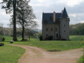
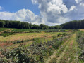
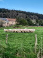
The walk starts in the small hamlet of Réglois, with its charming manor house, for a moderately challenging hike that takes you through the Morvan countryside, with its fir trees, forests and little streams.

Details

21348867
Creation:
Last update:
Last review:
  • Walking
    Activity: Walking
  • ↔
    Distance: 5.42 mi
  • ◔
    Average duration: 3h 00 
  • ▲
    Difficulty: Easy

  • ⚐
    Back to start: Yes
  • ↗
    Ascent: + 577 ft
  • ↘
    Descent: - 600 ft

  • ▲
    Highest point: 1,739 ft
  • ▼
    Lowest point: 1,329 ft

Photos

Description of the walk

Park near the glass recycling bin, at the junction of the C3 and C11 roads.

(S/E) Head east-southeast and take the Route du Manoir (C24).

(1) At the crossroads (cross), turn right onto Chemin de la Grand Vie. At the end of the tarmac road, continue along a track. Follow this track southwards for about 1.5 km.

(2) At the junction, continue straight ahead along the track. Head downhill until you reach a crossroads near a stream.

(3) Turn left and cross the stream by wading across or via a small stone bridge on the left. Ignore a turn-off on the left and head towards the first houses in the hamlet of Goix.

(4) Then turn sharply left and head uphill. Follow a lovely forest track and ignore all turn-offs to the right. Further on, at the top of the climb (elevation 513), the track gives way to a dirt track: carry on straight ahead, passing an old green gate (which remains open).

(5) Just before a gate leading to the D980, take a path on the left (do not go past the gate). Head north and descend along the path, which narrows (note cadastral marker no. 8 on the left). Cross a stream and head back up the other side along a pretty little stone-lined path which then widens as you emerge from the forest. Ignore a turn-off to the right, rejoin the tarmac road and you’ll soon reach a junction.

(6) Turn left onto Route du Manoir. Note the manor house on your left and carry straight on.

(1) At the junction you passed at the start of the walk, carry straight on to the car park (S/E).

Waypoints

  1. S/E : mi 0 - alt. 1,729 ft - Glass recycling bin
  2. 1 : mi 0.09 - alt. 1,732 ft - The hamlet of Réglois
  3. 2 : mi 1.05 - alt. 1,509 ft - Crossroads
  4. 3 : mi 1.87 - alt. 1,339 ft - Crossroads
  5. 4 : mi 2.2 - alt. 1,335 ft - Goix, near the - Ternin (rivière) - Affluent de l'Arroux
  6. 5 : mi 3.33 - alt. 1,670 ft - Intersection – Barrière
  7. 6 : mi 4.99 - alt. 1,739 ft - Intersection – Route du Manoir
  8. S/E : mi 5.42 - alt. 1,729 ft - Glass recycling bin

Notes

On most of the trails in the Morvan, you may encounter muddy or tricky sections, so please make sure you wear suitable footwear.

You are hiking in the Morvan Natural Park; please respect the guidelines for responsible hikers regarding the natural environment.

Not recommended during the hunting season.

In Alligny-en-Morvan you will find: a grocery shop, bread, newspapers, a café, a hotel, a restaurant, a pub, a wine shop, a post office,
a chemist’s, a municipal library, a council-run lodge and private lodges.

Reviews and comments

4.8 / 5
Based on 2 reviews

Reliability of the description
5 / 5
Ease of following the route
5 / 5
Route interest
4.5 / 5
harlem1
harlem1

Hello, and thank you for coming back to the route. Perhaps we’ll see each other soon at a nearby route? Best regards.

Machine-translated

Isabelle de Chissey
Isabelle de Chissey

Overall rating : 5 / 5

Date of your route : Feb 02, 2024
Reliability of the description : ★★★★★ Very good
Ease of following the route : ★★★★★ Very good
Route interest : ★★★★★ Very good
Very busy route : No

A lovely walk offering a wonderful variety of scenery. No particular difficulties; I was lucky not to come across any hunters and the sun was shining ☀️
Completed in 2 hours and 10 minutes without any breaks.
Definitely one to do again 👍🏻

Machine-translated

Ade Gdrt
Ade Gdrt

Overall rating : 4.7 / 5

Date of your route : Jan 07, 2023
Reliability of the description : ★★★★★ Very good
Ease of following the route : ★★★★★ Very good
Route interest : ★★★★☆ Good
Very busy route : No

A lovely walk, and the flora and fauna along the way are incredible. Unfortunately, there were a lot of hunters out that day, which made it less enjoyable – and there were no signs warning of this, either. Also, at three points we came across the river, but it had burst its banks, so we had to take a detour. The walk took 2 hours 30 minutes at a leisurely pace.

Machine-translated

Other walks in the area

For more walks, use our search engine .

The GPS track and description are the property of this route's author. Please do not copy them without permission.