The Tancoup circular route via the Pas du Diable

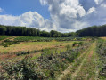
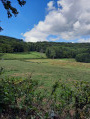
The walk starts from the village of Alligny-en-Morvan, with its charming château, and is a moderately challenging hike that takes you through the Morvan countryside, with its fir trees, forests and little streams.

Details

39283233
Creation:
Last update:
Last review:
  • Walking
    Activity: Walking
  • ↔
    Distance: 7.43 mi
  • ◔
    Average duration: 4h 05 
  • ▲
    Difficulty: Moderate

  • ⚐
    Back to start: Yes
  • ↗
    Ascent: + 735 ft
  • ↘
    Descent: - 709 ft

  • ▲
    Highest point: 2,070 ft
  • ▼
    Lowest point: 1,490 ft

Photos

Description of the walk

Park in the village square at Alligny-en-Morvan.

(S/E) With your back to the car park, turn right onto the D121, which forms part of theGRP® Tour du Morvan trail (marked in yellow and red). Turn right onto Rue Jean Genet, heading towards Jarnoy. You will then pass the Musée des Nourrices and the entrance to the château. Continue on until you reach a crossroads with several directions.

(1) Leave theGRP® and take the path on the left; further on, cross a stream, then reach a junction of paths by a pond.

(2) Take the small path leading uphill to the right to reach a junction with a road.

(3) Follow it downhill to the right and reach the Y-junction before the hamlet of Étang des Poix.

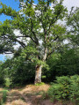
(4) Go up the road to the left, then turn left again onto Rue de l’Étang des Poix. Continue along the path that follows it until you reach the Vernet des As house: there is a lovely listed oak tree here.

(5) Take the path on the right and head towards the ‘Carrefour des Sapinières’ junction.

(6) Carry on to the left until you reach the road at the hamlet known as Le Magny.

(7) Take the road downhill to the right, then turn onto the village track branching off to the left. After the Cranays houses, enter the Bois de Tancoup. Then follow the blue markings to reach another crossroads in a clearing.

(8) Turn left and walk along the edge of this clearing until you reach another Y-shaped junction.

(9) Head into the woods on the right; you’ll soon reach the Pas du Diable in another clearing.

(10) Head back into the woods, descend gently and rejoin the D234. Turn right onto it for about a hundred metres, pass thefirst path junction and then come to asecond one.

(11) Turn right onto this path, follow it alongside the fields until you reach the junction withthe GRP® du Tour du Morvan. Turn right onto this path to quickly reach a junction with aPR®: look out for a signpost.

(12) Leave theGRP® and turn left onto thePR®, following the yellow markings. Walk along a relatively flat section before continuing the descent to reach the D121.

(13) Continue to the right along the road until you reach the bend, then turn left onto the path. Follow the yellow markings for the return journey. At the wide path – the old Tacot railway line – turn right and, a few metres further on, you’ll see the ford and the stone bridge over the Ternin, known as the Pont du Poriot. Continue straight on until you rejoin the D121.

(14) Cross this road diagonally and continue along the path opposite. This runs alongside the D121 before veering away from it and reaching a crossroad, the D521. Turn left, pass the cemetery and reach a junction. Turn right and head for the car park at the Place d’Alligny-en-Morvan (S/E).

Waypoints

  1. S/E : mi 0 - alt. 1,490 ft - Car park at the Place d’Alligny-en-Morvan
  2. 1 : mi 0.36 - alt. 1,555 ft - Crossroads with several directions
  3. 2 : mi 0.87 - alt. 1,601 ft - A narrow path leading uphill to the right
  4. 3 : mi 1.29 - alt. 1,745 ft - At the road, turn right
  5. 4 : mi 1.54 - alt. 1,696 ft - Crossroads, turn left
  6. 5 : mi 2.22 - alt. 1,946 ft - Le Vernet des As
  7. 6 : mi 2.57 - alt. 2,008 ft - Sapinières crossroads
  8. 7 : mi 2.99 - alt. 2,060 ft - Le Magny
  9. 8 : mi 3.87 - alt. 1,867 ft - Clearing crossroads
  10. 9 : mi 4.2 - alt. 1,985 ft - Y-junction
  11. 10 : mi 4.36 - alt. 1,955 ft - Le Pas du Diable
  12. 11 : mi 4.61 - alt. 1,998 ft - D234 junction
  13. 12 : mi 5.23 - alt. 1,857 ft - GRP®, PR® junction
  14. 13 : mi 5.72 - alt. 1,585 ft - D121. Towards the stone bridge at - Ternin (rivière) - Affluent de l'Arroux
  15. 14 : mi 6.7 - alt. 1,503 ft - Return via the D121
  16. S/E : mi 7.43 - alt. 1,490 ft - Car park at the Place d’Alligny-en-Morvan

Notes

On most of the paths in the Morvan, you may encounter muddy or tricky sections, so please make sure you wear suitable footwear.
You are hiking in the Morvan Natural Park; please respect the guidelines for responsible hikers regarding the natural environment.
Please note: not recommended during the hunting season.

Always be careful and prepared when out walking. Visorando and the author of this guide cannot be held liable for any accident or inconvenience that may occur on this route.

Worth a visit

(S/E) In Alligny-en-Morvan, you’ll find: a grocery shop, bread, newspapers, a café, a hotel, a restaurant, a pub, a wine shop, a post office, a chemist’s, the local library, a council-run lodge and private lodges.
After the (13) on the right, note the mound where the Château de la Tour d’Ocle once stood.

Always be cautious and plan ahead when you're outdoors. Visorando and the author of this route cannot be held responsible for any accidents occurring on this route.

The GR® and PR® markings are the intellectual property of the Fédération Française de Randonnée Pédestre.

Reviews and comments

3.9 / 5
Based on 4 reviews

Reliability of the description
4.3 / 5
Ease of following the route
3.5 / 5
Route interest
4 / 5
KRAPAHUTEUR21
KRAPAHUTEUR21

Overall rating : 3.7 / 5

Date of your route : Jun 14, 2026
Reliability of the description : ★★★★☆ Good
Ease of following the route : ★★★★☆ Good
Route interest : ★★★☆☆ Average
Very busy route : No

Paths that haven’t been properly cleared (tall grass, risk of ticks)

Machine-translated

laverdureolivier
laverdureolivier

Overall rating : 3.3 / 5

Date of your route : Jul 28, 2025
Reliability of the description : ★★★★☆ Good
Ease of following the route : ★★☆☆☆ Disappointing
Route interest : ★★★★☆ Good
Very busy route : No

Paths overgrown with vegetation; trees blocking the way, difficult to pass.

Machine-translated

Pierre59110
Pierre59110

Overall rating : 4.5 / 5

Date of your route : Jul 19, 2025
Reliability of the description : Not used / Not applicable
Ease of following the route : ★★★★☆ Good
Route interest : ★★★★★ Very good
Very busy route : No

Beautiful hike, varied route, climbs (some of them beautiful!), descents, shaded and sunny sections
The GPX track has a few discrepancies, but nothing serious! However, it was very useful for getting out of the woods around km 6.
A few sections were made difficult (around km 8 and km 9) by fallen trees.

Machine-translated

harlem1
harlem1

Hello. Thank you for your feedback. Please do have a look at the other walking routes in our town. Kind regards, Jean Luc

Machine-translated

Clem21
Clem21

Overall rating : 4.3 / 5

Date of your route : Jul 11, 2024
Reliability of the description : ★★★★★ Very good
Ease of following the route : ★★★★☆ Good
Route interest : ★★★★☆ Good
Very busy route : No

A lovely, very accessible walking route that follows the classic trails and lets you enjoy the heart of the Morvan; there aren’t many points of interest, but it’s a very pleasant walk!

Machine-translated

Other walks in the area

For more walks, use our search engine .

The GPS track and description are the property of this route's author. Please do not copy them without permission.