Woods and valleys around Maintenon

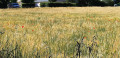
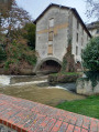
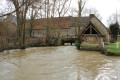
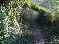
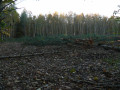
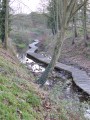
Starting from Maintenon, steeped in history, this refreshing route takes you from the woods of the plateau to the heart of the Eure Valley. Following the course of the river, you’ll wind your way through the valley’s numerous ponds. Around the bend, you might just spot a flock of barnacle geese or a swan.

Details

24820935
Creation:
Last update:
Last review:
  • Walking
    Activity: Walking
  • ↔
    Distance: 7.81 mi
  • ◔
    Average duration: 3h 45 
  • ▲
    Difficulty: Moderate

  • ⚐
    Back to start: Yes
  • ↗
    Ascent: + 171 ft
  • ↘
    Descent: - 174 ft

  • ▲
    Highest point: 436 ft
  • ▼
    Lowest point: 318 ft
  • ⚐ Country: France
  • ⚐ City: Maintenon (28130)
  • ⚑
    Start/End: N 48.589801° / E 1.578113°
  • ❏
    IGN map(s): Ref. 2115O, 2116O
  • Hour-by-hour weather

Description of the walk

You can park in the car park at 29 Rue Collin d’Harleville (starting point).

(S/E) Follow the Louis XIV Canal, which was dug for the construction of the aqueduct, to the D1164.

(1) Turn right to climb the steep slope beneath the railway line.

(2) Turn left and follow Rue du Coteau. Take Rue des Oiseaux on the right, then the first path on the left. Cross a small wood and the plain, until you reach a T-junction.

(3) Turn right, then, 20 metres further on, turn left and walk alongside another copse. When you see the apple trees, take the path on the left. Take Allée Sylvestre, which follows the hillside, then descends into the valley towards Villiers-le-Morhier.

(4) Take the path on the left and walk past the house known as Le Clos Verdelet. Continue to the farm and turn left to return to the hillside.

(5) Turn right (GR® signposted) and join Rue de Gallardon, which leads down to Villiers-le-Morhier.

(6) In the village, continue along the main road to your right. After 150 m, turn left into Rue de la Fontaine, continue along Impasse de la Fontaine and turn right.

(7) Walk past the stadium and take the path on the left, walking alongside the village pond.

(8) At a place called La Malmaison, take the path on the right, Rue des Étangs. After 150 m, turn right onto Rue du Lavoir. When you reach the old wash house, take the first path on the left running parallel to the River Eure. This will take you back to the path you followed on the way there. Turn right to cross the Louis XIV Canal.

(1) Take the D1164 on the right. After 300 m, take the path on the right.

(9) At the junction, cross the D983 and take the path on the left, Allée de Saint-Piat.

(10) At the crossroads, take the road on the right, then turn into the first path on the left. At the end of this path, head down Rue de la Boisramée on the left, then turn right onto Rue du Moulin.

(1) Turn left onto the D906 to pass close to the château and reach the car park via Rue Colin d’Harleville (S/E).


Waypoints

  1. S/E : mi 0 - alt. 331 ft - Car park at the - Château de Maintenon
  2. 1 : mi 0.85 - alt. 328 ft - D1164
  3. 2 : mi 1.06 - alt. 417 ft - Rue du Coteau
  4. 3 : mi 1.74 - alt. 407 ft - Eure Valley Tourist Board
  5. 4 : mi 2.62 - alt. 348 ft - Le Clos Verdelet
  6. 5 : mi 3.13 - alt. 404 ft - Rue de Gallardon
  7. 6 : mi 3.39 - alt. 358 ft - Main street
  8. 7 : mi 3.67 - alt. 318 ft - Municipal stadium
  9. 8 : mi 4.37 - alt. 318 ft - La Malmaison. Towards the - Eure (rivière)
  10. 9 : mi 6.23 - alt. 331 ft - D 983
  11. 10 : mi 6.91 - alt. 341 ft - Rue Jean Monnet
  12. 11 : mi 7.49 - alt. 335 ft - D906 - Eure (rivière)
  13. S/E : mi 7.81 - alt. 331 ft - Maintenon Castle car park - Voise (rivière) - Affluent de l'Eure

Worth a visit

- Maintenon Castle Golf Course.
- Les Clefs de Milton – Lodges & Escape room.
- Culinary trends.
- Maintenon’s gardens and aqueduct.

Always be cautious and plan ahead when you're outdoors. Visorando and the author of this route cannot be held responsible for any accidents occurring on this route.

The GR® and PR® markings are the intellectual property of the Fédération Française de Randonnée Pédestre.

Reviews and comments

3.4 / 5
Based on 4 reviews

Reliability of the description
3.3 / 5
Ease of following the route
3.3 / 5
Route interest
3.8 / 5
Le Fèvre61
Le Fèvre61

Overall rating : 4.3 / 5

Date of your route : Apr 28, 2025
Reliability of the description : ★★★★☆ Good
Ease of following the route : ★★★★☆ Good
Route interest : ★★★★★ Very good
Very busy route : No

A varied route. Beautiful scenery.

Machine-translated

Marvela8
Marvela8

Overall rating : 3.3 / 5

Date of your route : Aug 12, 2024
Reliability of the description : ★★★☆☆ Average
Ease of following the route : ★★★☆☆ Average
Route interest : ★★★★☆ Good
Very busy route : No

We tried to follow the walk using a photocopy of the map, but it wasn’t very easy to find our way. We still had a lovely walk between Villiers-le-Morhier and Pierres, even though we weren’t able to follow the route exactly.

Machine-translated

fdsh
fdsh
• Edited:

Overall rating : 5 / 5

Date of your route : Nov 25, 2023
Reliability of the description : ★★★★★ Very good
Ease of following the route : ★★★★★ Very good
Route interest : ★★★★★ Very good
Very busy route : No

In the description, it would be good to include details of the signposting that this route follows (GR/PR)
A lovely route to follow in winter –
from the station, it takes about 20 minutes to reach the starting point, which is easy to find

Machine-translated

farrolulu
farrolulu

Thank you for your reply. When I follow the route, there’s no longer any mention of the castle car park…
Here’s the mistake

Machine-translated

Eure-et-Loir Tourisme

The car park at the start is located at 29 Rue Collin d’Harleville, as explained in the description. You then need to follow the limestone track along the River Eure.
It has been renamed by the town hall: ‘Château car park’.

Machine-translated

farrolulu
farrolulu

Overall rating : 1 / 5

Date of your route : Aug 14, 2023
Reliability of the description : ★☆☆☆☆ Very disappointing
Ease of following the route : ★☆☆☆☆ Very disappointing
Route interest : ★☆☆☆☆ Very disappointing
Very busy route : No

For this walk, we set off from the castle car park, but after driving round Maintenon for an hour, we couldn’t find the D1164. It’s a real shame about this route description. I often go on walks using VIsorando, but in this case I really don’t understand the start-point description – it’s a real shame.

Machine-translated

Other walks in the area

For more walks, use our search engine .

The GPS track and description are the property of this route's author. Please do not copy them without permission.