Circular walk on the GR®655 between Saint-Martin-de-Nigelles and Villiers-le-Morhier

Between Beauce and the Eure Valley, this circular walk invites you to stroll along the Drouette in the footsteps of millers, lords and cathedral builders. The walk follows the GR®655 West, one of the Grande Randonnée trails leading to Santiago de Compostela.

Details

91531506
Creation:
Last update:
Last review:
  • Walking
    Activity: Walking
  • ↔
    Distance: 7.51 mi
  • ◔
    Average duration: 3h 35 
  • ▲
    Difficulty: Moderate

  • ⚐
    Back to start: Yes
  • ↗
    Ascent: + 184 ft
  • ↘
    Descent: - 187 ft

  • ▲
    Highest point: 430 ft
  • ▼
    Lowest point: 322 ft

Photos

Description of the walk

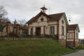
(S/E) Opposite the town hall, turn right onto Rue Jean Moulin. Walk past Saint-Martin Church. Turn left onto Rue Maurice Peltiez, then right onto Rue de la Villeneuve. At the next junction, turn right onto Rue de la Drouette.

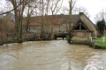
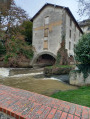
(1) Admire the Godets bridge and wash house and look to your right at the reservoir. Retrace your steps, turn right and continue along the Drouette on Rue des Saulx.

(2) At the crossroads, turn right onto Rue de Fervache.

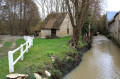
(3) Cross the bridges over the Drouette. Pass by the Moulin de Fervaches with the leat (an artificial canal to bring water to the mill) on your right. Continue and follow the GR®655 to the left, along Rue du Général de Gaulle. Continue to the bridge and wash house at La Perruche and the Moulin de la Perruche.

(4) On the left is the canal with reinforced banks. Retrace your steps and turn left onto Chemin du Bois d'Olivet. Turn left onto Chemin des Côtes, following the GR®655. Turn left to descend to Côte de Paradis. Continue straight ahead along the path.

(5) You’ll reach the Moulin de Nigelles and its bread oven. Retrace your steps and take the GR®655 to the left, along the Drouette.

(6) On Rue de Senantes, first turn right then left. At the bottom of the street, along the Drouette, you’ll find the Églancourt bridge and wash house. Continue along the path to Rue de Gobienne.

(7) Turn left onto it and stay on the street until the crossroads.

(8) Turn left as you cross the bridge. Pass in front of the Moulin de Tournachère. Continue right onto Rue du Château in Villiers-le-Morhier. Turn left before the roundabout.

(9) Pass through the church square. Continue left along the path near the post office and join Rue de la Mairie. After the town hall, turn left onto Route de Gallardon, then take the path on the right. Continue on the PR® (yellow markings) then follow the path to the edge of the forest. Turn onto the first path on the left until you reach Chantier de l'Orme.

(10) Then turn right. Continue along the path, then turn left and then right until you reach the road.

(11) At the junction, follow the road to the right, then turn left into the Bois des Glands. Continue along the path to the end, then turn left onto the Route du Val de Nigelles.

(12) Turn right onto it until you reach the town hall of Saint-Martin-de-Nigelles (S/E).

Waypoints

  1. S/E : mi 0 - alt. 371 ft - Saint-Martin-de-Nigelles Town Hall
  2. 1 : mi 0.73 - alt. 354 ft - Godets Bridge and Wash House - Drouette (rivière)
  3. 2 : mi 1.16 - alt. 351 ft - Crossroads
  4. 3 : mi 1.25 - alt. 348 ft - Fervaches Mill - Drouette (rivière)
  5. 4 : mi 1.59 - alt. 338 ft - La Perruche Mill - Drouette (rivière)
  6. 5 : mi 2.41 - alt. 338 ft - Nigelles Mill and bread oven - Drouette (rivière)
  7. 6 : mi 2.84 - alt. 348 ft - Églancourt
  8. 7 : mi 3.34 - alt. 397 ft - Rue de Gobienne
  9. 8 : mi 3.82 - alt. 331 ft - Tournachère Mill, crossroads - Drouette (rivière)
  10. 9 : mi 4.34 - alt. 354 ft - Église Saint-Étienne (Villiers-le-Morhier)
  11. 10 : mi 5.58 - alt. 417 ft - Chantier de l'Orme
  12. 11 : mi 6.33 - alt. 413 ft - Route
  13. 12 : mi 6.93 - alt. 358 ft - Val de Nigelles
  14. S/E : mi 7.51 - alt. 371 ft - Saint-Martin-de-Nigelles Town Hall

Notes

(S) Car park at the town hall

Worth a visit

(1) Godets Bridge and Wash House

(3) Fervaches Mill

(4) Moulin de la Perruche

(5) Nigelles Mill and bread oven

Always be cautious and plan ahead when you're outdoors. Visorando and the author of this route cannot be held responsible for any accidents occurring on this route.

The GR® and PR® markings are the intellectual property of the Fédération Française de Randonnée Pédestre.

Reviews and comments

4.2 / 5
Based on 2 reviews

Reliability of the description
4 / 5
Ease of following the route
4.5 / 5
Route interest
4 / 5
Anher
Anher

Overall rating : 4 / 5

Date of your route : Apr 20, 2026
Reliability of the description : ★★★★☆ Good
Ease of following the route : ★★★★☆ Good
Route interest : ★★★★☆ Good
Very busy route : Yes

A lovely walk, especially the first half.

Machine-translated

Denis26
Denis26 ★

Thank you, ealet, for pointing that out; I’ve just updated the description.

Machine-translated

ealet
ealet

Overall rating : 4.3 / 5

Date of your route : Apr 19, 2026
Reliability of the description : ★★★★☆ Good
Ease of following the route : ★★★★★ Very good
Route interest : ★★★★☆ Good
Very busy route : No

A pleasant walk with lovely stretches along the banks of the Drouette, featuring long tarmac sections but also quiet, little-used country lanes
Thanks to the author for sharing this
NB: from the car park opposite the town hall, you need to turn right onto Rue Jean Moulin (and not with your back to the town hall as mentioned in the description)

Machine-translated

Other walks in the area

For more walks, use our search engine .

The GPS track and description are the property of this route's author. Please do not copy them without permission.