Saint-Martin-de-Nigelles and its hamlets

Starting from Saint-Martin-de-Nigelles, this route passes through most of the hamlets in the commune around the Drouette valley, taking in Les Saulx, Les Godets, Ouencé, Gobienne, Eglancourt, Le Paradis and Puits Mignon.

Details

36325224
Creation:
Last update:
Last review:
  • Walking
    Activity: Walking
  • ↔
    Distance: 7.92 mi
  • ◔
    Average duration: 3h 55 
  • ▲
    Difficulty: Moderate

  • ⚐
    Back to start: Yes
  • ↗
    Ascent: + 272 ft
  • ↘
    Descent: - 285 ft

  • ▲
    Highest point: 472 ft
  • ▼
    Lowest point: 335 ft

Photos

Description of the walk

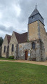
The starting point is accessible by car. A car park in front of the church can accommodate a small number of cars. The village of Saint-Martin-de-Nigelles is situated between Épernon and Maintenon. Both towns have an SNCF railway station.

(S/E) With your back to the church, cross the street, heading slightly downhill, to reach the D101.4. Cross it and head down the Sente de la Bourguignonne. At the bottom of the path, turn right for a few metres until you reach a fork.

(1) Turn right onto the small path that leads into the woods and forms part of the GR®655. Pass through Les Saulx and head towards the hamlet of Les Godets.

(2) Turn right onto the Chemin des Godets (GR®655), which goes round the last house and climbs gently towards the fields. You’ll come within sight of the first houses in Hanches.

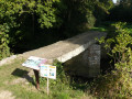
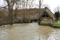
(3) Just before the first house (July 2023), leave theGR®655and head down the path on the left towards the river (PR®). Cross the Pont des Quatre Pierres bridge over the Drouette, then turn left onto Rue des Prés and continue to the next road junction.

(4) Cross the road and follow Rue de la Tourneuve straight ahead until you reach the Quatre Chemins crossroads.

(5) Leave thePR® and follow the path opposite, which continues slightly uphill towards the north-east. Take the first path on the left to reach the woodland to the north-west. This path then runs alongside several woodlands, winding through a series of bends to the right and left before descending back onto the D101.3 road. Turn right here and follow the road for a few metres until you reach the fork in the road.

(6) Head up to the right, along the D101.5 towards Saint-Lucien for about 350 m and, at the first right-hand bend at a right angle, take the path directly opposite to reach the Vallée Grosse woodland. Follow it, continuing across the fields until you reach another, smaller woodland.

(7) Take the path on the left at the corner and join the small road passing in front of the Ferme du Châtillon stud farm. Then turn left onto the D101 for 250 m to return to the Clos des Champs housing estate.

(8) Turn right onto the first path at the edge of the woodland until you reach Rue de Gobienne, then head downhill for about 100 metres to rejoin theGR®655.

(9) Turn sharply left onto a downhill path. TheGR® sign is on the trunk of the oak tree right on the corner. Head towards Églancourt via Rue Henri Baillods and emerge onto Rue des Senantes.

(10) First turn left then right onto Rue Adolphe Blanchon. Continue along the path which then runs alongside the River Drouette.

(11) Leave theGR® path, which climbs to the left up the Côte du Paradis, and follow the river to the road (Rue du Général de Gaulle) and the bridge in the centre of Saint-Martin-de-Nigelles. Then turn right to cross the bridge and continue to the next junction.

(12) Turn left onto Rue Jean Moulin to walk past the town hall and reach the church (S/E).

Waypoints

  1. S/E : mi 0 - alt. 417 ft - Church
  2. 1 : mi 0.12 - alt. 351 ft - Turn right at the junction. GR655 under the trees
  3. 2 : mi 0.85 - alt. 354 ft - Junction. Chemin des Godets
  4. 3 : mi 1.57 - alt. 364 ft - Junction: turn left. PR (leave the GR)
  5. 4 : mi 1.92 - alt. 390 ft - Junction. Rue de la Tourneuve
  6. 5 : mi 2.32 - alt. 436 ft - Les Quatre Chemins
  7. 6 : mi 3.82 - alt. 361 ft - Junction: turn right onto the D101.5 towards St Lucien
  8. 7 : mi 4.93 - alt. 459 ft - Woodland, junction
  9. 8 : mi 5.56 - alt. 427 ft - Junction: turn right onto the path at the edge of the woods
  10. 9 : mi 6.22 - alt. 394 ft - Junction. Rue de Gobienne (GR)
  11. 10 : mi 6.69 - alt. 344 ft - Rue des Senantes
  12. 11 : mi 7.08 - alt. 335 ft - Bottom of the Côte du Paradis
  13. 12 : mi 7.71 - alt. 367 ft - Crossroads. Rue Jean Moulin
  14. S/E : mi 7.92 - alt. 417 ft - Church

Always be cautious and plan ahead when you're outdoors. Visorando and the author of this route cannot be held responsible for any accidents occurring on this route.

The GR® and PR® markings are the intellectual property of the Fédération Française de Randonnée Pédestre.

Reviews and comments

3.7 / 5
Based on 4 reviews

Reliability of the description
4 / 5
Ease of following the route
3.8 / 5
Route interest
3.3 / 5
eclo5326
eclo5326

Overall rating : 4 / 5

Date of your route : Apr 29, 2024
Reliability of the description : ★★★★☆ Good
Ease of following the route : ★★★★☆ Good
Route interest : ★★★★☆ Good
Very busy route : Yes

See next message (closure of a section of the route)

Machine-translated

eclo5326
eclo5326

Walk taken on 28 April 2024.
Major problem between Point 1 and Point 2.
Large trees had fallen across the path in the woods. The path is signposted as closed and is blocked by a small barrier.
We went ahead with the walk anyway, ignoring the signs.
I wouldn’t recommend it if there are children with you.
I think it was the rain and wind that caused this ‘damage’. It’s just like being in the woods.
Danger is ‘everywhere’.
You have to step over a few large trees blocking the path.
The local council has taken responsibility, which is only right.
In my opinion, you can reach point 2 by turning right straight from the start at the church, then taking the first road on the left. It’s in the woods that the path is blocked.

Machine-translated

ealet
ealet

Overall rating : 4 / 5

Date of your route : Mar 03, 2024
Reliability of the description : ★★★★☆ Good
Ease of following the route : ★★★★☆ Good
Route interest : ★★★★☆ Good
Very busy route : No

A walk with quite a few (quiet) roads – best avoided after heavy rain as many sections are very muddy – with a few interesting sights (the Pont des 4 Pierres, churches, the banks of the Drouette and some scenic viewpoints)
Thanks to the author for sharing this.

Machine-translated

ovil
ovil

Overall rating : 3.7 / 5

Date of your route : Oct 10, 2023
Reliability of the description : ★★★★☆ Good
Ease of following the route : ★★★★☆ Good
Route interest : ★★★☆☆ Average
Very busy route : No

We combined this walk with the one called “Villiers-le-Morhier Circular”, following the GR from point 9 to Villiers and back to finish it off.
It was a warm day for the time of year and there was very little shade; we often walked alongside woods without actually going through them.
The church is closed until further notice whilst the roof structure is being inspected.
There are two picnic tables (in the sun but by the river) along the D 101.3, about a hundred metres from the junction heading towards Saint Lucien (point 6).

Machine-translated

Beauceron
Beauceron

Overall rating : 3 / 5

Date of your route : Oct 10, 2023
Reliability of the description : ★★★★☆ Good
Ease of following the route : ★★★☆☆ Average
Route interest : ★★☆☆☆ Disappointing
Very busy route : No

To get to the hamlets, in my opinion, unless you like it, there are too many paths through the fields, too many roads
Not enough woodland.

Machine-translated

Other walks in the area

For more walks, use our search engine .

The GPS track and description are the property of this route's author. Please do not copy them without permission.