Country:
 City:
City:


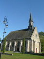
From Maintenont, take the D115A towards Villiers-le-Morhier. Park near the Church of Saint-Étienne.
(S/E) From the Place de l’Église, turn left onto Rue de la Mairie and continue until you reach a Y-junction.
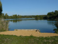
(1) Take the first street on the right, Rue de la Fontaine, running alongside the primary school. Then pass a lane on the left, followed by a path on the right. You’ll reach a Y-junction near a pumping station. Continue to the right for 800 m. At the next junction of tracks, head straight on and pass between the ponds. Then keep going straight until you reach the Fossé Maillard.
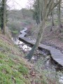
(2) Follow the path that runs alongside the ditch. Then ignore thePR® signpost heading left.
(3) Go straight on and follow a canal. Follow the same path until you reach the track coming from the left.
(4) Take the Chemin de la Grande Rivière straight ahead for 300 m. Then turn left onto the D116.4 for 150 m before heading straight ahead onto a small, sloping path. Turn left at the end of the path (Rue du Coteau) then right at the sharp junction (Rue des Oiseaux). After a few bends, look for a path on the left at the corner by number 21.
(5) Continue along the track for 800 metres, going straight on at the first two junctions. You’ll come to a third junction.
(6) Turn left and carry on straight ahead until you reach Rue de Gallardon.
(7) Stay on this path, passing the water tower and then the town hall, until you reach the fork in the road from the outward journey.
(1) Carry on straight ahead to reach the Church of Saint-Étienne (S/E).



 Tourism professional
 Moderate
 Association / Club / Walk leader
 Visorando Member