Circular between Mévoisins and Bailleau-Armenonville

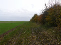
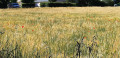
This is a pleasant and easy circular route, alternating between wooded areas, forest edges and fields. Most of the route offers unobstructed views, even overlooking the Eure and Voise valleys. It is a landscape with very little traffic, allowing you to enjoy watching herons and harriers take flight, small game such as deer and hares scampering across the fields and paths, and, in season, gliders soaring through the sky.

Details

1420835
Creation:
Last update:
Last review:
  • Walking
    Activity: Walking
  • ↔
    Distance: 12.04 mi
  • ◔
    Average duration: 5h 45 
  • ▲
    Difficulty: Moderate

  • ⚐
    Back to start: Yes
  • ↗
    Ascent: + 272 ft
  • ↘
    Descent: - 246 ft

  • ▲
    Highest point: 509 ft
  • ▼
    Lowest point: 371 ft
  • ⚐ Country: France
  • ⚐ City: Mévoisins (28130)
  • ⚑
    Start/End: N 48.550858° / E 1.592058°
  • ❏
    IGN map(s): Ref. 2116E, 2116O
  • Hour-by-hour weather

Photos

Description of the walk

(S/E) Start from the church in Mévoisins, which is in the heart of the village. Walk up Rue de la Liberté, leaving the church on your right, and cross the level crossing. Immediately after the level crossing, take a small street on the left that runs alongside the leisure ground, pass a small tunnel on the left and take the path that starts in front of it. The path runs alongside the railway line for a while.

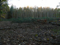
(1) When you reach a pine forest, the path forks: take the right fork. The path climbs slightly, surrounded by woods. At the top of the path, before leaving the woods, you will find a solid hut on your left, set back from the path ("Cabane de Tarzan" on the front). The path continues and goes around another grove.

(2) At the corner of the copse, follow the path on the right, which descends slightly to join the D329-4.

(3) Follow this road to the left for 100 metres. At the end of the copse on the right-hand side, leave the road and take the path on the right. Walk around the copse, which is home to many birds. Then rejoin the road.

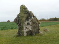
(3) Follow the road to the left and pass in front of the Mévoisins menhir.

(4) About 200 metres after the menhir and just before a copse, take the path on the left (south-east). Follow the path to a T-junction: then first turn right then left to continue south-east. You will reach a crossroads about 500 metres further on.

(5) Turn left and head uphill. You will arrive at the access point to the dolmen (information board in a field).

(6) The Pierre Frite Dolmen is located in a field on the left. This is a plot of land that has been left uncultivated and is kept accessible for visitors. Leave the path and enter the plot, heading towards the information board. Retrace your steps.

(6) Returning from the dolmen, follow the path you came along to the left. After about 100 metres, take the path on the right.

(7) At the end, turn right onto Chemin Creux (its name), which is wooded on the left. After about 200 metres, take the path on the left (south-east). On a hillock, first turn left then right and descend, keeping south-east.

(8) Cross a small road and continue straight ahead to reach a small wooded area. Continue along the path, still heading south-east, until you reach a very small road, the D329. Follow this road to the left for about 50 metres until you reach a small wayside shrine with a wooden cross.

(9) Then take the path on the right that passes behind the wayside shrine. From here, in summer, enjoy the direct view of the gliders taking off. Descend to the next intersection after a few groves. Then turn onto the path on the left and join a new small road, the D329-1.

(10) Follow this rarely used road to the right. At the crossroads (elevation 140), continue straight ahead, climbing towards the flying club. At the highest point (153m), ignore the turn-off on the right, continue south and cross a wooded area (note the Bailleau-Armenonville flying club on the right). Cross the bridge over the Vélo-rail and head for the Ferme des Bordes.

(11) At the three-way junction, turn right. In a left-hand bend (elevation 147), leave the road and take the path on the right. Reach the Vélo-rail.

(12) Cross the old railway line: be careful, this line is operated by the Vélorail du Pays Chartrain association, so don't be caught out when crossing. Continue along the path opposite. Follow the path to the left as it goes around the southern runway of the flying club (which is hardly ever used).

(13) At the crossroads at the end of the runway, turn right. Turn right again and continue along the runway, in the opposite direction to before.

(14) After going around the southern runway, take the path on the left and enter the woods.

(15) At the fork, take the left path between Bois Deligneris and Bois du Séminaire. Continue for several hundred metres, cross a small road, the D106-2, and continue straight ahead.

(16) Cross the D329. About 20 metres further on, at a fork, take the path on the left. Follow this path for about 1.2 km, ignoring the paths branching off to the sides.

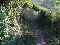
Be careful, this point is a little tricky. As the main path bends to the right, turn left and go further into the undergrowth. Follow what looks like a boundary between plots of land, i.e. a very narrow path shaped like a gutter. After about 500 metres, you will come to a large path blocked by barbed wire. This is private land and you will need to go around it on the left, still following the small path that descends slightly. The path then widens.

(18) Turn left onto the path that eventually descends between Les Bruyères and La Vigne aux Vaches until you reach a very small road.

(19) Follow theGRP® de la Vallée de l'Eure by turning right and going uphill. After 50 metres, there is a fork in the path: stay on theGRP® on the right. Continue straight ahead. Cross a road: be careful, as drivers have poor visibility on this section and may be travelling at speed. Continue straight ahead for about 50 metres.

(20) At the crossroads, continue straight ahead (leaving theGRP® trail to your left). About 500 metres further on, you will emerge from the undergrowth and enjoy a beautiful view of the Eure Valley. The path descends to the railway line and takes you to the level crossing. Turn left to return to the church (S/E).


Waypoints

  1. S/E : mi 0 - alt. 371 ft - Church of Mévoisins
  2. 1 : mi 0.44 - alt. 410 ft - Houssu fork
  3. 2 : mi 0.8 - alt. 476 ft - Intersection
  4. 3 : mi 1.2 - alt. 469 ft - Route D329-4
  5. 4 : mi 1.78 - alt. 407 ft - Start of the route
  6. 5 : mi 2.58 - alt. 443 ft - Crossroads
  7. 6 : mi 2.86 - alt. 469 ft - Dolmen de la Pierre Frite - Access
  8. 7 : mi 3.59 - alt. 459 ft - The "Chemin Creux"
  9. 8 : mi 4.45 - alt. 443 ft - Crossroads with a small road.
  10. 9 : mi 4.97 - alt. 492 ft - Calvaire
  11. 10 : mi 5.47 - alt. 472 ft - Route D329-1
  12. 11 : mi 6.33 - alt. 505 ft - Ferme des Bordes
  13. 12 : mi 6.94 - alt. 482 ft - Level crossing on the Pays Chartrain Vélorail
  14. 13 : mi 7.43 - alt. 446 ft - Crossroads
  15. 14 : mi 7.78 - alt. 489 ft - Turn left
  16. 15 : mi 7.95 - alt. 482 ft - Fourche Bois Deligneris
  17. 16 : mi 8.61 - alt. 472 ft - Route D329
  18. 17 : mi 9.39 - alt. 495 ft - The heights of the Butte aux Loups
  19. 18 : mi 10.34 - alt. 482 ft - Between Bois Collin and Les Bruyères
  20. 19 : mi 10.73 - alt. 417 ft - Meeting with the GRP of the Eure Valley
  21. 20 : mi 11.25 - alt. 482 ft - Crossroads
  22. S/E : mi 12.04 - alt. 371 ft - Church of Mévoisins

Notes

- Shaded areas alternate with large, very exposed spaces. Bring a hat and sunglasses, especially when the wheat or rapeseed fields reflect the sunlight.
- Very good mobile phone and satellite reception.
- There are a few short sections of tarmac, but these are small, single-lane country roads with very little traffic.
- 800 metres from the starting point, the small Saint-Piat station is on the line serving Chartres/Paris-Montparnasse.

Worth a visit

- The menhir, at the edge of the village, between (3) and (4). A remarkable monument erected by the municipality to celebrate the year 2000. Made from a Neolithic stone found in a nearby field, a computer was buried underneath it for posterity.
- The Pierre Frite dolmen, a burial site dating from the Neolithic period that still contains human bones.
- The Bailleau-Armenonville gliding club, where you can take your first flight.
- Vélorail du Pays Chartrain: This starts at the disused Pont-Sous-Gallardon railway station and offers a very pleasant 8 km ride along the railway track.

Reviews and comments

4.3 / 5
Based on 10 reviews

Reliability of the description
4.6 / 5
Ease of following the route
4.5 / 5
Route interest
3.8 / 5
Igor le breton
Igor le breton

Overall rating : 4.7 / 5

Date of your route : Sep 14, 2025
Reliability of the description : ★★★★★ Very good
Ease of following the route : ★★★★☆ Good
Route interest : ★★★★★ Very good
Very busy route : No

A bit too many fields. The forest, perhaps, requires special attention to find the way back.
Otherwise, a very pleasant hike.

Machine-translated

ealet
ealet

Overall rating : 4.7 / 5

Date of your route : Aug 11, 2024
Reliability of the description : ★★★★★ Very good
Ease of following the route : ★★★★★ Very good
Route interest : ★★★★☆ Good
Very busy route : No

A beautiful hike on a beautiful day, no one else on the trail; a bit of road (the least exciting part between 10 and 12).
the route through the forest is great (be careful at point 17 where you need to pay attention to find the path)
Thanks to the author for sharing this.

Machine-translated

ovil
ovil
• Edited:

Overall rating : 4 / 5

Date of your route : Nov 14, 2023
Reliability of the description : ★★★★★ Very good
Ease of following the route : ★★★★☆ Good
Route interest : ★★★☆☆ Average
Very busy route : No

Hike taken on a mild but grey and windy autumn day.
The paths through the fields are often muddy after the recent rains.
We did not see any animals or hear any birds.
At point 17, "the gutter" is often blocked by trees or branches that you have to go around when entering the woods. Probably the result of last week's storm.
The private plot has now been cleared and the barbed wire is on the ground, but you can clearly see that the narrow path turns to the left. Afterwards, we searched for and found point 18 with some difficulty, following a vague trail cluttered with branches.
The church is currently undergoing restoration.
One note: the street where we started is called Rue de l'Arbre de la Liberté (Freedom Tree Street).

Machine-translated

Carinec
Carinec
• Edited:

Overall rating : 4.7 / 5

Date of your route : Aug 06, 2023
Reliability of the description : ★★★★★ Very good
Ease of following the route : ★★★★★ Very good
Route interest : ★★★★☆ Good
Very busy route : No

A beautiful hike through fields and forests that offers a change of scenery in no time.
A front-row seat at the Bailleau flying club, where you can watch aeroplanes and gliders take off 👍
No major difficulties, lovely encounters in the forest (two deer).

Machine-translated

STux
STux

Overall rating : 5 / 5

Date of your route : May 24, 2020
Reliability of the description : ★★★★★ Very good
Ease of following the route : ★★★★★ Very good
Route interest : ★★★★★ Very good
Very busy route : No

Route completed today, under glorious sunshine.

For locals, you can admire the silo (aka the Cathedral) in Gas, and the tower and church in Gallardon in a single view.

The black spot on the route is indeed point 17. When I saw it appear on the route on the mobile app, knowing the area, I feared the worst.
I couldn't find the alternative route near the barricade, but I saw one 50 to 100 metres before it. Maybe that was it? I changed my route by continuing on the main path (the one that turns right), then left to finally find point 18 of the route. (I left the rating as "Very good" because it mentions a point that is not obvious).

A very good route overall: alternating between forest and fields as far as the eye can see, and with the weather adding to the mix... it's a great way to get away from it all!

Machine-translated

VincentLafon
VincentLafon

Overall rating : 4 / 5

Date of your route : Feb 24, 2020
Reliability of the description : ★★★★★ Very good
Ease of following the route : ★★★★★ Very good
Route interest : ★★☆☆☆ Disappointing

Hike completed on 24/2/2020 in 5 hours by two 62-year-old hikers (including a 15-minute lunch break) - Very cloudy sky, steady wind with gusts of force 5 - 50% of the hike was through fields and 50% in forest - No significant elevation - Uninteresting landscapes and no villages crossed (the snowless winter did not help matters)

Machine-translated

toplevel
toplevel ★

Thank you, JLMALHERBE, for your comment.

Machine-translated

JLMALHERBE
JLMALHERBE

Overall rating : 5 / 5

Date of your route : Aug 15, 2019
Reliability of the description : ★★★★★ Very good
Ease of following the route : ★★★★★ Very good
Route interest : ★★★★★ Very good

A very pleasant hike with lots of beautiful views.
I didn't encounter any particular problems at the unmarked sensitive points, but it's true that I use the IGN route a lot on my smartphone.

Machine-translated

medved
medved

Overall rating : 3.7 / 5

Date of your route : Feb 06, 2019
Reliability of the description : ★★★★☆ Good
Ease of following the route : ★★★★☆ Good
Route interest : ★★★☆☆ Average

The path through the woods is poorly marked and can be misleading.

Machine-translated

toplevel
toplevel ★

Hello @blmh,
thank you for your comment. I will revisit the description for the point you mention.

F

Machine-translated

blmh
blmh

Overall rating : 3.7 / 5

Date of your route : Nov 19, 2018
Reliability of the description : ★★★☆☆ Average
Ease of following the route : ★★★★☆ Good
Route interest : ★★★★☆ Good

Hello,

It's interesting to go hiking without any signposts! In October, the weather was overcast but not rainy. Noteworthy features include a menhir and a dolmen.

A few comments:
- Point 17 is not indicated in the description; following the path, you realise that "Caution, this point is a..." corresponds to point 17, but it would be better if this were clearly written.

- The path between point 17 and point 18 could be better described because in some places the trail is not easy to follow and without using GeoPortal, we would have got lost...

Kind regards.

Machine-translated

toplevel
toplevel ★

Thank you, Drazakil, for your feedback on my first posted hike.
This part of the Beauce region does not offer spectacular scenery.

Machine-translated

drazakil
drazakil

Overall rating : 3.7 / 5

Date of your route : Oct 15, 2018
Reliability of the description : ★★★★☆ Good
Ease of following the route : ★★★★☆ Good
Route interest : ★★★☆☆ Average

This is an unmarked trail, so it is important to follow the well-written description.

Some paths have tree trunks across them and are not very well used.

A pleasant walk, but don't expect to see magnificent scenery or lots of animals.

Machine-translated

Other walks in the area

For more walks, use our search engine .

The GPS track and description are the property of this route's author. Please do not copy them without permission.