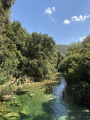
Éouvière Wood

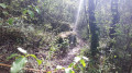
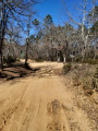
An easy walk through the forest: track, footpath and return via a minor road.
Mountain biking is possible for the more adventurous, with a steep climb and a lovely descent.
Moderator’s note: – there are a few tricky sections on this route; see the reviews at the bottom of this page

Details

n°8469065
Creation:
Last update:
Last review:
  • Walking
    Activity: Walking
  • ↔
    Distance: 4.03 mi
  • ◔
    Average duration: 2h 25 
  • ▲
    Difficulty: Moderate

  • ⚐
    Back to start: Yes
  • ↗
    Ascent: + 666 ft
  • ↘
    Descent: - 676 ft

  • ▲
    Highest point: 1,270 ft
  • ▼
    Lowest point: 682 ft

Photos

Description of the walk

Park in the car park by the La Colle Noire bus stop on the RD562.

(S/E) Take Chemin du Magnanon. After 400 m, head up to the left past the two luxury houses, then take the old railway line to the right. Once at the four-way junction, head up to the left to join the RD562. Follow it to the left with care for about fifty metres.

(1) Cross carefully (no pedestrian crossing) to join Impasse de Font Pascal. Head straight up initially, then take the track on the left. Keep to the right at the junction. At the top, go to the right of the first water tank, join a track and follow it to the left.

(2) Turn right to pass in front of the second water tank and continue for 800 metres, up a slight incline.

(3) At the 373-metre mark, take the wide path on the right which leads to Boulevard du Belvédère. Follow this road to the left for about a hundred metres.

(4) Turn left onto Chemin de l’Éouvière, which starts as a road and then becomes a track.

(5) Just before the track begins to descend and at the end of a clearing, take the path on the right marked in blue (not shown on the map) and begin the descent. This path leads down until it joins another path in the valley.

(6) Then turn right, keep to the right at the junction just after this, and follow the path which runs alongside the valley until it crosses it to join a track at the very bottom. Continue to the tarmac road.

(7) Turn left, then keep right onto the Chemin de Font Taboureno, then turn left before the broken bridge (elevation 209), onto the Chemin de Narbonne (tarmac). Continue straight on to the car park (S/E).

Waypoints

  1. S/E : mi 0 - alt. 745 ft - La Colle Noire car park on the RD562
  2. 1 : mi 0.86 - alt. 843 ft - Crossing the RD562
  3. 2 : mi 1.55 - alt. 1,184 ft - Turn right at the fork, second water tank
  4. 3 : mi 2.03 - alt. 1,220 ft - Elevation 373, on the right
  5. 4 : mi 2.43 - alt. 1,211 ft - Chemin de l’Éouvière
  6. 5 : mi 2.72 - alt. 1,260 ft - Blue Trail on the right
  7. 6 : mi 2.89 - alt. 1,043 ft - Valley, on the right
  8. 7 : mi 3.2 - alt. 761 ft - Junction with tarmac road
  9. S/E : mi 4.03 - alt. 745 ft - La Colle Noire car park on the RD562

Reviews and comments

2.8 / 5
Based on 5 reviews

Reliability of the description
2.6 / 5
Ease of following the route
2.8 / 5
Route interest
3 / 5
claudemarcel.durand@gmail.com

Hello everyone,
This walk is perfectly fine. But I would advise everyone not to do it anymore; the car park is dangerous, the route is unclear and muddy, and I won’t even mention walking against the flow of traffic along the side of a main road where people drive like mad and there is no protection for about 100 metres.
In conclusion, keep the walk, but change the starting point.
Have a great day
Marcel, an occasional user.
Good luck to everyone.
Marcel

Machine-translated

labuge
labuge

Overall rating : 4.3 / 5

Date of your route : Nov 14, 2024
Reliability of the description : ★★★★★ Very good
Ease of following the route : ★★★★☆ Good
Route interest : ★★★★☆ Good
Very busy route : No

It needs to be signposted

Machine-translated

Yesdge
Yesdge
• Edited:

Overall rating : 2.7 / 5

Date of your route : Apr 22, 2024
Reliability of the description : ★★☆☆☆ Disappointing
Ease of following the route : ★★☆☆☆ Disappointing
Route interest : ★★★★☆ Good
Very busy route : No

The start is a bit steep but not for long; after that, it’s pleasant and full of flowers. But when we reached point 5, we never managed to find the blue-marked path. We followed the route on the GPS, got lost in the woods, then found the path again, which was already starting to disappear. In the end, we turned back – it was the safer option as we’d got lost amongst brambles and retaining walls.
For the intrepid souls who still want to tackle the route, bear in mind that the path branches off to the right at a large kerne (stone mound) at the foot of a tree, but it isn’t marked in blue.

Machine-translated

Pauline0783
Pauline0783
• Edited:

Overall rating : 1.7 / 5

Date of your route : Jan 22, 2022
Reliability of the description : ★☆☆☆☆ Very disappointing
Ease of following the route : ★★★☆☆ Average
Route interest : ★☆☆☆☆ Very disappointing
Very busy route : No

Not relevant
The section from the start to point N1 is of no use.
The section from 1 to 2 is extremely steep; we came across a dog on its own in the first part (near the olive trees)
The rest is uninteresting, even dangerous (5–6–7)
No views
Not suitable for children
I’d rate the first section, which climbs steeply, as medium to difficult +++
If it’s raining, don’t go.
I won’t be going back there

Machine-translated

roquepertuse
roquepertuse

Overall rating : 1.3 / 5

Date of your route : Feb 07, 2022
Reliability of the description : ★☆☆☆☆ Very disappointing
Ease of following the route : ★☆☆☆☆ Very disappointing
Route interest : ★★☆☆☆ Disappointing
Very busy route : No

I am very disappointed with this route, which some people had promised would feature mimosas, yet there are absolutely none, and sections 5, 6 and 7 are IMPASSABLE: unmarked, with dense vegetation, thick undergrowth (brambles and vines) and numerous banks of bancaou over 2 metres high.
Segments 5, 6 and 7 are of no interest whatsoever and DANGEROUS.

Machine-translated

espedito
espedito

Overall rating : 4 / 5

Date of your route : Jan 10, 2022
Reliability of the description : ★★★★☆ Good
Ease of following the route : ★★★★☆ Good
Route interest : ★★★★☆ Good
Very busy route : No

A rather pleasant route to cycle.

Machine-translated

Other walks in the area

For more walks, use our search engine .

The GPS track and description are the property of this route's author. Please do not copy them without permission.