Around Lake Saint-Cassien

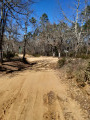
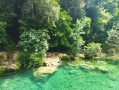
Follow the western arm of Lake Saint-Cassien, then take an easy climb through the Castanier and Tabaroun woods to reach the Friaoud track. Complete this circular route by heading to the observation point at the Fondurane Biological Reserve.

Details

74482580
Creation:
Last update:
Last review:
  • Walking
    Activity: Walking
  • ↔
    Distance: 5.67 mi
  • ◔
    Average duration: 3h 05 
  • ▲
    Difficulty: Moderate

  • ⚐
    Back to start: Yes
  • ↗
    Ascent: + 512 ft
  • ↘
    Descent: - 551 ft

  • ▲
    Highest point: 991 ft
  • ▼
    Lowest point: 440 ft

Description of the walk

Park in the car park at the Fondurane Nature Reserve.

(S/E) Head south along the tarmac road marked with red and white GR®49 signposts and cross the bridge. After a short climb, leave the road and turn left onto a wide track. Follow the GR® signposts to reach the crossroads at the nature reserve.

(1) Keep straight on along the GR® and you’ll soon reach the Gayet crossroads.

(2) Carry on straight ahead along the GR®, gradually drawing closer to the lakeshore. Walk along the lakeside, overlooking the lake, and reach the Vallon du Laquet at a hairpin bend.

(3) Continue along the wide track until you reach the junction with an unmarked path leading up into the woods.

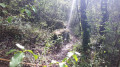
(4) Turn right onto this path and, via a gentle climb amongst box trees and oaks, reach a crossroads with several routes.

(5) Ignore the paths branching off to the right and left and continue straight ahead to join a wider track, then the Friaoud track.

(6) Turn right onto this track and, following an easy descent, reach the Gayet crossroads, where the DFCI MTX1 and MTX2 water tanks are located.

(2) Turn left and, a few metres further on, you’ll come back to the original crossroads.

(1) Turn right onto the yellow-marked path and head for the nature reserve’s observatory.

(7) Complete the circular loop to return to the original crossroads.

(1) Follow the route you took on the way out in the opposite direction to return to the car park at the Fondurane Nature Reserve (S/E).

Waypoints

  1. S/E : mi 0 - alt. 492 ft - Fondurane Reserve car park. Towards the bridge at - Biançon - Affluent de la Siagne
  2. 1 : mi 0.88 - alt. 502 ft - Junction of the circular loop
  3. 2 : mi 0.97 - alt. 522 ft - Gayet
  4. 3 : mi 1.79 - alt. 492 ft - Laquet Valley
  5. 4 : mi 2.29 - alt. 571 ft - Unmarked trail junction - Lac de Saint-Cassien
  6. 5 : mi 2.81 - alt. 843 ft - Multi-way junction
  7. 6 : mi 3.46 - alt. 981 ft - MTX1 and MTX2 water tanks
  8. 7 : mi 4.65 - alt. 463 ft - Observation Point
  9. S/E : mi 5.67 - alt. 440 ft - Fondurane Nature Reserve car park

Notes

There is no water on this route, so be sure to bring some with you, especially on hot days.
(6) At this junction, there is a large open area where you can enjoy a picnic break, for example.

Worth a visit

(7) Reserve observation point: it is currently undergoing renovation due to the risk of collapse and is therefore closed to the public.

Always be cautious and plan ahead when you're outdoors. Visorando and the author of this route cannot be held responsible for any accidents occurring on this route.

The GR® and PR® markings are the intellectual property of the Fédération Française de Randonnée Pédestre.

Reviews and comments

3.7 / 5
Based on 5 reviews

Reliability of the description
3.6 / 5
Ease of following the route
3.6 / 5
Route interest
4 / 5
User 4767380

Overall rating : 4 / 5

Date of your route : Jun 12, 2026
Reliability of the description : ★★★★☆ Good
Ease of following the route : ★★★☆☆ Average
Route interest : ★★★★★ Very good
Very busy route : No

A lovely, easy walk in the first section, with no significant elevation gain and beautiful views of the lake; there’s a spot for a picnic by the lake along the paths past the high-voltage power line. The return journey via the PR is much less straightforward: take the unmarked path on the left after the ford, which has several unmarked junctions (be very careful) and involves a significant climb. Then, at the next fork after a good kilometre of stony path and passing under the high-voltage power line, follow track G32 to the left (not mentioned in the description…) for about 300–400 metres before taking another unmarked path, which descends north-east to rejoin the GR 39 at the start after a good kilometre. In short, expect a distance of around 15–16 km depending on any wrong turns…

Machine-translated

BiiDii
BiiDii

Overall rating : 4.3 / 5

Date of your route : Jun 15, 2026
Reliability of the description : ★★★★★ Very good
Ease of following the route : ★★★★★ Very good
Route interest : ★★★☆☆ Average
Very busy route : No

Easy to find and do at the start.
On the lower part of the route, there are a few more people, but this section is easy. The climb is difficult. A major nuisance with motocross bikes, even though the paths are in principle off-limits to them!

Machine-translated

Henrybo
Henrybo

Overall rating : 4.3 / 5

Date of your route : Apr 21, 2026
Reliability of the description : ★★★★☆ Good
Ease of following the route : ★★★★★ Very good
Route interest : ★★★★☆ Good
Very busy route : No

Easy to find. Easy to follow. Stunning views of the lake. However, it’s worth noting that, after point 4, the hike does become quite challenging with a significant climb. On the way back, not far from the car park, the VISORANDO trail branches off from the main path, but it has become impassable.

Machine-translated

D'JEAM
D'JEAM

Overall rating : 4 / 5

Date of your route : Dec 01, 2025
Reliability of the description : ★★★★☆ Good
Ease of following the route : ★★★★☆ Good
Route interest : ★★★★☆ Good
Very busy route : No

.

Machine-translated

luelno
luelno

Overall rating : 2 / 5

Date of your route : Jun 28, 2025
Reliability of the description : ★☆☆☆☆ Very disappointing
Ease of following the route : ★☆☆☆☆ Very disappointing
Route interest : ★★★★☆ Good
Very busy route : No

The map is unclear, the starting point is very difficult to find, there are no indications of the distances between the different points, and there are very few signposts.
In the end, I went on an improvised walk that certainly did not correspond to this elusive route.
Thanks anyway.

Machine-translated

Other walks in the area

For more walks, use our search engine .

The GPS track and description are the property of this route's author. Please do not copy them without permission.