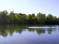
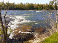
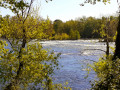
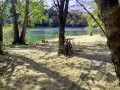
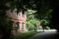
Circular walk between Blagnac and Gagnac via Fenouillet

A rural route, pleasant through the woods and along the banks of the Garonne.

Please note: much of the path through the woods is shared with runners, mountain bikers, etc.!

Details

7416308
Creation:
Last update:
Last review:
  • Walking
    Activity: Walking
  • ↔
    Distance: 15.69 mi
  • ◔
    Average duration: 7h 20 
  • ▲
    Difficulty: Difficult

  • ⚐
    Back to start: Yes
  • ↗
    Ascent: + 131 ft
  • ↘
    Descent: - 144 ft

  • ▲
    Highest point: 476 ft
  • ▼
    Lowest point: 364 ft
  • ⚐ Country: France
  • ⚐ City: Blagnac (31700)
  • ⚑
    Start/End: N 43.637253° / E 1.391063°
  • ❏
    IGN map(s): Ref. 2043ET
  • Hour-by-hour weather

Photos

Description of the walk

Start from Place du Relais in Blagnac, the tram and bus stop for line 70, next to a small park with a fountain.

(S/E) Set off along the Vieux Chemin de Grenade, heading north. At the Henri Matisse roundabout, go straight on, staying on the Vieux Chemin de Grenade. At the second roundabout, continue straight ahead for about a hundred metres and cross a small stream.

(1) Take the path on the right, following the stream downhill, until you reach the Chemin de Cloutos at a bridge.

(2) Cross the bridge. Turn right and take the path on the left, 50 metres further on. Walk along the path, following the Ruisseau du Riou on your left, until you reach the Garonne.

(3) Facing the Garonne, turn left. Cross a bridge and head uphill towards Beauzelle. Once at the top, follow Rue de Latché to the right, then Rue de la Marquette. Pass Rue Beau Soleil and continue for about 150 metres.

(4) Turn right onto Rue des Noisetiers. Further on, at Rue des Pins, turn left. Continue to the Crédit Agricole roundabout.

(5) Turn right and follow the cycle path along Route de Grenade. Cross Seilh via Chemin de Percin and then Allée des Tricheries until you reach the end.

(6) Turn right onto Chemin du Bouscassié. Head down towards the Garonne along this path, with tree-lined areas on your left and the banks of the Garonne opposite. Just before reaching the Garonne, turn left towards ‘Passerelle de Garonne’, keeping the Garonne on your right.

(7) Pass under the Pont de Gagnac. Continue along the river to the footbridge.

(8) Cross the footbridge. Turn right to reach, a few metres further on, a playground, a picnic area and a viewing platform. Head down to the left of the platform and enter a woodland. You’ll come out into a small park.

(9) Keep close to the Garonne as you pass under the bridge. The path is narrow until you cross the fields that form the site of a garage, and widens out at the banks of the Garonne. Follow the Garonne. Take the tarmac section at the entrance to Fenouillet.

(10) Leave the tarmac road and head back towards the Garonne on the right. Along the way, you’ll see signs again pointing towards ‘Pont de Blagnac’.

(11) As you leave the forest, turn right towards the Garonne.

(12) Follow the river on your right for several kilometres. You’ll reach the Pont de Blagnac.

(13) Cross the Garonne via the bridge.

(14) Turn right to head down towards the river. Follow it northwards until you reach the Fork in the road at the Terrasse de Maniban in the Parc des Ramiers de Blagnac.

(15) Head slightly to the left. Go up onto the embankment, then immediately head down to the left. Walk halfway across the park.

(16) Turn left onto Chemin des Blanchisseuses and leave the park. Climb the steps leading to Blagnac’s historic centre. First turn left then right onto Rue du Vieux Blagnac to follow Rue de l’Église and reach the church.

(17) Then turn left onto Rue Lavigne. Walk past the town hall on Place Jean-Louis Puig. Follow a section of Rue Pasteur, then turn right onto Rue des Mines. At the end, Rue des Bûches ends at Place du Relais (S/E).

Waypoints

  1. S/E : mi 0 - alt. 469 ft - Place du Relais
  2. 1 : mi 1.11 - alt. 446 ft - Le Riou stream
  3. 2 : mi 2.01 - alt. 404 ft - Quinze Sols Leisure Centre
  4. 3 : mi 2.36 - alt. 394 ft - Footbridge - Garonne (fleuve)
  5. 4 : mi 3.17 - alt. 459 ft - Rue des Noisetiers
  6. 5 : mi 3.54 - alt. 466 ft - Roundabout
  7. 6 : mi 4.98 - alt. 453 ft - Chemin du Bouscassié
  8. 7 : mi 5.94 - alt. 387 ft - Left bank - Pont de Gagnac
  9. 8 : mi 6.61 - alt. 387 ft - Footbridge over the - Garonne (fleuve)
  10. 9 : mi 7.56 - alt. 394 ft - Right bank - Pont de Gagnac
  11. 10 : mi 9.24 - alt. 394 ft - Start of the path on the right
  12. 11 : mi 9.53 - alt. 394 ft - Junction
  13. 12 : mi 9.72 - alt. 387 ft - Garonne (fleuve)
  14. 13 : mi 14.25 - alt. 433 ft - Right bank - Pont de Blagnac
  15. 14 : mi 14.41 - alt. 436 ft - Left bank - Pont de Blagnac
  16. 15 : mi 14.79 - alt. 423 ft - Maniban Terrace
  17. 16 : mi 15.03 - alt. 420 ft - Chemin des Blanchisseuses
  18. 17 : mi 15.16 - alt. 446 ft - Église Saint-Pierre (Blagnac)
  19. S/E : mi 15.69 - alt. 469 ft - Place du Relais

Notes

Excluding breaks, the author walked for 5 hours and 25 minutes.

Reviews and comments

4.6 / 5
Based on 3 reviews

Reliability of the description
5 / 5
Ease of following the route
4.7 / 5
Route interest
4 / 5
User 25955588

Overall rating : 4.7 / 5

Date of your route : Jan 26, 2026
Reliability of the description : ★★★★★ Very good
Ease of following the route : ★★★★★ Very good
Route interest : ★★★★☆ Good
Very busy route : No

Pleasant

Machine-translated

MonaBen
MonaBen

Overall rating : 4.7 / 5

Date of your route : Oct 14, 2023
Reliability of the description : ★★★★★ Very good
Ease of following the route : ★★★★★ Very good
Route interest : ★★★★☆ Good
Very busy route : Yes

The sections through town are quite busy and make up about a third of the walk, but once you reach the banks of the Garonne, it’s very pleasant and you come across fewer people.

Machine-translated

caouec
caouec

Overall rating : 4.3 / 5

Date of your route : May 03, 2021
Reliability of the description : ★★★★★ Very good
Ease of following the route : ★★★★☆ Good
Route interest : ★★★★☆ Good
Very busy route : No

A lovely walk, but best suited to keen walkers
For those who aren’t familiar with the Garonne upstream from Toulouse, it’s well worth a go – there are loads of birds
Set off early
Alternative route: starting and finishing at the Blagnac Bridge (14) (13) makes for a more pleasant walk, following the Garonne from (14) via Ramier de Blagnac to the Beauzelle Leisure Centre (3) (well signposted and there’s a route guide on Visorando)
You can’t avoid going from point 3 to point 6 via the streets of Beauzelle and Seilh, but it’s very peaceful

Machine-translated

Other walks in the area

For more walks, use our search engine .

The GPS track and description are the property of this route's author. Please do not copy them without permission.