Belvédère de la Brire, starting from Prénovel

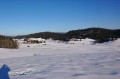
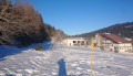
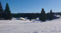
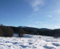
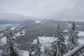
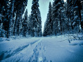
The marked trail takes you on snowshoes through the forest, towards Les Piards, to reach the Brire viewpoint at an altitude of 950 metres. You’ll be able to make out the Monts-Jura range, with the rounded peak of La Dôle directly opposite silhouetted against the horizon, and you might even catch a glimpse of the summit of Mont Blanc if the tall spruce trees weren’t blocking the view. What a shame.

Details

n°18701617
Creation:
Last update:
Last review:
  • Snowshoeing
    Activity: Snowshoeing
  • ↔
    Distance: 3.86 mi
  • ◔
    Duration according to the author: 2 hrs 
  • ▲
    Difficulty: Easy

  • ⚐
    Back to start: Yes
  • ↗
    Ascent: + 400 ft
  • ↘
    Descent: - 440 ft

  • ▲
    Highest point: 3,251 ft
  • ▼
    Lowest point: 2,907 ft

Photos

Description of the walk

To reach the start point, head towards Prénovel (39150). At the roundabout, opposite the church, head towards Claivaux-les-Lacs and park near the Duchet Centre.

(S/E) Head towards the hut at the Duchet Centre to pay for your ski pass, then put on your snowshoes once past the hut. Keep to the left of the piste to follow the marked snowshoe trail; to do this, follow snowshoe route no. 2, marked by yellow signs fixed to or hanging from the trees and firs. Cross the cross-country ski trail, then continue through the woods until you reach the D308E1.

(1) Cross it carefully, then continue along the signposted snowshoe trail. After a 1.5 km gentle climb, you’ll reach the highest point at the Brire viewpoint.

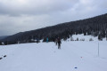
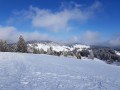
(2) Continue eastwards down the slope. Cross the cross-country ski trail, then, 100 metres beyond it, turn right towards the south-west, following the markings. The path leads you to the highest point of a vast snow-covered meadow.

(3) At the signpost, turn left towards La Basse. Walk down the meadow, cross the D232 with care and continue along the open ground for 150 metres, then turn right towards the chapel visible in the distance. You’ll reach the Piards Cemetery.

(4) Turn left twice to follow the Nanchez leat, heading north. Continue in this direction for 2 km, passing to the right of the hamlet of Les Janiers, then arrive on the left-hand side of Prenovel Cemetery.

(5) Take off your snowshoes and head right after the cemetery to reach the roundabout.Carefully cross the D232 opposite the church, then continue towards the town hall to return to the car park at the Duchet Centre hut (S/E).

Waypoints

  1. S/E : mi 0 - alt. 3,018 ft - Car park at the Duchet Centre hut
  2. 1 : mi 0.37 - alt. 3,071 ft - D308E1
  3. 2 : mi 1.36 - alt. 3,173 ft - La Brire Viewpoint
  4. 3 : mi 1.95 - alt. 3,104 ft - Signpost
  5. 4 : mi 2.38 - alt. 2,976 ft - Les Piards Cemetery
  6. 5 : mi 3.78 - alt. 2,992 ft - Prenovel Cemetery
  7. S/E : mi 3.86 - alt. 3,005 ft - Car park at the Duchet Centre hut

Notes

Access to the car park:
Equipment hire: Le Village Vacances le Duchet is ideally situated in Prénovel at the start of the cross-country ski trails and snowshoe routes at this pioneering site in Grandvaux.
Here you’ll find an equipment hire shop, picnic rooms and a restaurant/bar.
(S/E) Snowshoe hiking pass available at the ticket booth or online. You can pay for your pass and download the Nordic Pass onto your smartphone. Information: Your contribution helps fund the maintenance and grooming of the ski trails, as well as the services provided by safety staff.
The piste map

Reviews and comments

4.5 / 5
Based on 4 reviews

Reliability of the description
5 / 5
Ease of following the route
4.7 / 5
Route interest
3.8 / 5
piccolopripri
piccolopripri
• Edited:

Overall rating : 3 / 5

Date of your route : May 12, 2024
Reliability of the description : Not used / Not applicable
Ease of following the route : Not used / Not applicable
Route interest : ★★★☆☆ Average
Very busy route : No

In 2024, the Brire viewpoint is no longer clear, so there is no view. The landowner used to keep it clear, but he has handed over responsibility to his son, who does not. That is why this viewpoint is not signposted. We just saw an old wooden sign and used the GPX file

Machine-translated

guénolé
guénolé
• Edited:

We went for a lovely walk but never found the Brise viewpoint

Machine-translated

Angèle LEMMEL
Angèle LEMMEL

We haven't done that hike yet... we're planning to go in May. Thanks anyway for the info.

Machine-translated

Agnès Bo
Agnès Bo

Overall rating : 5 / 5

Date of your route : Jun 23, 2023
Reliability of the description : ★★★★★ Very good
Ease of following the route : ★★★★★ Very good
Route interest : ★★★★★ Very good
Very busy route : No

This route is best done in summer. It takes you through mown meadows, hamlets and woods. It’s a very pleasant route.

Machine-translated

mamie.jac21
mamie.jac21

Overall rating : 4.7 / 5

Date of your route : Jan 28, 2023
Reliability of the description : ★★★★★ Very good
Ease of following the route : ★★★★★ Very good
Route interest : ★★★★☆ Good
Very busy route : No

A lovely, easy walk away from the busy trails.

Machine-translated

philacroixplenise
philacroixplenise

Overall rating : 4 / 5

Date of your route : Jan 31, 2022
Reliability of the description : ★★★★★ Very good
Ease of following the route : ★★★★☆ Good
Route interest : ★★★☆☆ Average
Very busy route : No

an easy, sunny route

Machine-translated

Other walks in the area

For more walks, use our search engine .

The GPS track and description are the property of this route's author. Please do not copy them without permission.