The Lajoux Balconies

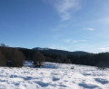
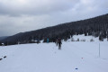
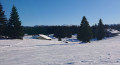
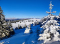
Starting from Lajoux, this 5 km walk, which takes place in open country, winds through a highly fragmented area of pastureland. The meadows stretch across undulating terrain. The scattered settlements are typical of the Hautes-Combes region.

Details

18589672
Creation:
Last update:
Last review:
  • Snowshoeing
    Activity: Snowshoeing
  • ↔
    Distance: 3.21 mi
  • ◔
    Duration according to the author: 1.5 hrs 
  • ▲
    Difficulty: Easy

  • ⚐
    Back to start: Yes
  • ↗
    Ascent: + 331 ft
  • ↘
    Descent: - 348 ft

  • ▲
    Highest point: 4,108 ft
  • ▼
    Lowest point: 3,832 ft

Photos

Description of the walk

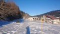
To get to the start point, head towards Lajoux. The car park is located in the centre of the village, opposite the Le Chariot restaurant.

(S/E) Put on your snowshoes on the slope in front of Le Chariot (don’t forget to bring your trail pass) and head towards the trail start point, located about 200 metres away, by the ski rope and the ESF hut. Head left along the La GTJ (Grande Traversée du Jura) cross-country ski trail, following the yellow markings reserved for snowshoe routes. At the end of the flat section, cross the Route de Sur les Champs and head towards the edge of the woods, in the direction of Le Fournet, then continue to the top of the hill.

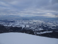
(1) From the top of the hill, the view to the north-east takes in the Petit Mont-Rond and its telecommunications mast, then the Colomby and the Monts-Jura range. Directly to the south, the Manon and the Platières perfectly illustrate the undulating landscape of the Hautes-Combes.

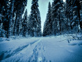
Continue northwards along the bottom of a long valley to reach the edge of a forest of spruce and beech trees. Follow the edge of the woodland to the right and cross the meadow before arriving at La Baumette, a former summer chalet converted into a lodge on the edge of the GTJ.

(2) Cross the Route des Forêts-Monts (which becomes a cross-country ski trail in winter). At Le Petit-Pré, let the GTJ-Raquettes route branch off to the left, towards Le Massacre, whilst you head south-east to go round the small chalet nestled behind the hillock, before descending along the edge of the valley followed by the cross-country ski trail.

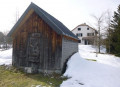
(3) Fortified granary at La Joux du Dessus. Look out for an old fortified granary on the left-hand slope of the valley. Then follow the route down the slope, skirting the edge of the woods.

(4) Cross the small pass at the bottom of the valley, then, beyond the chalets, you’ll come to the main street of the village of Lajoux. Walk down Chemin de Trécombe and head towards the ESF hut to return to the car park (S/E).

Waypoints

  1. S/E : mi 0 - alt. 3,848 ft - Le Chariot
  2. 1 : mi 0.82 - alt. 3,986 ft - Top of the hill
  3. 2 : mi 1.9 - alt. 4,042 ft - La Beaumette
  4. 3 : mi 2.42 - alt. 3,967 ft - Grenier-fort at La Joux-du-Dessus
  5. 4 : mi 2.77 - alt. 3,960 ft - Petit Col
  6. S/E : mi 3.21 - alt. 3,848 ft - Car park at the start point

Notes

See the car park:
Hilly route. ‘Snowshoes’ signposting: yellow posts mark the route
Equipment hire: Located in Lajoux in the car park at the start point beneath the restaurant Le Chariot, in the Haut-Jura, the ski shop Benoit-Jeannin Sport offers snowshoe hire.
For further information, please contact Benoit-Jeannin on 06 33 26 44 42 or 03 84 41 27 89
Map of the Haut-Jura snowshoe trails:
Buy a pass here or at the Maison du Parc

Worth a visit

Lajoux cheese dairy at the entrance to the village on the road to Saint-Claude. Tours and tastings available.
Retail sales: Comté, Bleu de Gex, Morbier, Mont d’Or, regional produce
Haut-Jura Park Centre

Reviews and comments

5 / 5
Based on 1 review

Reliability of the description
5 / 5
Ease of following the route
5 / 5
Route interest
5 / 5
fanee
fanee

Overall rating : 5 / 5

Date of your route : Jul 01, 2022
Reliability of the description : ★★★★★ Very good
Ease of following the route : ★★★★★ Very good
Route interest : ★★★★★ Very good
Very busy route : No

This route should only be tackled on snowshoes, as there are no markings left in summer!

Machine-translated

Other walks in the area

For more walks, use our search engine .

The GPS track and description are the property of this route's author. Please do not copy them without permission.