The Gandi well in Lajoux

An easy, short circular snowshoe route to explore the area around Lajoux. The entire route is signposted.

Details

n°4554267
Creation:
Last update:
Last review:
  • Snowshoeing
    Activity: Snowshoeing
  • ↔
    Distance: 1.45 mi
  • ◔
    Duration according to the author: 1.5 hrs 
  • ▲
    Difficulty: Easy

  • ⚐
    Back to start: Yes
  • ↗
    Ascent: + 105 ft
  • ↘
    Descent: - 102 ft

  • ▲
    Highest point: 3,921 ft
  • ▼
    Lowest point: 3,835 ft

Photos

Description of the walk

To get to the starting point, head towards Lajoux. Drive through the village towards Mijoux until you reach the post office. The car park is located in front of it.

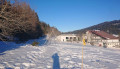
(S/E) From the car park, cross the D436 to reach the entrance to the ski area, situated to the right of the rural lodge. Put on your snowshoes and head towards the cross-country ski trail to find the start of the Puits Gandi snowshoe route (marked in yellow). Then continue westwards along the cross-country ski trail, which passes behind the school and the farm (watch out for skiers).

(1) Turn left, carefully crossing the cross-country ski trail, then carry on until you reach the top of the hamlet known as ‘Sur les fûts’, in a small beech wood with slender trunks.
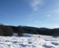
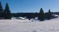
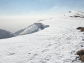
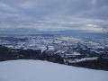
Take in the panoramic view, which showcases the typical landscape of the Hautes Combes du Jura, with its undulating hills and valleys; on a clear day, you can see the Jura Mountains and their snow-capped peaks in the distance.
Continue south-west along the ridge,

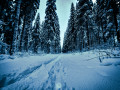
(2) Turn slightly to the right, heading north-west, to walk through the spruce and beech trees, following the “Coulée aux lièvres” (you can spot numerous animal tracks here: hares, roe deer and squirrels).

(3) Continue north-east along the path, which crosses the ski runs several times and descends towards La Petite Joux. The path passes an old farmhouse, climbs again, then joins the multi-activity trail opposite the village nappy-changing facility.

At the junction, follow the ski run which climbs to the right towards the east, then joins and runs alongside the blue cross-country ski trail. Make sure you stay on the far left-hand side of the trail so as not to get in the way of skiers, and return to the starting point of the route (S/E) (take care when crossing the D436).

Waypoints

  1. S/E : mi 0 - alt. 3,842 ft - Car park opposite the town hall
  2. 1 : mi 0.21 - alt. 3,862 ft - Turn left
  3. 2 : mi 0.46 - alt. 3,907 ft - Turn slightly to the right
  4. 3 : mi 0.8 - alt. 3,865 ft - Continue north-east
  5. S/E : mi 1.45 - alt. 3,842 ft - Car park opposite the town hall

Notes

Equipment hire: Located in Lajoux in the car park at the starting point beneath the restaurant Le Chariot, in the Haut-Jura, the Benoit-Jeannin Sport ski shop offers snowshoe hire.
For further information, please contact Benoit-Jeannin on 06 33 26 44 42 or 03 84 41 27 89
Map of the Haut-Jura snowshoe trails: click here

To view the car park and the starting point , click here

Worth a visit

Discover the Maison du Parc. The Maison du Parc in Lajoux is the administrative headquarters of the Haut-Jura Nature Park; it offers a visitor centre, a permanent exhibition and a shop for visitors.

Lajoux Cheese Dairy at the entrance to the village on the road to Saint-Claude. Tours and tastings available.
Retail sales: Comté, Bleu de Gex, Morbier, Mont d’Or and regional produce

Lajoux Layette Workshop. A display room showcases layettes of various sizes, with a choice of drawer quantities and sizes, each individually fitted. In the past, layettes were mainly used to store watch parts. In front of the workshop, spruce logs await transformation into layettes.

Reviews and comments

4.7 / 5
Based on 1 review

Reliability of the description
5 / 5
Ease of following the route
5 / 5
Route interest
4 / 5
Dylanovitch
Dylanovitch

Overall rating : 4.7 / 5

Date of your route : Jan 19, 2022
Reliability of the description : ★★★★★ Very good
Ease of following the route : ★★★★★ Very good
Route interest : ★★★★☆ Good
Very busy route : No

A route completed in January, perfect for trying out snowshoes and going on a hike that isn’t too long (1 hour at the very most). The route is very well signposted; no need for a map.

Machine-translated

Other walks in the area

For more walks, use our search engine .

The GPS track and description are the property of this route's author. Please do not copy them without permission.