


Refine your search for walks in Baume de l'Eau
Baume de l'Eau walks


 Aigue Brun valley
 Visorando Member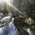
 5.04 mi
 +869 ft
 -846 ft
 3h 05
3h 05
 Moderate
 Departure from Buoux (Vaucluse)
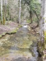
A loop around the green valley of the Aigue Brun, a permanent stream in the Luberon, enclosed by imposing cliffs, passing through Sivergues and the Baume de l'Eau on the way back.
 Easy
Easy Walks near Baume de l'Eau
From Sivergues to Vitrolles via the Luberon ridges
 13.06 mi
+2,159 ft
-2,703 ft
7h 55
13.06 mi
+2,159 ft
-2,703 ft
7h 55
 Difficult
Departure from Sivergues (Vaucluse)
Difficult
Departure from Sivergues (Vaucluse)
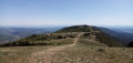
This second stage is both long and superb! First, you climb the highest point of the Luberon, the Mourre Nègre, alternating between steep paths and gently sloping tracks. Then, you follow the ridges from west to east, always on open terrain with sweeping panoramic views. The (long) descent to Vitrolles is shaded.
From Apt to Sivergues via the Rocher des Druides
 6.27 mi
+2,106 ft
-630 ft
4h 45
Moderate
Departure from Apt (Vaucluse)
6.27 mi
+2,106 ft
-630 ft
4h 45
Moderate
Departure from Apt (Vaucluse)
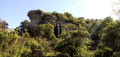
This first stage is mainly uphill, leading to the foot of the western part of the Grand Luberon ridges. Halfway through, there is a descent to pass by the foot of the Rocher des Druides and the hamlet of Roscalière, followed by a climb back up. It is possible to avoid this detour and thus shorten the stage.
From Cucuron to Vitrolles-en-Lubéron
 15.61 mi
+3,950 ft
-3,337 ft
10h 35
Difficult
Departure from Cucuron (Vaucluse)
15.61 mi
+3,950 ft
-3,337 ft
10h 35
Difficult
Departure from Cucuron (Vaucluse)
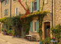
This third stage takes you through the forests on the southern slopes of the Grand Lubéron. From Cucuron, the route climbs gently northwards across fields, then rises steeply up the wooded flank of the Montagne du Grand Lubéron and, following various valleys, reaches the bare ridge at the small pass of Basse Cabrière, east of the Mourre Nègre, the highest point of the massif. It winds along the ridge and, at its end, drops down the northern slope, then, skirting Mont La Grand Colle, returns south via the Vallat de la Combe d’Apt, before reaching Vitrolles-en-Lubéron.
From Saint-Saturnin-lès-Apt to Gordes via the Gorges de la Véroncle
 16.68 mi
+2,257 ft
-1,690 ft
9h 40
Difficult
Departure from Saint-Saturnin-lès-Apt (Vaucluse)
16.68 mi
+2,257 ft
-1,690 ft
9h 40
Difficult
Departure from Saint-Saturnin-lès-Apt (Vaucluse)
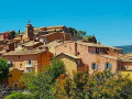
This sixth stage crosses the wooded slope of Perréal Hill before reaching the village of Gargas and winding through the farmland of the Urbane Valley, then climbing up to the pretty village of Roussillon, where you can allow an hour to visit the old ochre quarry, with its magnificently coloured landscapes of cliffs and fairy chimneys. The route returns to the cultivated fields and enters the narrow Gorges de la Véroncle – a little gem waiting to be discovered – before heading up the Ravin de Vézaule to reach Camping des Sources.
From Céreste to Apt via the plain, Auribeau and Saignon
 13.87 mi
+1,532 ft
-2,051 ft
7h 45
Difficult
Departure from Céreste (Alpes-de-Haute-Provence)
13.87 mi
+1,532 ft
-2,051 ft
7h 45
Difficult
Departure from Céreste (Alpes-de-Haute-Provence)
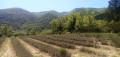
The final stage of this route is long and varied. The first section takes place on the plain at the foot of the Luberon ridges, which were traversed in the opposite direction during the second stage. We then gain altitude, climbing successively to the villages of Glorivette, Castellet-en-Lubéron and Auribeau, the latter two boasting a rich heritage. We then descend all the way, passing through the beautiful village of Saignon along the way.
From Vitrolles-en-Lubéron to Oppedette
 16.74 mi
+2,434 ft
-2,405 ft
9h 50
Difficult
Departure from Vitrolles-en-Lubéron (Vaucluse)
16.74 mi
+2,434 ft
-2,405 ft
9h 50
Difficult
Departure from Vitrolles-en-Lubéron (Vaucluse)
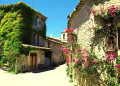
This fourth stage begins with a route halfway up the wooded slope of the Vallat de Pissaire before entering the Ravin du Gancet and then crossing the Aiguebelle valley to reach the hilltop village of Montjustin. The route follows the ridge of the hill separating this valley from that of the Encrême and descends to reach Céreste, situated at their confluence. It crosses the remarkable Pont de la Baou before revealing, nestled in the woods, the medieval Priory of Carluc. It climbs the side of the valley and swings over to that of the Grand Vallat, then ascends its sunny slope towards Sainte-Croix-à-Lauze, from where it reaches the top of the Cavalon valley before descending it to reach the village of Oppedette.
From Vitrolles to Céreste via Montjustin
 9.01 mi
+915 ft
-1,312 ft
4h 55
Moderate
Departure from Vitrolles-en-Lubéron (Vaucluse)
9.01 mi
+915 ft
-1,312 ft
4h 55
Moderate
Departure from Vitrolles-en-Lubéron (Vaucluse)
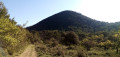
The third stage is the shortest of this route. After a very pleasant walk along a track at the foot of wooded hills, we take a narrow path that allows us to cross from the southern to the northern side of the massif. We then climb up to the pretty village of Montjustin, before descending via a ridge offering superb views.
Gorges de Véroncle
 3.62 mi
+974 ft
-36 ft
2h 30
Difficult
Departure from Gordes (Vaucluse)
3.62 mi
+974 ft
-36 ft
2h 30
Difficult
Departure from Gordes (Vaucluse)
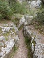
The walk starts near Gordes (listed as one of the most beautiful villages in France) and passes through the Véroncle gorge to Murs and its castle.
A very pleasant, energetic walk in the ravine of the Véroncle gorges, discovering the remains of old mills from different periods along the way.
There are a few ladders and ropes, and an old sluice shaft that cannot be avoided.
From Mérindol to Cucuron
 18.44 mi
+3,422 ft
-2,858 ft
11h 25
Difficult
Departure from Mérindol (Vaucluse)
18.44 mi
+3,422 ft
-2,858 ft
11h 25
Difficult
Departure from Mérindol (Vaucluse)
This second stage of the Tour du Luberon takes place on the sunny side of the Durance valley, through the wooded valleys of the Luberon Nature Park. From Mérindol, the route follows the valleyfloor and, after passing Les Borrys, climbs towards the Pic de l’Aigle before descending into the Vallon du Gros Ubac, which it follows to reach the Combe de Recaute. It climbs its slope then crosses over to the Combe du Sautadou, which it descends before climbing up the Vallon des Séyes and reaching the Cap de Serre. Via the Vallon du Bon Dieu, it reaches Lourmarin and, skirting the foot of the Grand Luberon, heads to Cucuron.
From Gordes to Fontaine-de-Vaucluse
 14.71 mi
+2,156 ft
-3,350 ft
8h 40
Difficult
Departure from Gordes (Vaucluse)
14.71 mi
+2,156 ft
-3,350 ft
8h 40
Difficult
Departure from Gordes (Vaucluse)
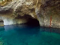
The seventh stage brings this week-long hike through the enchanting Luberon region to a close. The route leads to the village of Gordes, perched on a rocky outcrop, where the dry-stone buildings, winding paved slanting streets and its proud, imposing castle reveal all the charm of these Provençal villages that have weathered centuries of conflict. It then heads to the magnificent Sénanque Abbey, peacefully nestled in a valley; its simple Romanesque architecture, built of grey limestone, is set off by the contrast of a vast field of lavender. Through the woods of the Vaucluse Plateau, he visits the charming little village of Saumane-de-Vaucluse, perched on a rocky outcrop and protected by its fortified castle, now converted into a bastion. He then descends to Fontaine-de-Vaucluse to admire the mighty resurgence of the Sorgue de Velleron, before returning to the car park where he started.