


Refine your search for walks in Basses de les Salamandres
Basses de les Salamandres walks


 Estany de la Cabana Sorda and return via Val d'Inclès
 Visorando Member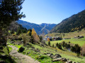
 8.61 mi
 +2,503 ft
 -2,503 ft
 6h 10
6h 10
 Difficult
 Departure from Canillo (Andorra)
This beautiful and demanding hike allows you to discover several high-altitude lakes in an exceptional environment, including Estany del Querol, Estany de la Cabana Sorda and Estany d'Anrodat, to name but the most important. Other small lakes, some of which are unfortunately drying up, dot the route. After a particularly challenging descent, the return journey takes you along the Chemin de l'Ubac d'Inclès, which allows you to discover this beautiful valley as you walk alongside the Riu d'Inclès, close to pastures where cows, donkeys and horses graze in the summer. However, you will need to save your strength for the climb back up to the car park, which can be very tiring at the end of the walk.
Walks near Basses de les Salamandres
From the Juclar Refuge to Pas de la Case
 9.19 mi
+1,762 ft
-2,421 ft
5h 45
9.19 mi
+1,762 ft
-2,421 ft
5h 45
 Moderate
Departure from Canillo (Andorra)
Moderate
Departure from Canillo (Andorra)
This third stage of the route linking Ax-les-Thermes to Latour de Carol takes you to Pas de la Case… and its hotels and refreshment stops; it is an easy, somewhat long stage that takes place at altitude, mainly along the gentle, grassy ridges of Andorra, but without any difficulty. It is best to tackle this stage in good weather, as landmarks can be misleading, especially if fog sets in.
Refuge du Ruhle - Col de Belh - de la Didorte - Cabane Rieutort - Laparan
 5.31 mi
+1,198 ft
-3,297 ft
3h 30
Moderate
Departure from Ariège
5.31 mi
+1,198 ft
-3,297 ft
3h 30
Moderate
Departure from Ariège
From the start of the hike, pay attention to the common white and red GR® T66 and GR®10 markings, as there are several crossroads and forks in the trail. Please note: the hike is in open terrain until the descent into the forest, well after the Rieutort hut.From the refuge, via the Crête des Isards and up to the Col de la Didorte, what a view! Of course, you need to be very careful on this ridge, which is often steep and jagged. But as soon as you stop, you can enjoy a 360° panorama.The steep descent to the Rieutort hut is on a narrow but safe path, offering beautiful views. The return to the road is not easy, but the path (GR®T66), although steep in places, is well marked throughout the descent.
Refuge du Rulhe - Castelet
11.00 mi
+958 ft
-5,958 ft
5h 55
Difficult
Departure from Ariège
This second day is exceptional. Most of it takes place on ridges from which you can see the Ax 3 Domaines resort on one side and the Plateau de Beille on the other. And everywhere, there are lakes and breathtaking landscapes. This stage is long (nearly 18 km), but you'll never want it to end before you descend into the valley through the forest. It's best to have someone waiting for you in the valley, or else you can reach Ax-les-Thermes on foot or by bus. Be aware that as you will be taking photos and spending time admiring the landscape, you should allow 6½ to 7 hours for the whole trip.
Laparan - La Peyre - Passerelle - Fontargente - Aston - Refuge du Rulhe
 6.31 mi
+2,976 ft
-883 ft
5h 30
Moderate
Departure from Ariège
6.31 mi
+2,976 ft
-883 ft
5h 30
Moderate
Departure from Ariège
Please note: the approach walk along the road is the only part of the hike that is in the shade if you set off early enough in the morning. This is the only way to complete this loop. It may seem tedious, but the landscape is very beautiful.The hike can be classified as quite difficult. After the footbridge over the Ruisseau de la Coume de Varilhes, the path is not easy: steep, with steps, a paved scree slope, a ledge to cross, etc. But once you reach the top, you will be rewarded. Then the GR®T66 from the largest of the Étang de Fontagente lakes to the refuge is more of the same. This is definitely a mountain hike.
Ascent to the Refuge du Rulhe via the Col de la Didorte and the Crête des Isards
 5.33 mi
+3,002 ft
-902 ft
5h 05
Difficult
Departure from Ariège
5.33 mi
+3,002 ft
-902 ft
5h 05
Difficult
Departure from Ariège
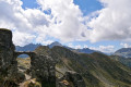
First day of the trip at the Refuge du Rulhe.
This stage can be classified as difficult due to the climb up to the Col de la Didorte and the section along the Crête des Isards.
The route follows paths that are very clearly marked on the ground, whether signposted or not.
In the event of fog or rain: take extra care on the ridge between (4) and (7).
From Pas de la Case to the Joaquim Folch i Girona Refuge
 8.68 mi
+4,058 ft
-3,114 ft
7h 30
Difficult
Departure from Porta (Pyrénées-Orientales)
8.68 mi
+4,058 ft
-3,114 ft
7h 30
Difficult
Departure from Porta (Pyrénées-Orientales)
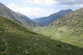
The fourth stage of the route linking Ax-les-Thermes to Latour-de-Carol. A beautiful high-mountain stage with no significant difficulties but featuring some elevation gain.
This stage sets off from Pas de la Case, followed by two small passes and then, a little further down, the Portella Blanca – the ‘white gate’ – which opens onto the descent into the Engaït valley before a final pass. It ends with the descent to the Jhaquim Floch i Girona refuge, which is in poor condition but offers a safe shelter.
From the Pra Redoun Refuge to the Juclar Refuge
 5.47 mi
+2,884 ft
-1,168 ft
5h 00
Moderate
Departure from Savignac-les-Ormeaux (Ariège)
5.47 mi
+2,884 ft
-1,168 ft
5h 00
Moderate
Departure from Savignac-les-Ormeaux (Ariège)
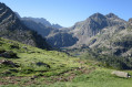
The second stage of the “Ax-les-Thermes to Latour-de-Carol” route; this is a beautiful high-mountain stage with magnificent scenery. Favourable weather is recommended.
This route follows a path which is initially very poorly signposted, climbing steeply towards the first pass, the Col de Behl, before reaching the Refuge de Ruhle, then the beautiful ascent to the Col de Juclar and finally the descent into Andorra towards the manned refuge of the same name.
Étang des Castellasses
4.31 mi
+2,648 ft
-322 ft
4h 15
Moderate
Departure from Ariège
A short, not too difficult hike – very enjoyable. You follow streams all the way, first through the forest, then across a plateau. A very wild, natural atmosphere. Countless spots, ideal for pitching a tent, with trees galore, majestic rocks and a fast-flowing yet calm river. A very good population of brown trout in the river. The lake, too, is teeming with fish – large brown trout and rainbow trout – to potentially delight the palates of food lovers.
El Serrat - Pic de Tristagne - Refuge de l'Étang Fourcat
6.14 mi
+4,327 ft
-1,476 ft
6h 35
 Very difficult
Departure from Ordino (Andorra)
Very difficult
Departure from Ordino (Andorra)
The fifth and final stage of the high-mountain route passes by the iconic Pic de Tristagne, which towers over the many lakes in the surrounding area, and its short, fairly exposed ridge route, before returning to France via the magnificent Étangs Fourcat site.
L'Hospitalet near Andorra - Refuge des Bésines
 4.50 mi
+2,359 ft
-180 ft
4h 10
Moderate
Departure from L'Hospitalet-près-l'Andorre (Ariège)
4.50 mi
+2,359 ft
-180 ft
4h 10
Moderate
Departure from L'Hospitalet-près-l'Andorre (Ariège)
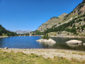
Part of the long route (9 stages) around Carlit, hiking from refuge to refuge, based on the Tour des Pérics and using various marked trails,GRP® andGR® in the area.
Initial stage designed to ease you gently into the hike.