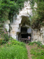
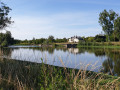
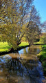
Countryside and vineyards in Lye

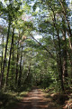
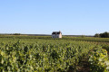
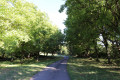
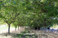
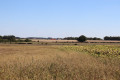
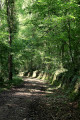
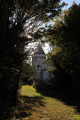
This walk in the northern Boischaut region of the Indre, on the border with the Loir-et-Cher, offers a chance to explore the area around the village of Lye. You’ll come across the Church of Notre-Dame (12th–16th century) and, in the distance, the Château de Saray (private), as you follow the Traîne-Feuilles stream. Narrow roads and paths will take you to the Lye vineyards, which form part of the Valençay and Val de Loire appellations, where you can admire the vineyard house ‘La Loge à Perrin’.

Details

n°17617009
Creation:
Last update:
Last review:
  • Walking
    Activity: Walking
  • ↔
    Distance: 8.67 mi
  • ◔
    Average duration: 4h 20 
  • ▲
    Difficulty: Average

  • ⚐
    Back to start: Yes
  • ↗
    Ascent: + 430 ft
  • ↘
    Descent: - 407 ft

  • ▲
    Highest point: 430 ft
  • ▼
    Lowest point: 272 ft
  • ⚐ Country: France
  • ⚐ City: Lye (36600)
  • ⚑
    Start/End: N 47.226662° / E 1.473069°
  • ❏
    IGN map(s): Ref. 2023SB, 2123SB
  • Hour-by-hour weather

Photos

Description of the walk

Park at Place de l’Église.
Most of the walk follows an old route marked in yellow.

(S/E) Head north, following theGRP® du Pays de Valençay (which merges with the new “Benjamin Rabier” discovery trail), then west, turning left onto Rue des Ponts. Pass Le Mondon, then continue straight on at the next junction onto Route de Faverolles.

(1) Turn right towards Les Blanchardières; the tarmac road gives way to a farm track.
Shortly after a sign for the “Benjamin Rabier” discovery trail, turn left and then immediately right. The track descends onto a small road; follow it to the right for a few tens of metres.

(2) At the road junction, turn left onto the bridge over the Traîne-Feuilles and continue to the first crossroads you come to.

(3) Turn left, following theGRP® signposts along a wide path from which you can see the dovecote at Saray Castle on your right. Continue straight on towards the south-west until you reach a small road.

(4) Leave theGRP® by turning left whilst crossing the Traîne-Feuilles again via a bridge. Turn left again onto a farm track.

(5) At the next junction, turn right and head up to the Chenevières mushroom farm. Then follow the small road to a road junction (cross).

(6) Carry on along the road to the left, then take the road on the right leading to Les Aubruns. Continue along the path on the right into the hamlet. After a steep descent, follow the small road to the right until you reach a T-junction.

(7) Carry on along the road to the right, then take a gravel track to the left, once again following theGRP® du Pays de Valençay. 300 metres further on, at a bench bearing a sign for the “Benjamin Rabier” discovery trail, turn left and leave the GRP®. After passing a pond on the left, follow a stream passing under a road bridge and turn left onto a path between the D33 and some gardens.

(8) Turn right onto the small road and head towards L’Époncay. At the road junction, turn left.

(9) At the junction with a cross-road, carry on straight ahead north-east along a grassy track. Cross the first track, then turn left at the second. Then turn right onto a wide farm track that winds through the vineyards. At the following junctions, carry on straight ahead northwards until you reach a small road (elevation 131).

(10) Carry on straight ahead to rejoin theGRP® du Pays de Valençay, which you should follow to the left. Then take the road on the right for about 50 metres.

(11) At the cross, leave theGRP® by taking a white gravel track to the right, then enter the woods by heading down the path to the left.

(12) Cross the D33a with care and continue along the path opposite, then turn left. Take a small road on the left.

(13) At the junction, carry on straight ahead along Rue de la Maison Locquin. Walk down to the D33, which you follow to the left. Turn right onto Rue du Commerce and carry on straight ahead to the church (S/E).

Waypoints

  1. S/E : mi 0 - alt. 276 ft - Place de l’Église Notre-Dame - Modon (rivière) - Affluent du Cher
  2. 1 : mi 0.26 - alt. 282 ft - Les Blanchardières on the right
  3. 2 : mi 0.89 - alt. 272 ft - Bridge
  4. 3 : mi 1.13 - alt. 279 ft - Crossroads, GRP trail in the Pays de Valençay
  5. 4 : mi 2.2 - alt. 282 ft - Bridge - Traîne Feuilles (cours d'eau) - Affluent du Modon
  6. 5 : mi 2.56 - alt. 285 ft - Junction
  7. 6 : mi 3.26 - alt. 430 ft - Cross at the junction
  8. 7 : mi 4.22 - alt. 279 ft - GRP on the right (road)
  9. 8 : mi 4.77 - alt. 299 ft - On the right, the road towards Épancay
  10. 9 : mi 5.6 - alt. 410 ft - Carry on straight ahead along the grassy path
  11. 10 : mi 6.63 - alt. 430 ft - Road junction
  12. 11 : mi 7.12 - alt. 397 ft - White gravel path on the right and woodland on the left
  13. 12 : mi 7.63 - alt. 348 ft - D33a
  14. 13 : mi 8.11 - alt. 390 ft - Rue de la Maison Locquin
  15. S/E : mi 8.67 - alt. 276 ft - Notre-Dame Church Square

Notes

Make sure you wear good walking shoes as there are different types of surface.
This section may be tricky after heavy rain, under the bridge along the stream before the (8).

Worth a visit

Reviews and comments

4.2 / 5
Based on 2 reviews

Reliability of the description
4 / 5
Ease of following the route
4.5 / 5
Route interest
4 / 5
User 17926161

Overall rating : 4 / 5

Date of your route : Jul 16, 2025
Reliability of the description : ★★★★☆ Good
Ease of following the route : ★★★★☆ Good
Route interest : ★★★★☆ Good
Very busy route : No

very good, but old signposting, you need to be familiar with the area

Machine-translated

Anne36
Anne36

Overall rating : 4.3 / 5

Date of your route : Feb 09, 2025
Reliability of the description : ★★★★☆ Good
Ease of following the route : ★★★★★ Very good
Route interest : ★★★★☆ Good
Very busy route : No

Hello – a route with lots of small roads but very pleasant. The paths were a bit tricky to navigate given the weather (it had been raining the previous few days).
We did this route (as a dog-led hike) with our club, Cani-run36.

Machine-translated

Other walks in the area

For more walks, use our search engine .

The GPS track and description are the property of this route's author. Please do not copy them without permission.