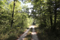
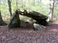
Fontguenand, in the valley of the Petit Rhône, a tributary of the Fouzon

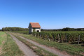
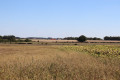
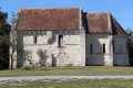
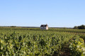
Fontguenand, a small village in the far north of the Indre department, on the border with Loir-et-Cher, is crossed by the Petit Rhône, a tributary of the Fouzon. This walk allows you to explore the surrounding countryside, typical of the Boischaut-Nord region, from vineyards to cereal fields, passing by the little chapel at L’Epinat.

Details

39842673
Creation:
Last update:
Last review:
  • Walking
    Activity: Walking
  • ↔
    Distance: 7.46 mi
  • ◔
    Average duration: 3h 35 
  • ▲
    Difficulty: Moderate

  • ⚐
    Back to start: Yes
  • ↗
    Ascent: + 151 ft
  • ↘
    Descent: - 148 ft

  • ▲
    Highest point: 407 ft
  • ▼
    Lowest point: 289 ft
  • ⚐ Country: France
  • ⚐ City: Fontguenand (36600)
  • ⚑
    Start/End: N 47.220164° / E 1.537377°
  • ❏
    IGN map(s): Ref. 2123SB
  • Hour-by-hour weather

Photos

Description of the walk

The start is at the car park by the picnic area behind the town hall, near the church, beside the D956.

(S/E) Join the D956, cross it carefully at the War Memorial and head up the Allée des Tilleuls leading to the church. It branches off to the right to join the Route de Rhône; follow this to the left until you reach the cross.

(1) Turn left towards the cemetery. Pass the cemetery and continue along a farm track until you reach a junction.

(2) Carry on straight through the vineyards, then turn right onto a hard-packed track that passes under a power line and leads to a road.

(3) Head down the road to the right towards Rhône. At the first junction, follow the road to the left, cross a bridge, then at the second junction, continue uphill opposite towards La Drévaudière for 250 metres until you reach a crossroads.

(4) Turn right onto a grassy track. Ignore a track on the right heading towards the Bois Gaultier farm and carry on straight ahead at the next junction. Pass under the power line again and carry on for about fifty metres.

(5) Turn left onto a grassy track, go to the end and then follow it to the right. Carry on straight ahead southwards until you reach a small road. Continue in the same direction until you reach the D52.

(6) Follow it to the right until you reach the next junction, from where you can see the Épinat Chapel. Turn left, then right, following the signs for Malakoff; pass the entrance to the farm and you’ll come to a crossroads.

(7) Go up the grassy path on the right; then, at the top, turn right again, passing under the power line, to reach the hamlet of La Tiercerie.

(8) Follow the D52 to the left; then, 50 metres after a pond on your right, take a lane on the right between the houses, which continues as a grassy path. Turn left and you’ll reach a car park with glass recycling bins, beside the D956.

(9) Cross the departmental road carefully and continue along a farm track which leads onto the D52, passing through the hamlet of La Cure. Follow it to the right until you reach the next road junction.

(10) Continue straight ahead on the D52, following signs for Villentrois. Soon, pass a road on your right; 60 metres after this, go up the grassy track on the right and arrive at a junction.

(11) Turn right onto a farm track. Cross a small road, then follow a grassy track to the right until you reach a T-junction.

(12) Turn left and continue straight on at all junctions until you return to the starting car park (S/E).

Waypoints

  1. S/E : mi 0 - alt. 364 ft - Car park behind the town hall, near the church
  2. 1 : mi 0.3 - alt. 354 ft - Junction towards the cemetery
  3. 2 : mi 0.67 - alt. 361 ft - Vineyards
  4. 3 : mi 1.17 - alt. 335 ft - Junction on the road
  5. 4 : mi 1.83 - alt. 341 ft - Junction before La Drévaudière
  6. 5 : mi 2.67 - alt. 381 ft - Junction after the power line
  7. 6 : mi 3.66 - alt. 390 ft - D52
  8. 7 : mi 4.58 - alt. 381 ft - Junction on a grassy path
  9. 8 : mi 5 - alt. 384 ft - La Tiercerie
  10. 9 : mi 5.65 - alt. 404 ft - D956
  11. 10 : mi 6.08 - alt. 344 ft - D52 junction
  12. 11 : mi 6.45 - alt. 407 ft - Junction: take the path on the right
  13. 12 : mi 7.1 - alt. 348 ft - T-junction
  14. S/E : mi 7.46 - alt. 364 ft - Car park behind the town hall, near the church

Notes

No water points.
Wear sturdy shoes and long trousers: varied terrain and paths that can be very grassy in places.

Be sure to follow the instructions and the map carefully as there are no signposts (this is the former ‘Yellow’ route, and even the ValençayGRP®® is not signposted along the section we’re taking).

Worth a visit

Reviews and comments

3.3 / 5
Based on 1 review

Reliability of the description
4 / 5
Ease of following the route
4 / 5
Route interest
2 / 5
tcheuma
tcheuma
• Edited:

Overall rating : 3.3 / 5

Date of your route : May 10, 2024
Reliability of the description : ★★★★☆ Good
Ease of following the route : ★★★★☆ Good
Route interest : ★★☆☆☆ Disappointing
Very busy route : No

As far as I’m concerned, this route is of no interest whatsoever, apart from the little chapel. Fields as far as the eye can see, a lot of walking (over 2.5 km). Many of the grassy paths were poorly maintained; it wasn’t easy walking through grass that came up to your knees... What’s more, the path wasn’t signposted at all, not even the Valençay GRP, which we followed for part of the way... Is that normal? I’ll be quick to forget this walk.

Machine-translated

Other walks in the area

For more walks, use our search engine .

The GPS track and description are the property of this route's author. Please do not copy them without permission.