Walk along the Ruisseau de Jordane in Saint-Sulpice-sur-Lèze

A 40- to 50-minute walk around the historic village of Saint-Sulpice-sur-Lèze, starting from the centre, first through the village and then through the fields along the River Lèze.

Details

3142340
Creation:
Last update:
Last review:
  • Walking
    Activity: Walking
  • ↔
    Distance: 2.03 mi
  • ◔
    Average duration: 0h 55 
  • ▲
    Difficulty: Easy

  • ⚐
    Back to start: Yes
  • ↗
    Ascent: + 10 ft
  • ↘
    Descent: - 10 ft

  • ▲
    Highest point: 650 ft
  • ▼
    Lowest point: 636 ft

Photos

Description of the walk

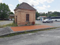
Park at Place de l’Hôtel de Ville.

(S/E) With the town hall on your left, set off along the road towards Auterive, following Rue Marcel Vidal (formerly Route de la Méditerranée). Pass the cul-de-sac on your right and continue to the second junction before the Lèze bridge.

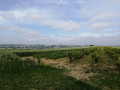
(1) Take the street on the right, which is the old railway line known as the ‘Chemin du Tortillard’ (train). At the next junction, follow the road to the left (Chemin Le Corbusier), which slopes down slightly. Continue along the road, which turns right at a right angle; follow the left-hand side of the first field before reaching the end of the road. Take a track on the left that runs alongside the Lèze.

(2) After about 200 m, at a place called La Barguère, turn right onto the track and carry on to the end of the field.

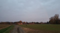
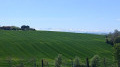
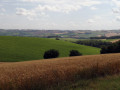
(3) Turn left. Depending on the season, and particularly in the morning or evening, you may spot pheasants, ducks, roe deer and so on in the fields. The track joins the River Lèze, where you may see anglers further down below.

Carry on to the left along the field (there is no road suitable for vehicles) and follow the Lèze to the end of the field. In the river, you may spot coypu, ducks, moorhens and ducklings.
When you reach the end, go down to the lower level (there may be anglers there) then return to the track by turning left.

(2) Carry on straight ahead. At the end of the track, continue straight on along the Chemin de la Barguère and take the next street on the right, Rue Jean-Jaurès.

(4) At the junction, carry on straight ahead along Rue Riquet. At the end of the street, at the junction with Route Marcel Vidal, turn left to return to Place de l’Hôtel de Ville and the car park (S/E).

Waypoints

  1. S/E : mi 0 - alt. 646 ft - Place de l’Hôtel de Ville
  2. 1 : mi 0.13 - alt. 643 ft - Junction before the - Lèze (rivière)
  3. 2 : mi 0.63 - alt. 643 ft - La Barguère
  4. 3 : mi 1 - alt. 643 ft - End of the field
  5. 4 : mi 1.85 - alt. 643 ft - Crossroads
  6. S/E : mi 2.03 - alt. 646 ft - Place de l’Hôtel de Ville

Notes

The walk around the field is a very popular spot with many dog walkers.

Worth a visit

Depending on the season, you may spot pheasants, ducks and roe deer in the fields, and in the river, coypu, ducks and moorhens, as well as ducks with their ducklings – usually in the mornings or evenings.

Reviews and comments

3.9 / 5
Based on 3 reviews

Reliability of the description
4.7 / 5
Ease of following the route
4.3 / 5
Route interest
2.7 / 5
Gummychan
Gummychan

Overall rating : 4.3 / 5

Date of your route : Aug 04, 2022
Reliability of the description : ★★★★★ Very good
Ease of following the route : ★★★★★ Very good
Route interest : ★★★☆☆ Average
Very busy route : No

The description is clear and well-written, but this route wasn’t quite what I was looking for, which was a walk along the River Lèze.
This one is more of a walk round a sunflower field, which isn’t bad but isn’t exactly what I was after.
What’s more, the ‘path’ near the river isn’t maintained, so watch out for ticks!

Machine-translated

NOUVENE
NOUVENE
• Edited:

Overall rating : 3.3 / 5

Date of your route : Jun 14, 2020
Reliability of the description : ★★★★☆ Good
Ease of following the route : ★★★★☆ Good
Route interest : ★★☆☆☆ Disappointing
Very busy route : No

The walk could have been really lovely. We’d combined it with the other walk, ‘The countryside around Saint-Sulpice-sur-Lèze’, which headed north. When we reached the end of the field heading towards the river, we had to turn back, walking sometimes along the edge of the field and sometimes through the maize. No view of the river, no marked trail. Perhaps maintenance had fallen a bit behind due to the lockdown. A shame...

Machine-translated

titiclems31
titiclems31

Overall rating : 4 / 5

Date of your route : Jun 07, 2020
Reliability of the description : ★★★★★ Very good
Ease of following the route : ★★★★☆ Good
Route interest : ★★★☆☆ Average
Very busy route : No

A pleasant walk thanks to its location amidst the fields; however, once past the long path running alongside the fields, the return journey off the track—which is rather bumpy—takes you through all sorts of grass and shrubs, and at times you’re forced to weave your way through the maize stalks to clear a path. A shame, and no view of the river; nature has well and truly reclaimed the area, and it’s clearly rarely used.
So, unspoilt nature – be prepared to go all Robinson Crusoe in the grass...

Machine-translated

Other walks in the area

For more walks, use our search engine .

The GPS track and description are the property of this route's author. Please do not copy them without permission.