Around Montgazin via the Domaine Lastronques

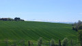
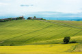
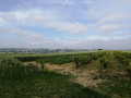
In the hillsides of Montgazin, a walk through the fields with magnificent views all around and the Pyrenees mountain range in the background.

Details

5753250
Creation:
Last update:
Last review:
  • Walking
    Activity: Walking
  • ↔
    Distance: 4.58 mi
  • ◔
    Average duration: 2h 30 
  • ▲
    Difficulty: Easy

  • ⚐
    Back to start: Yes
  • ↗
    Ascent: + 423 ft
  • ↘
    Descent: - 436 ft

  • ▲
    Highest point: 971 ft
  • ▼
    Lowest point: 705 ft

Photos

Description of the walk

Park in the church car park.

(S/E) Head right through the centre of the village onto the D74 and follow the road to the cross.

(1) Take the path that descends to the right between the fields to the brick bridge.

(2) Head up to the left towards the Rouja and continue along the road.

(3) Take the path on the right towards Les Rességayres, where you’ll rejoin the tarmac road.

(4) Carry on straight ahead, passing through the farmyards, and continue along the path after the last farm buildings.

(5) At the Lastronques crossroads, turn left, skirting the vineyards to avoid entering the estate.
At the crossroads, turn right to walk above the vineyards, skirting the estate.

(6) After crossing the stream, follow it to the left for 20 metres, then head up to the right. Halfway up the slope, take the path branching off to the left and continue straight on until you reach the road.

(7) Turn right and follow the road to the village to return to the church car park (S/E).

Waypoints

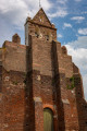
  1. S/E : mi 0 - alt. 965 ft - Car park at the - Église Sainte-Catherine (Montgazin)
  2. 1 : mi 0.35 - alt. 902 ft - Cross
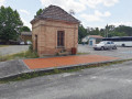
  3. 2 : mi 0.73 - alt. 705 ft - Remarkable old bridge
  4. 3 : mi 1.3 - alt. 778 ft - Crossroads, path on the right
  5. 4 : mi 1.68 - alt. 827 ft - Fermes des Rességayres
  6. 5 : mi 2.19 - alt. 899 ft - Crossroads – Domaine Lastronques
  7. 6 : mi 3.06 - alt. 728 ft - Ruisseau de l’Olivier
  8. 7 : mi 3.66 - alt. 879 ft - Les Gaspardes – Road junction
  9. S/E : mi 4.58 - alt. 971 ft - Car park at the - Église Sainte-Catherine (Montgazin)

Reviews and comments

4.4 / 5
Based on 3 reviews

Reliability of the description
4.3 / 5
Ease of following the route
4.3 / 5
Route interest
4.7 / 5
Blondie
Blondie

Overall rating : 4.3 / 5

Date of your route : Apr 08, 2026
Reliability of the description : ★★★★☆ Good
Ease of following the route : ★★★★☆ Good
Route interest : ★★★★★ Very good
Very busy route : No

A magnificent view across the entire Pyrenees mountain range. We love it.
Dogs are allowed off the lead in the hamlet; they’re not aggressive, but do be careful if you have a dog.

Machine-translated

Fanny31
Fanny31

Overall rating : 4.7 / 5

Date of your route : Aug 08, 2021
Reliability of the description : ★★★★★ Very good
Ease of following the route : ★★★★★ Very good
Route interest : ★★★★☆ Good
Very busy route : No

A peaceful and interesting walk. It took us 1 hour 50 minutes, including a short break. The only downside was that, near the farms mentioned in point 4, we came across several dogs running loose – they were quite aggressive and their owners weren’t around. We managed to get past, but it wasn’t exactly a relaxing experience.

Machine-translated

Bernard Bros
Bernard Bros

Overall rating : 4.3 / 5

Date of your route : Apr 26, 2021
Reliability of the description : ★★★★☆ Good
Ease of following the route : ★★★★☆ Good
Route interest : ★★★★★ Very good
Very busy route : No

a pleasant and varied route

Machine-translated

Other walks in the area

For more walks, use our search engine .

The GPS track and description are the property of this route's author. Please do not copy them without permission.