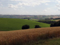
The hills above Saint-Sulpice-sur-Lèze and Montgazin

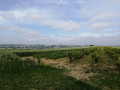
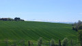
This walk takes place on the western slopes of Saint-Sulpice-sur-Lèze, offering lovely views of the surrounding countryside to the south, west and east, as well as a view of the Pyrenees mountain range.
It will allow you to explore the administrative area of this historic market town, dating from the 12th century, listed by Bâtiments de France, which is particularly well-preserved, and its main buildings.

Details

3336836
Creation:
Last update:
Last review:
  • Walking
    Activity: Walking
  • ↔
    Distance: 3.85 mi
  • ◔
    Average duration: 2h 00 
  • ▲
    Difficulty: Easy

  • ⚐
    Back to start: Yes
  • ↗
    Ascent: + 289 ft
  • ↘
    Descent: - 289 ft

  • ▲
    Highest point: 935 ft
  • ▼
    Lowest point: 646 ft

Photos

Description of the walk

Park at Place de l’Hôtel de Ville.

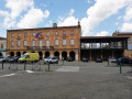
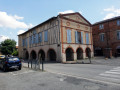
(S/E) With the town hall on your right and with your back to the house of Alphonse de Poitiers, Count of Toulouse, take Rue de la Poste opposite you – a street with arcades that climbs up to the Esplanade Andrée Maurette. At the top of Rue de la Poste, turn left onto Boulevard du 8 Mai 1945 and continue straight on until you reach the old public weighbridge on Place de la Combe.

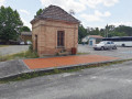
(1) Continue straight on and take Avenue du Grand Vignemale, which is directly opposite and slightly to the right. At the end of this street, cross the Route de Marquefave (take care when crossing, as cars can approach very quickly) and continue along the footpath directly opposite.
This path leads to the Chemin de Jourdane (a road and cul-de-sac); turn right and head uphill. Continue to the end, passing a cluster of houses. The Chemin de Jourdane ends at a bypass where you’ll find a farm track opposite.

(2) Carry on along the farm track, which joins the Route de Marquefave; follow this to the left. At the next junction, turn right onto the road leading down towards Marquefave (signposted).

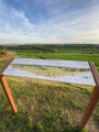
(3) 300 metres after the junction, leave the Route de Marquefave on your left and continue along the road on the right. At this fork, a monument consisting of a beam resting on two posts commemorates the agricultural and rural resistance movement via an inscription (see photo). Continue along the road, which bends to the right and climbs; in fine weather, this offers a lovely view to your left of the countryside to the south and south-west, and the Pyrenees mountain range, including Mont Valier (the highest peak in the Ariège). Continue uphill until you reach a junction where two roads meet.

(4) At the junction, take the road on the right which leads back to Saint-Sulpice-sur-Lèze. The road offers views of the eastern slopes of Saint-Sulpice before the descent into the village and will take you past the former schools after you have passed the village’s current primary school. On the descent, the view allows you to see almost the entire administrative area of the commune of Saint-Sulpice-sur-Lèze, with the top of the church and, on the right, the Escons farm, an architecturally interesting building.

(5) Behind the old schools, turn left and continue along the street opposite (Avenue du Cimetière), which curves to the left and leads to the cemetery entrance. At the cemetery, take the street on the right, then the next one on the right again at the chemist’s (Rue du Regou). At the first junction, turn right to return to the Esplanade, where you will see the 12th-century church opposite and the old school buildings on the right.

(6) Take the street on the left that leads downhill and carry straight on past the esplanade into Rue de Verdun.

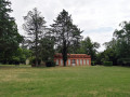
(7). Cross Rue de la République – which is the Toulouse–Foix road – and continue along Rue du 11 Novembre 1918, which runs behind the town hall and ends in the park, where you can admire the former orangery, now a nursery school, before returning to the square on your right. This is where your walk ends (S/E).


Waypoints

  1. S/E : mi 0 - alt. 646 ft - Town Hall Square - Maison d'Alphonse de Poitiers, Comte de Toulouse
  2. 1 : mi 0.17 - alt. 659 ft - Public weighbridge
  3. 2 : mi 1.06 - alt. 771 ft - End of the road, turning area
  4. 3 : mi 1.66 - alt. 860 ft - Crossroads
  5. 4 : mi 2.19 - alt. 932 ft - Crossroads
  6. 5 : mi 3.24 - alt. 676 ft - Behind the old school buildings
  7. 6 : mi 3.65 - alt. 666 ft - Esplanade in Saint-Sulpice-sur-Lèze - Esplanade de Saint Sulpice sur Lèze
  8. 7 : mi 3.75 - alt. 650 ft - Junction with the Toulouse–Foix road
  9. S/E : mi 3.85 - alt. 646 ft - Town Hall Square - Mairie de Saint Sulpice sur Lèze

Notes

Most of this walk takes place on roads with very little traffic, so you don’t need hiking boots; a simple pair of trainers will do just fine.
Despite excellent visibility in the surrounding area, you must remain very vigilant on the road section where the path from point (2) joins the road, right up to point (3) (the stretch of road from Saint-Sulpice-sur-Lèze towards Marquefave and Montgazin).

Worth a visit

At the starting point (S/E), you will find two notable buildings:
- the house of Alphonse de Poitiers, Count of Toulouse, and the former home of the Dehoey family;
- the Town Hall of Saint-Sulpice-sur-Lèze, which, along with the Parc de Pechbusque, was a family home that belonged to the Dehoey family in the early 19th century.

There are lovely views of the surrounding countryside to the south, west and east of Saint-Sulpice-sur-Lèze, as well as of the Pyrenees mountain range and Mont Valier, the highest peak in the Ariège.
On a clear day, it is possible to see the Pic du Midi de Bigorre, 150 km away.

Reviews and comments

4.1 / 5
Based on 4 reviews

Reliability of the description
4.8 / 5
Ease of following the route
4.3 / 5
Route interest
3.3 / 5
digir
digir

Overall rating : 4.3 / 5

Date of your route : Dec 29, 2025
Reliability of the description : ★★★★★ Very good
Ease of following the route : ★★★★★ Very good
Route interest : ★★★☆☆ Average
Very busy route : No

An easy route. Lots of roads, fortunately with little traffic. Beautiful view of Saint Sulpice at the end of the route.

Machine-translated

Yannick242
Yannick242

Overall rating : 4.3 / 5

Date of your route : Jul 15, 2024
Reliability of the description : ★★★★★ Very good
Ease of following the route : ★★★★☆ Good
Route interest : ★★★★☆ Good
Very busy route : No

Right from the village centre, you can tell it’s going to be a lovely outing! You might be tempted to book a table at the nearest restaurant. Then you walk through the village, passing close to the magnificent church, and suddenly you’re surrounded by nature! There’s quite a bit of tarmac, though – but in fine weather, what a view once you reach the heights….
An accessible walk with a bit of an incline – fun guaranteed.

Machine-translated

Michel P54
Michel P54

Overall rating : 4.3 / 5

Date of your route : Feb 27, 2021
Reliability of the description : ★★★★★ Very good
Ease of following the route : ★★★★★ Very good
Route interest : ★★★☆☆ Average
Very busy route : No

The route is almost entirely on public roads, and the route is very clear.

Machine-translated

galuse
galuse

Overall rating : 3.3 / 5

Date of your route : Oct 12, 2020
Reliability of the description : ★★★★☆ Good
Ease of following the route : ★★★☆☆ Average
Route interest : ★★★☆☆ Average
Very busy route : No

The end of the route took us through a ploughed and muddy field alongside the Lèze; it seems the farmer who owns the field had ploughed the path running alongside it, and it was very difficult going for 300 metres

Machine-translated

Other walks in the area

For more walks, use our search engine .

The GPS track and description are the property of this route's author. Please do not copy them without permission.