A walk around and through Gussignies

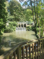
This walk takes you round Gussignies, heading towards Belgium, whilst offering a beautiful view of the village, charming rustic cobbled streets and a path along the water’s edge.

Details

34335806
Creation:
Last update:
Last review:
  • Walking
    Activity: Walking
  • ↔
    Distance: 3.52 mi
  • ◔
    Average duration: 1h 50 
  • ▲
    Difficulty: Easy

  • ⚐
    Back to start: Yes
  • ↗
    Ascent: + 292 ft
  • ↘
    Descent: - 289 ft

  • ▲
    Highest point: 367 ft
  • ▼
    Lowest point: 207 ft

Description of the walk

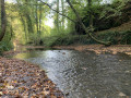
Park in the village square, on the banks of the Hogneau.

(S/E) Set off opposite the restaurant “Au Baron”, situated on the other side of the river; head towards the bridge over the Hogneau, cross it and turn right to follow the path which bends to the right, then passes under a bridge. At the end, turn left as you enter Belgium. Continue along Rue du Piémont for several hundred metres, until you reach the right-hand corner at the top of the hill. Enjoy the view over Gussignies.

(1) Head down to the cobbled street, then continue to the right. Pass the old railway station and, once you reach the concrete street (Rue de la Station), turn left and join the N555.

(2) Keep to the right and immediately turn onto the gravel road on the right (Rue de la Marbrerie). Follow this road, then carry on to the footpath and follow it to the boundary at the café “Chez Mireille”.

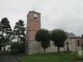
(3) Turn left to head up the hill. Before reaching the church, turn left onto Rue Boutenier and continue to the top, re-entering Belgium. At the end, keep to the right as you continue uphill, re-enter France and carry on to the crossroads by the town hall.

(4) Carry on straight ahead, then take the path on the right, past the houses. You’ll come out onto the square and the car park at the entrance to the castle.

(5) At the far end of the square, take the path on the left between two houses. Continue downhill, cross the road (Rue du Bourlard) carefully, and carry on straight ahead to return to the car park where you started (S/E).

Waypoints

  1. S/E : mi 0 - alt. 217 ft - Car park
  2. 1 : mi 0.65 - alt. 308 ft - Viewpoint
  3. 2 : mi 1.18 - alt. 223 ft - N555
  4. 3 : mi 1.72 - alt. 226 ft - Frontière, “Chez Mireille” café
  5. 4 : mi 2.81 - alt. 354 ft - Crossroads by the town hall
  6. 5 : mi 3.3 - alt. 335 ft - Place du Château, car park
  7. S/E : mi 3.52 - alt. 217 ft - Car park

Notes

An easy walk requiring no special equipment.

Worth a visit

Reviews and comments

4.6 / 5
Based on 3 reviews

Reliability of the description
4.3 / 5
Ease of following the route
4.3 / 5
Route interest
5 / 5
Polin
Polin

A very pretty village, with one part in France and the other in Belgium!! Very picturesque, with a lovely stream. You can visit the brewery. A real change of scenery. Apparently, it’s covered in daffodils in spring.
We had a lovely time.

Machine-translated

Paul Bottieau
Paul Bottieau

Overall rating : 4 / 5

Date of your route : Mar 01, 2025
Reliability of the description : ★★★★☆ Good
Ease of following the route : ★★★☆☆ Average
Route interest : ★★★★★ Very good
Very busy route : No

A lovely walk.
Some lovely views and a village well worth exploring.

Machine-translated

Daniel Poley
Daniel Poley

Overall rating : 4.7 / 5

Date of your route : Mar 14, 2024
Reliability of the description : ★★★★☆ Good
Ease of following the route : ★★★★★ Very good
Route interest : ★★★★★ Very good
Very busy route : No

A lovely little walk to explore Gussignies and the surrounding area. I’d definitely recommend it! Please note that Rue Boutonnier isn’t signposted. But as it’s just before the church (which is well worth a visit), you can’t go wrong...
Also worth noting are the many signposted walks starting from the same spot...

Machine-translated

Jacky dum
Jacky dum

Overall rating : 5 / 5

Date of your route : Jul 16, 2023
Reliability of the description : ★★★★★ Very good
Ease of following the route : ★★★★★ Very good
Route interest : ★★★★★ Very good
Very busy route : No

Stunning views, a good elevation gain. Hike completed on 7 July

Machine-translated

Other walks in the area

For more walks, use our search engine .

The GPS track and description are the property of this route's author. Please do not copy them without permission.