In search of the boundary markers of La Flamengrie

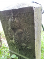
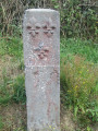
A short walk to discover around twenty beautiful boundary markers specific to La Flamengrie and Roisin. Sixty-five markers were erected around La Flamengrie in 1781, following a boundary change.

Details

15079303
Creation:
Last update:
Last review:
  • Walking
    Activity: Walking
  • ↔
    Distance: 4.00 mi
  • ◔
    Average duration: 1h 55 
  • ▲
    Difficulty: Easy

  • ⚐
    Back to start: Yes
  • ↗
    Ascent: + 49 ft
  • ↘
    Descent: - 49 ft

  • ▲
    Highest point: 427 ft
  • ▼
    Lowest point: 361 ft

Photos

Description of the walk

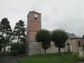
Park in the square between the town hall and the church.

(S/E) Set off with the town hall on your left and the church on your right, and walk up Rue des Toubaqueux. At the junction with Rue Basse, carry straight on.

(1) At the end, turn left into Rue Haute. Take thefirst right, Chemin des Rocs, and after about 150 metres, you’ll find markers nos. 42 and 43. Retrace your steps back to the junction with Rue des Toubaqueux.

(1) Carry on straight ahead along Rue Haute.

(2) At the junction with Rue Ballette on the right-hand side, turn left onto the picturesque Sentier Voit N’y Goutte. At the end, a good hundred metres further on, you’ll find boundary marker no. 46. Retrace your steps.

(2) Continue along Rue Haute until it ends (Notre-Dame de Bon Secours Chapel; boundary marker no. 53). Then turn left into Rue de la Perche (watch out for cars). Carry on straight ahead until the next junction (boundary markers nos. 57 and 58).

(3) Turn right onto Chemin du Bosquet. At the end, turn right onto the D154 towards the village. Walk past the cemetery and you’ll soon come to a junction with a dirt track on the left.

(4) Follow this track for about a hundred metres until you reach a clump of trees. Below the track, you can see marker no. 3. Turn back.

(4) Continue along the D154 towards the village (to the left as you return from the cluster of trees). Pass marker no. 15.

(5) At the Calotin crossroads (markers nos. 17 and 18), turn left into Rue du Vieux Chemin de Valenciennes. Take thefirst right, Rue du Rivage (marker no. 21).

(6) At the end, turn left onto Rue de l’Église. After a right-hand bend, turn left onto a grassy path to find marker no. 31. Turn round and head back along Rue de l’Église on the left.

(7) At the end, head left towards Roisin (Belgium). After about a hundred metres, you’ll find marker no. 36. Turn back.

(7) Carry on straight ahead along Rue haute, following the border. Take thefirst right, Rue Verte, and walk downhill to a stream. Then turn left onto a grassy path and follow the stream on your right. You’ll come out onto Rue des Toubaqueux; follow it to the left to reach the town hall square (S/E).

Waypoints

  1. S/E : mi 0 - alt. 377 ft - Town Hall Square - Église Saint-Gilles (La Flamengrie)
  2. 1 : mi 0.12 - alt. 374 ft - Rue des Toubaqueux x Rue Haute
  3. 2 : mi 0.53 - alt. 377 ft - Rue Haute x Sentier Voit N’y Goutte
  4. 3 : mi 1.31 - alt. 407 ft - Rue de la Perche x Chemin du Bosquet
  5. 4 : mi 1.96 - alt. 413 ft - Junction after the cemetery
  6. 5 : mi 2.68 - alt. 397 ft - Calotin junction
  7. 6 : mi 3.12 - alt. 374 ft - Rue du Rivage x Rue de l’Église
  8. 7 : mi 3.48 - alt. 371 ft - Rue de l’Église x Rue Haute
  9. S/E : mi 4 - alt. 377 ft - Town Hall Square - Église Saint-Gilles (La Flamengrie)

Notes

Signposted with a fleur-de-lis and a double-headed eagle.

Suitable for pushchairs.

An information leaflet is available at the bus shelter.

Short alternative route:
Follow the start of the main route, then at the junction with Rue Perche, turn right and follow this street for 500 metres to the Calotin junction.
Follow the main route from (5).

Reviews and comments

4.7 / 5
Based on 2 reviews

Reliability of the description
5 / 5
Ease of following the route
5 / 5
Route interest
4 / 5
User 15758127

Overall rating : 4.3 / 5

Date of your route : Aug 24, 2026
Reliability of the description : ★★★★★ Very good
Ease of following the route : ★★★★★ Very good
Route interest : ★★★☆☆ Average
Very busy route : No

Easy route
The signposts are always the same, and we couldn’t find some of them
Relatively limited interest; a route through villages, fields and roads.
Worth doing once if you’re in the area, but that’s about it.

Machine-translated

boussu101
boussu101

Overall rating : 5 / 5

Date of your route : Apr 21, 2026
Reliability of the description : ★★★★★ Very good
Ease of following the route : ★★★★★ Very good
Route interest : ★★★★★ Very good
Very busy route : No

of historical interest, which may overlap with the border marker route at La Flamengrie

Machine-translated

Other walks in the area

For more walks, use our search engine .

The GPS track and description are the property of this route's author. Please do not copy them without permission.