In the days of the marble masons in Gussignies

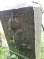
As you follow this route, you’ll discover that the quarrymen and stonemasons have left a lasting mark on the village.

Details

n°22234521
Creation:
Last update:
Last review:
  • Walking
    Activity: Walking
  • ↔
    Distance: 0.87 mi
  • ◔
    Average duration: 0h 30 
  • ▲
    Difficulty: Easy

  • ⚐
    Back to start: Yes
  • ↗
    Ascent: + 121 ft
  • ↘
    Descent: - 121 ft

  • ▲
    Highest point: 338 ft
  • ▼
    Lowest point: 217 ft

Photos

Description of the walk

Park on the Place de Gussignies. Take in the view of the château, the bandstand and then the Sirjacq house.

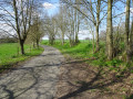
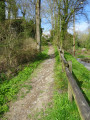
(S/E) Follow Rue de la Place away from the château. Shortly afterwards, as you come out of a right-hand bend, turn left onto Ruelle des Marchelles. Turn left, then right as the lane curves. Cross Rue du Bourlard and continue straight ahead onto the Sentier du Fond de Rocs.

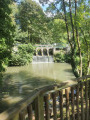
(1) At the end, turn left to cross the bridge straight away. Opposite, you’ll see the château’s factory. Retrace your steps.

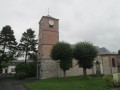
(1) Carry on straight ahead for a few metres and turn right onto an uphill path. At the end of this path, turn sharply right onto Rue de la Chapelle. At the end of this street, you’ll find yourself facing the church.

(2) Turn right into Rue de l’Église. At the three-way junction, turn left into Rue Émile Sohier. At the next three-way junction, turn right into Rue de la Place. Carry on straight ahead and return to the starting point (S/E).

Waypoints

  1. S/E : mi 0 - alt. 338 ft - Village square - Château de Gussignies
  2. 1 : mi 0.27 - alt. 217 ft - Château Factory
  3. 2 : mi 0.59 - alt. 312 ft - Église Saint-Médard (Gussignies)
  4. S/E : mi 0.87 - alt. 338 ft - Village square - Château de Gussignies

Notes

Unmarked route.

Worth a visit

Au Baron: Brewery, Restaurant and Local Produce Shop in Gussignies

Hikers’ café Chez Mireille

Reviews and comments

5 / 5
Based on 1 review

Reliability of the description
5 / 5
Ease of following the route
5 / 5
Route interest
5 / 5
randotine59
randotine59

Overall rating : 5 / 5

Date of your route : Mar 09, 2025
Reliability of the description : ★★★★★ Very good
Ease of following the route : ★★★★★ Very good
Route interest : ★★★★★ Very good
Very busy route : No

I combined the two routes – the Marble Route and the Quarry Route – in Bettrechies. On reaching number 7, take the path leading towards Bettrechies. A magnificent spring day with varied scenery. Lovely villages, countryside and woodland with its daffodils. Mostly tarmac, but on quiet country roads with little traffic.
Picnic table in Bellignies.

Machine-translated

Other walks in the area

For more walks, use our search engine .

The GPS track and description are the property of this route's author. Please do not copy them without permission.